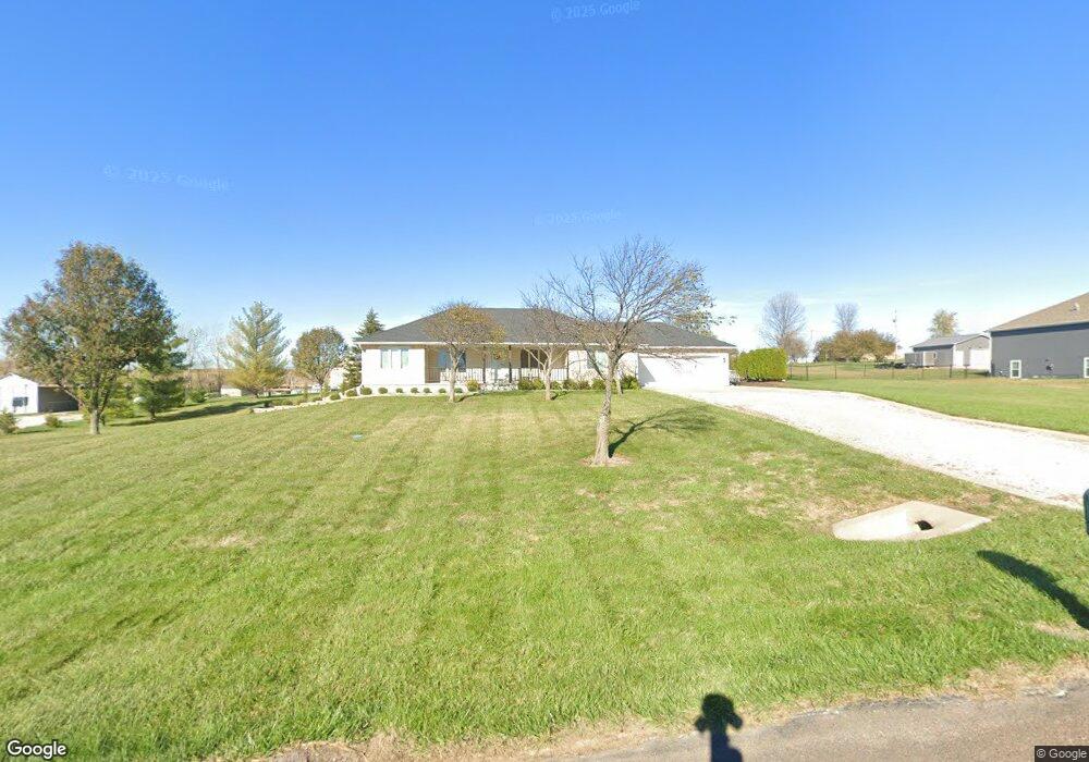
16480 Dana Ln Leavenworth, KS 66048
Estimated Value: $408,532 - $488,000
3
Beds
3
Baths
1,730
Sq Ft
$262/Sq Ft
Est. Value
About This Home
This home is located at 16480 Dana Ln, Leavenworth, KS 66048 and is currently estimated at $453,883, approximately $262 per square foot. 16480 Dana Ln is a home located in Leavenworth County with nearby schools including Lansing Elementary School, Lansing Middle 6-8, and Lansing High 9-12.
Ownership History
Date
Name
Owned For
Owner Type
Purchase Details
Closed on
Aug 27, 2018
Sold by
Quinn Robert M and Quinn Maria C
Bought by
Quinn Robert M and Quinn Maria C
Current Estimated Value
Purchase Details
Closed on
Jan 1, 2002
Bought by
Quinn Robert M and Quinn Maria C
Home Financials for this Owner
Home Financials are based on the most recent Mortgage that was taken out on this home.
Original Mortgage
$135,000
Interest Rate
7.16%
Mortgage Type
New Conventional
Create a Home Valuation Report for This Property
The Home Valuation Report is an in-depth analysis detailing your home's value as well as a comparison with similar homes in the area
Home Values in the Area
Average Home Value in this Area
Purchase History
| Date | Buyer | Sale Price | Title Company |
|---|---|---|---|
| Quinn Robert M | -- | None Listed On Document | |
| Quinn Robert M | $20,500 | -- |
Source: Public Records
Mortgage History
| Date | Status | Borrower | Loan Amount |
|---|---|---|---|
| Previous Owner | Quinn Robert M | $135,000 | |
| Closed | Quinn Robert M | $120,000 |
Source: Public Records
Tax History Compared to Growth
Tax History
| Year | Tax Paid | Tax Assessment Tax Assessment Total Assessment is a certain percentage of the fair market value that is determined by local assessors to be the total taxable value of land and additions on the property. | Land | Improvement |
|---|---|---|---|---|
| 2025 | $5,554 | $44,500 | $6,755 | $37,745 |
| 2024 | $5,210 | $42,789 | $7,921 | $34,868 |
| 2023 | $5,210 | $41,542 | $7,921 | $33,621 |
| 2022 | $4,945 | $37,766 | $5,369 | $32,397 |
| 2021 | $4,494 | $33,306 | $4,479 | $28,827 |
| 2020 | $4,337 | $31,422 | $4,314 | $27,108 |
| 2019 | $4,169 | $29,923 | $3,969 | $25,954 |
| 2018 | $4,023 | $28,693 | $3,049 | $25,644 |
| 2017 | $3,941 | $27,899 | $2,844 | $25,055 |
| 2016 | $3,545 | $26,125 | $2,819 | $23,306 |
| 2015 | $3,307 | $25,047 | $2,819 | $22,228 |
| 2014 | $3,171 | $24,300 | $2,819 | $21,481 |
Source: Public Records
Map
Nearby Homes
- 16430 Dana Ln
- Lot 6 163rd St
- 00000 Gilman Rd
- 25770 Tonganoxie Dr
- 24450 171st St
- 25030 177th Terrace
- 25055 Woodridge Cir
- 17860 Clearview Dr
- 1221 S Desoto Rd
- 000 4-H Rd
- 833 Rock Creek Dr
- 875 Clearview Dr
- 811 4-H Rd
- 15280 Roger Rd
- 0000 Eisenhower Rd
- 16055 W Eisenhower Rd
- 705 Rock Creek Dr
- 15915 Eisenhower Rd
- 17096 Eisenhower Rd
- 17739 Eisenhower Rd