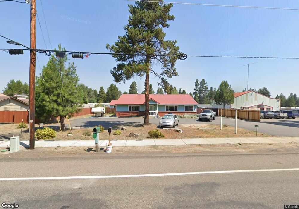
16480 Wm Foss Rd La Pine, OR 97739
Estimated Value: $321,323
3
Beds
1
Bath
1,800
Sq Ft
$179/Sq Ft
Est. Value
About This Home
This home is located at 16480 Wm Foss Rd, La Pine, OR 97739 and is currently estimated at $321,323, approximately $178 per square foot. 16480 Wm Foss Rd is a home located in Deschutes County with nearby schools including Rosland Elementary School, La Pine Middle School, and La Pine Senior High School.
Ownership History
Date
Name
Owned For
Owner Type
Purchase Details
Closed on
Aug 31, 2025
Sold by
Cynthia A Lowry Administrative Trust and Lowry Sadie K
Bought by
Lowry Patrick
Current Estimated Value
Purchase Details
Closed on
Dec 2, 2024
Sold by
Ross Brett Allen and Countryman Steffanie
Bought by
Cynthia A Lowry Administrative Trust and Lowry
Purchase Details
Closed on
Sep 4, 2020
Sold by
Ross Brett Allen
Bought by
Ross Brett Allen and Ross Stefanie
Purchase Details
Closed on
May 12, 2015
Sold by
Lasseter Rocky G and Molina Brenda J
Bought by
Ross Brett Allen
Purchase Details
Closed on
Aug 22, 2006
Sold by
Holmdahl James Steven
Bought by
Pickle Linda N
Purchase Details
Closed on
Oct 28, 2005
Sold by
Lasseter Rocky G and Molina Brenda J
Bought by
Holmdahl James Steven
Purchase Details
Closed on
Oct 25, 2005
Sold by
Holmdahl James Steven
Bought by
Lasseter Rocky G and Molina Brenda L
Create a Home Valuation Report for This Property
The Home Valuation Report is an in-depth analysis detailing your home's value as well as a comparison with similar homes in the area
Home Values in the Area
Average Home Value in this Area
Purchase History
| Date | Buyer | Sale Price | Title Company |
|---|---|---|---|
| Lowry Patrick | -- | None Listed On Document | |
| Cynthia A Lowry Administrative Trust | $315,000 | Amerititle | |
| Cynthia A Lowry Administrative Trust | $315,000 | Amerititle | |
| Ross Brett Allen | -- | Accommodation | |
| Ross Brett Allen | $145,000 | First American Title | |
| Pickle Linda N | $159,500 | Western Title & Escrow Co | |
| Holmdahl James Steven | -- | First Amer Title Ins Co Or | |
| Lasseter Rocky G | $165,000 | First Amer Title Ins Co Or |
Source: Public Records
Tax History Compared to Growth
Tax History
| Year | Tax Paid | Tax Assessment Tax Assessment Total Assessment is a certain percentage of the fair market value that is determined by local assessors to be the total taxable value of land and additions on the property. | Land | Improvement |
|---|---|---|---|---|
| 2025 | $3,381 | $186,670 | -- | -- |
| 2024 | $3,243 | $181,240 | -- | -- |
| 2023 | $3,168 | $175,970 | $0 | $0 |
| 2022 | $2,828 | $165,880 | $0 | $0 |
| 2021 | $2,842 | $161,050 | $0 | $0 |
| 2020 | $2,697 | $161,050 | $0 | $0 |
| 2019 | $2,621 | $156,360 | $0 | $0 |
| 2018 | $2,544 | $151,810 | $0 | $0 |
| 2017 | $2,447 | $147,390 | $0 | $0 |
| 2016 | $2,346 | $143,100 | $0 | $0 |
| 2015 | $2,260 | $138,940 | $0 | $0 |
| 2014 | -- | $134,895 | $0 | $0 |
Source: Public Records
Map
Nearby Homes
- 16540 William Foss Rd
- 51455 Huntington Rd
- 51395 Preble Way
- 51443 Morson St
- 16365 3rd St
- 16480 Carter Ct
- 51332 Preble Way
- 51423 Mac Ct
- 0 Walling Ln Unit 3202 220188525
- 51420 Wheeler Rd
- 16676 Mcclintock Place
- 16410 Heath Dr
- 51505 Mitts Way
- 16470 Cassidy Dr
- 16662 Cabin Lake Ln
- 16691 Oakridge Place
- 16672 Shaw Pine Ct
- 16485 Cassidy Dr
- 51730 Jubilee Pine Dr
- 51734 Jubilee Pine Dr
- 16480 William Foss Rd
- 16486 Wm Foss Rd
- 16464 Wm Foss Rd
- 16464 William Foss Rd
- 1 Paulina
- 16460 Wm Foss
- 16492 Wm Foss
- 16467 William Foss Rd
- 16492 William Foss Rd
- 16460 William Foss Rd
- 16489 William Foss Rd
- 51500 Highway 97
- 51500 Highway 97
- 51515 Shields Dr
- 51468 Bonnie Way
- 51500 U S 97
- 16461 Wm Foss Rd
- 51490 Highway 97
- 51530 U S 97
- 16511 William Foss Rd