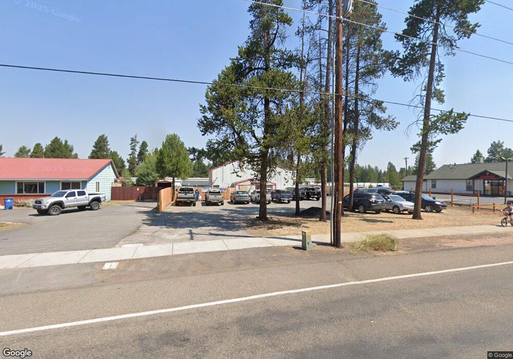
16486 Wm Foss Rd La Pine, OR 97739
Estimated Value: $221,287
--
Bed
--
Bath
1,840
Sq Ft
$120/Sq Ft
Est. Value
About This Home
This home is located at 16486 Wm Foss Rd, La Pine, OR 97739 and is currently estimated at $221,287, approximately $120 per square foot. 16486 Wm Foss Rd is a home located in Deschutes County with nearby schools including Rosland Elementary School, La Pine Middle School, and La Pine Senior High School.
Ownership History
Date
Name
Owned For
Owner Type
Purchase Details
Closed on
Oct 25, 2022
Sold by
Graper Edward B
Bought by
Porter Brewing Co Llc
Current Estimated Value
Home Financials for this Owner
Home Financials are based on the most recent Mortgage that was taken out on this home.
Original Mortgage
$189,000
Outstanding Balance
$172,943
Interest Rate
6.02%
Mortgage Type
New Conventional
Estimated Equity
$48,344
Purchase Details
Closed on
Jun 3, 2010
Sold by
Holmdahl James Steven
Bought by
Graper Edward B
Create a Home Valuation Report for This Property
The Home Valuation Report is an in-depth analysis detailing your home's value as well as a comparison with similar homes in the area
Home Values in the Area
Average Home Value in this Area
Purchase History
| Date | Buyer | Sale Price | Title Company |
|---|---|---|---|
| Porter Brewing Co Llc | $210,000 | First American Title | |
| Graper Edward B | -- | Accommodation |
Source: Public Records
Mortgage History
| Date | Status | Borrower | Loan Amount |
|---|---|---|---|
| Open | Porter Brewing Co Llc | $189,000 |
Source: Public Records
Tax History Compared to Growth
Tax History
| Year | Tax Paid | Tax Assessment Tax Assessment Total Assessment is a certain percentage of the fair market value that is determined by local assessors to be the total taxable value of land and additions on the property. | Land | Improvement |
|---|---|---|---|---|
| 2025 | $1,750 | $96,600 | -- | -- |
| 2024 | $1,678 | $93,790 | -- | -- |
| 2023 | $1,639 | $91,060 | $0 | $0 |
| 2022 | $1,463 | $85,840 | $0 | $0 |
| 2021 | $1,471 | $83,340 | $0 | $0 |
| 2020 | $1,396 | $83,340 | $0 | $0 |
| 2019 | $1,356 | $80,920 | $0 | $0 |
| 2018 | $1,317 | $78,570 | $0 | $0 |
| 2017 | $1,281 | $76,290 | $0 | $0 |
| 2016 | $1,222 | $74,070 | $0 | $0 |
| 2015 | $1,333 | $71,920 | $0 | $0 |
| 2014 | $1,293 | $69,830 | $0 | $0 |
Source: Public Records
Map
Nearby Homes
- 16540 William Foss Rd
- 51455 Huntington Rd
- 51395 Preble Way
- 51443 Morson St
- 16365 3rd St
- 51423 Mac Ct
- 16480 Carter Ct
- 51332 Preble Way
- 51420 Wheeler Rd
- 0 Walling Ln Unit 3202 220188525
- 16676 Mcclintock Place
- 51505 Mitts Way
- 16410 Heath Dr
- 16662 Cabin Lake Ln
- 16672 Shaw Pine Ct
- 16470 Cassidy Dr
- 16485 Cassidy Dr
- 51730 Jubilee Pine Dr
- 51734 Jubilee Pine Dr
- 51738 Jubilee Pine Dr
- 16480 Wm Foss Rd
- 16480 William Foss Rd
- 16492 Wm Foss
- 16492 William Foss Rd
- 1 Paulina
- 16489 William Foss Rd
- 16464 Wm Foss Rd
- 16464 William Foss Rd
- 51515 Shields Dr
- 16467 William Foss Rd
- 16460 Wm Foss
- 51468 Bonnie Way
- 16460 William Foss Rd
- 51500 Highway 97
- 16511 William Foss Rd
- 16511 Wm Foss Rd
- 51500 Highway 97
- 51530 U S 97
- 51500 U S 97
- 16461 Wm Foss Rd