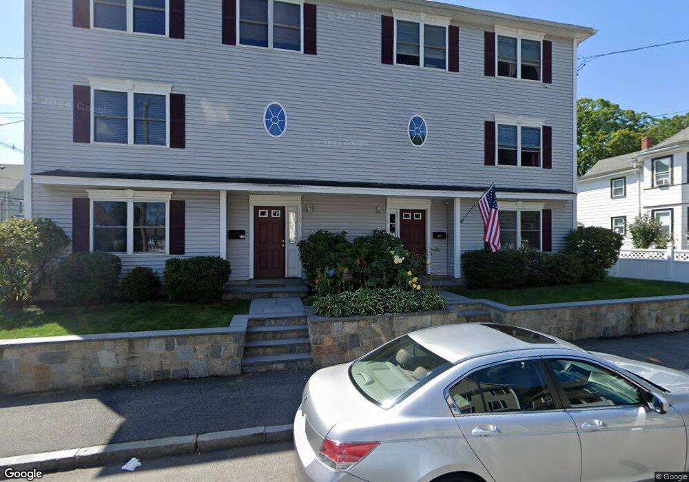
165 Ash St Unit 2 Waltham, MA 02453
South Side NeighborhoodEstimated Value: $824,000 - $942,000
3
Beds
3
Baths
1,524
Sq Ft
$581/Sq Ft
Est. Value
About This Home
This home is located at 165 Ash St Unit 2, Waltham, MA 02453 and is currently estimated at $884,745, approximately $580 per square foot. 165 Ash St Unit 2 is a home located in Middlesex County with nearby schools including Henry Whittemore Elementary School, John W. Mcdevitt Middle School, and Waltham Sr High School.
Ownership History
Date
Name
Owned For
Owner Type
Purchase Details
Closed on
Sep 2, 2016
Sold by
Lance Margaret
Bought by
Nelson Laura M
Current Estimated Value
Home Financials for this Owner
Home Financials are based on the most recent Mortgage that was taken out on this home.
Original Mortgage
$400,000
Outstanding Balance
$319,710
Interest Rate
3.45%
Mortgage Type
New Conventional
Estimated Equity
$565,035
Purchase Details
Closed on
Oct 31, 2014
Sold by
Lance Jerome E
Bought by
Lance Margaret and Lance Jerome E
Create a Home Valuation Report for This Property
The Home Valuation Report is an in-depth analysis detailing your home's value as well as a comparison with similar homes in the area
Home Values in the Area
Average Home Value in this Area
Purchase History
| Date | Buyer | Sale Price | Title Company |
|---|---|---|---|
| Nelson Laura M | $460,000 | -- | |
| Lance Margaret | -- | -- |
Source: Public Records
Mortgage History
| Date | Status | Borrower | Loan Amount |
|---|---|---|---|
| Open | Nelson Laura M | $400,000 |
Source: Public Records
Tax History Compared to Growth
Tax History
| Year | Tax Paid | Tax Assessment Tax Assessment Total Assessment is a certain percentage of the fair market value that is determined by local assessors to be the total taxable value of land and additions on the property. | Land | Improvement |
|---|---|---|---|---|
| 2025 | $7,396 | $753,200 | $0 | $753,200 |
| 2024 | $7,126 | $739,200 | $0 | $739,200 |
| 2023 | $7,312 | $708,500 | $0 | $708,500 |
| 2022 | $7,677 | $689,100 | $0 | $689,100 |
| 2021 | $7,361 | $650,300 | $0 | $650,300 |
| 2020 | $7,440 | $622,600 | $0 | $622,600 |
| 2019 | $6,738 | $532,200 | $0 | $532,200 |
| 2018 | $5,260 | $417,100 | $0 | $417,100 |
| 2017 | $5,006 | $398,600 | $0 | $398,600 |
| 2016 | $4,879 | $398,600 | $0 | $398,600 |
| 2015 | $5,230 | $398,300 | $0 | $398,300 |
Source: Public Records
Map
Nearby Homes
- 47 Alder St Unit 6
- 40 Myrtle St Unit 9
- 81 Alder St
- 42 Alder St
- 15 Alder St Unit 1
- 25 Tolman St Unit 2
- 659 Moody St Unit 2
- 24 Tolman St Unit A
- 138 Myrtle St Unit 2
- 31-37 Washington Ave
- 312 Newton St Unit 1A
- 308 Newton St Unit 1
- 162 Myrtle St Unit 1
- 61 Hall St Unit 9
- 61 Hall St Unit 7
- 73 Orange St Unit 2
- 29 Cherry St Unit 2
- 39 Clinton St Unit 2
- 39 Clinton St Unit 1
- 5-7 Chester Ave
- 165 Ash St Unit 1
- 155 Lowell St
- 155 Lowell St Unit 1
- 157 Lowell St Unit 157
- 157 Lowell St Unit 1
- 161 Ash St
- 159 Lowell St
- 166 Ash St
- 166 Ash St Unit 2
- 166 Ash St Unit 1
- 155 Ash St
- 164 Ash St Unit 2
- 164 Ash St Unit T
- 164 Ash St Unit 3
- 164 Ash St
- 164 Ash St Unit 1
- 164 Ash St
- 175 Ash St Unit 3
- 175 Ash St Unit 5
- 175 Ash St Unit 4