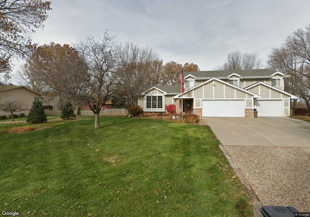
165 Briar Ridge Dr Council Bluffs, IA 51503
Estimated Value: $359,000 - $375,000
3
Beds
3
Baths
1,645
Sq Ft
$222/Sq Ft
Est. Value
About This Home
This home is located at 165 Briar Ridge Dr, Council Bluffs, IA 51503 and is currently estimated at $365,118, approximately $221 per square foot. 165 Briar Ridge Dr is a home located in Pottawattamie County with nearby schools including E.A. Kreft Primary School, Titan Hill Intermediate School, and Lewis Central Middle School.
Ownership History
Date
Name
Owned For
Owner Type
Purchase Details
Closed on
Sep 26, 2006
Sold by
Johnson Ronald D
Bought by
Smith Steve W and Smith Carrie S
Current Estimated Value
Home Financials for this Owner
Home Financials are based on the most recent Mortgage that was taken out on this home.
Original Mortgage
$146,800
Interest Rate
6.49%
Mortgage Type
New Conventional
Purchase Details
Closed on
Jul 28, 2006
Sold by
Vallier Dale R and Vallier Debra L
Bought by
Johnson Ronald D
Home Financials for this Owner
Home Financials are based on the most recent Mortgage that was taken out on this home.
Original Mortgage
$146,800
Interest Rate
6.49%
Mortgage Type
New Conventional
Create a Home Valuation Report for This Property
The Home Valuation Report is an in-depth analysis detailing your home's value as well as a comparison with similar homes in the area
Home Values in the Area
Average Home Value in this Area
Purchase History
| Date | Buyer | Sale Price | Title Company |
|---|---|---|---|
| Smith Steve W | $183,500 | Mrt | |
| Johnson Ronald D | $187,500 | Mrt |
Source: Public Records
Mortgage History
| Date | Status | Borrower | Loan Amount |
|---|---|---|---|
| Closed | Smith Steve W | $146,800 | |
| Previous Owner | Johnson Ronald D | $173,500 |
Source: Public Records
Tax History Compared to Growth
Tax History
| Year | Tax Paid | Tax Assessment Tax Assessment Total Assessment is a certain percentage of the fair market value that is determined by local assessors to be the total taxable value of land and additions on the property. | Land | Improvement |
|---|---|---|---|---|
| 2025 | $3,692 | $367,700 | $47,300 | $320,400 |
| 2024 | $3,692 | $336,100 | $41,200 | $294,900 |
| 2023 | $3,528 | $336,100 | $41,200 | $294,900 |
| 2022 | $3,120 | $254,400 | $38,000 | $216,400 |
| 2021 | $4,505 | $254,400 | $38,000 | $216,400 |
| 2020 | $2,892 | $211,900 | $33,400 | $178,500 |
| 2019 | $3,020 | $211,900 | $33,400 | $178,500 |
| 2018 | $2,950 | $211,900 | $33,400 | $178,500 |
| 2017 | $2,950 | $217,200 | $33,355 | $183,845 |
| 2015 | $3,082 | $217,200 | $33,355 | $183,845 |
| 2014 | $3,106 | $217,200 | $33,355 | $183,845 |
Source: Public Records
Map
Nearby Homes
- 11494 Woodland Trail
- 15.74 AC Dumfries Ave
- 11059 Dumfries Ave
- 11635 Dumfries Ave
- 11749 Dumfries Ave
- 21253 Ashwood Ln
- 12626 Greystone Ct
- 11704 240th St
- 1330 Rolling Hills Loop
- Lot 15 Grandfield
- 21085 Abbey Rd
- 21823 Chestnut Rd
- 18000 Bunge Ave
- 17850 Bunge Ave
- LOT 1 -2 Overland Trail
- 23013 Cayuse St
- 23088 Cayuse St
- 22954 Cattail Bend
- 55.25 AC M L 192nd St
- 52222 230th St
- 15 Briar Ridge Dr
- 155 Briar Ridge Dr
- 5 Briar Ridge Dr
- 25 Briar Ridge Dr
- 11212 Red Fox Ridge
- 160 Briar Ridge Dr
- 20 Briar Ridge Dr
- 170 Briar Ridge Dr
- 170 Briar Dr
- 150 Briar Ridge Dr
- 11138 Red Fox Ridge
- 125 Briar Ridge Dr
- 11306 Woodland Trail
- 130 Briar Ridge Dr
- 95 Briar Ridge Dr
- 11338 Woodland Trail
- 11277 Walnut Ridge
- 11110 Red Fox Ridge
- 110 Briar Ridge Dr
- 65 Briar Ridge Dr