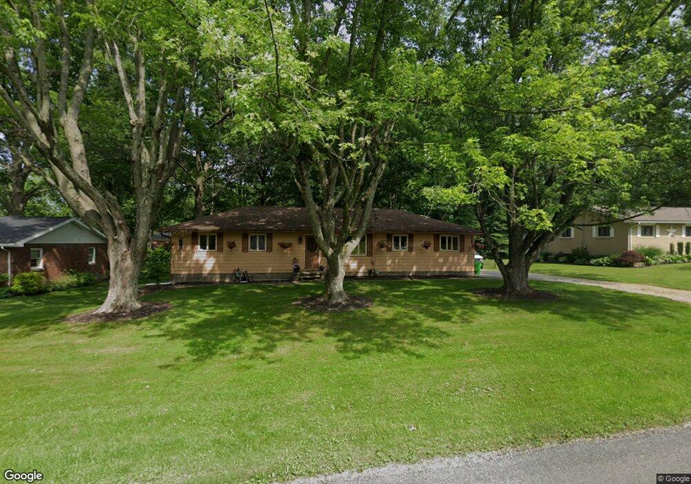
165 Circle Dr Doylestown, OH 44230
Estimated Value: $192,094 - $218,000
3
Beds
1
Bath
1,092
Sq Ft
$191/Sq Ft
Est. Value
About This Home
This home is located at 165 Circle Dr, Doylestown, OH 44230 and is currently estimated at $208,774, approximately $191 per square foot. 165 Circle Dr is a home located in Wayne County with nearby schools including Hazel Harvey Elementary School, Chippewa Intermediate School, and Chippewa Jr./Sr. High School.
Ownership History
Date
Name
Owned For
Owner Type
Purchase Details
Closed on
Mar 25, 2022
Sold by
Hall Grant S and Hall Debra K
Bought by
Hall Shelby J
Current Estimated Value
Home Financials for this Owner
Home Financials are based on the most recent Mortgage that was taken out on this home.
Original Mortgage
$112,000
Outstanding Balance
$96,040
Interest Rate
3.69%
Mortgage Type
New Conventional
Estimated Equity
$112,734
Purchase Details
Closed on
May 15, 2020
Sold by
Hall Margaret L Tod
Bought by
Hall Grant S
Purchase Details
Closed on
Jan 1, 1987
Bought by
Hall Hall M and Hall Margaret
Create a Home Valuation Report for This Property
The Home Valuation Report is an in-depth analysis detailing your home's value as well as a comparison with similar homes in the area
Home Values in the Area
Average Home Value in this Area
Purchase History
| Date | Buyer | Sale Price | Title Company |
|---|---|---|---|
| Hall Shelby J | $140,000 | Dixon Robyn R | |
| Hall Shelby J | -- | None Listed On Document | |
| Hall Grant S | -- | -- | |
| Hall Hall M | -- | -- |
Source: Public Records
Mortgage History
| Date | Status | Borrower | Loan Amount |
|---|---|---|---|
| Open | Hall Shelby J | $112,000 | |
| Closed | Hall Shelby J | $112,000 |
Source: Public Records
Tax History
| Year | Tax Paid | Tax Assessment Tax Assessment Total Assessment is a certain percentage of the fair market value that is determined by local assessors to be the total taxable value of land and additions on the property. | Land | Improvement |
|---|---|---|---|---|
| 2024 | $1,886 | $51,540 | $18,480 | $33,060 |
| 2023 | $1,895 | $51,540 | $18,480 | $33,060 |
| 2022 | $1,537 | $37,340 | $13,390 | $23,950 |
| 2021 | $1,549 | $37,340 | $13,390 | $23,950 |
| 2020 | $1,171 | $37,340 | $13,390 | $23,950 |
| 2019 | $1,023 | $32,790 | $13,370 | $19,420 |
| 2018 | $1,032 | $32,790 | $13,370 | $19,420 |
| 2017 | $1,002 | $32,790 | $13,370 | $19,420 |
| 2016 | $985 | $31,520 | $12,850 | $18,670 |
| 2015 | $981 | $31,520 | $12,850 | $18,670 |
| 2014 | $869 | $31,520 | $12,850 | $18,670 |
| 2013 | $1,003 | $33,080 | $12,850 | $20,230 |
Source: Public Records
Map
Nearby Homes
- 204 Circle Dr
- 100 Merlot Ct
- 580 Thorn Way
- 680 Thorn Way
- 620 Thorn Way
- 46 Hidden Pond Dr
- 0 S Portage St
- VL 1067 Homan Dr
- 497 Gates St
- 233 Homan Dr
- V/L 1050 Melanie Ln
- 14831 Calaboone Rd
- 0 Akron Rd Unit 5123781
- 15899 Mccallum Dr
- 500 W Clinton St
- V/L approx 67.56ac Gates St
- 12214 Vince Dr
- 15500 Freedom Dr
- 12045 Coal Bank Rd
- 14525 Serfass Rd
Your Personal Tour Guide
Ask me questions while you tour the home.