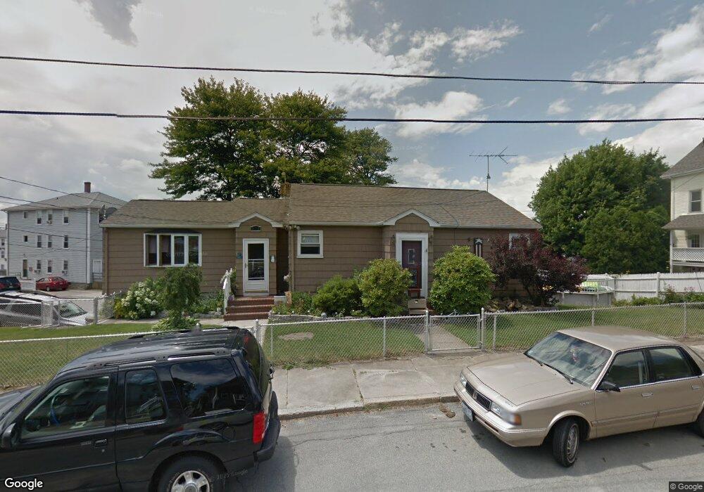
165 Division St Woonsocket, RI 02895
Bernon District NeighborhoodEstimated Value: $382,000 - $486,000
3
Beds
2
Baths
1,390
Sq Ft
$298/Sq Ft
Est. Value
About This Home
This home is located at 165 Division St, Woonsocket, RI 02895 and is currently estimated at $413,703, approximately $297 per square foot. 165 Division St is a home located in Providence County with nearby schools including Woonsocket High School, Founders Academy, and Beacon Charter School.
Ownership History
Date
Name
Owned For
Owner Type
Purchase Details
Closed on
Jan 1, 1987
Bought by
Roy Arthur B and Roy Claire I
Current Estimated Value
Create a Home Valuation Report for This Property
The Home Valuation Report is an in-depth analysis detailing your home's value as well as a comparison with similar homes in the area
Home Values in the Area
Average Home Value in this Area
Purchase History
| Date | Buyer | Sale Price | Title Company |
|---|---|---|---|
| Roy Arthur B | -- | -- |
Source: Public Records
Mortgage History
| Date | Status | Borrower | Loan Amount |
|---|---|---|---|
| Open | Roy Arthur B | $10,000 | |
| Open | Roy Arthur B | $75,000 | |
| Closed | Roy Arthur B | $56,000 | |
| Closed | Roy Arthur B | $25,000 |
Source: Public Records
Tax History Compared to Growth
Tax History
| Year | Tax Paid | Tax Assessment Tax Assessment Total Assessment is a certain percentage of the fair market value that is determined by local assessors to be the total taxable value of land and additions on the property. | Land | Improvement |
|---|---|---|---|---|
| 2025 | $4,694 | $418,000 | $105,800 | $312,200 |
| 2024 | $4,209 | $289,500 | $93,800 | $195,700 |
| 2023 | $4,047 | $289,500 | $93,800 | $195,700 |
| 2022 | $4,047 | $289,500 | $93,800 | $195,700 |
| 2021 | $3,717 | $156,500 | $58,000 | $98,500 |
| 2020 | $3,756 | $156,500 | $58,000 | $98,500 |
| 2018 | $3,769 | $156,500 | $58,000 | $98,500 |
| 2017 | $3,919 | $130,200 | $46,200 | $84,000 |
| 2016 | $4,146 | $130,200 | $46,200 | $84,000 |
| 2015 | $4,763 | $130,200 | $46,200 | $84,000 |
| 2014 | $3,240 | $128,800 | $50,700 | $78,100 |
Source: Public Records
Map
Nearby Homes
- 219 Crawford St
- 25 Jillson Ave
- 216 Maple St
- 304 Getchell Ave
- 24 Paradis Ave
- 17 Wilson Ave
- 233 Grove St
- 204 Welles St
- 0 Irving Lot 206 Ave Unit 1397321
- 74 Maple St
- 199 Roberts St
- 0 Irving Lot 192 Ave Unit 1383138
- 0 Irving Lot 191 Ave Unit 1383135
- 222 Carrington Ave
- 59 Cooper Ave
- 379 Front St
- 122 Grand St
- 71 Hamlet Ave
- 35 Greene St
- 410 Carrington Ave
- 214 Crawford St
- 147 Division St
- 147 Division St Unit 2
- 141 Division St
- 168 Division St
- 178 Division St
- 227 Crawford St
- 137 Division St
- 237 Crawford St
- 209 Crawford St
- 190 Crawford St Unit 1L
- 140 Division St
- 127 Division St
- 211 Division St
- 28 Washington St
- 0 Division St Unit 5
- 0 Division St Unit 3
- 0 Division St Unit 818700
- 0 Division St Unit 5
- 0 Division St Unit 4