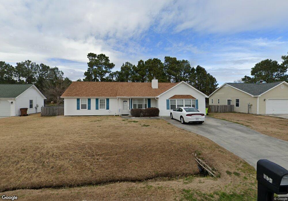
165 Glenwood Dr Hubert, NC 28539
Hubert NeighborhoodEstimated Value: $241,000 - $260,000
3
Beds
2
Baths
1,641
Sq Ft
$151/Sq Ft
Est. Value
About This Home
This home is located at 165 Glenwood Dr, Hubert, NC 28539 and is currently estimated at $248,018, approximately $151 per square foot. 165 Glenwood Dr is a home located in Onslow County with nearby schools including Sand Ridge Elementary School, Swansboro Middle School, and Swansboro High School.
Ownership History
Date
Name
Owned For
Owner Type
Purchase Details
Closed on
Jun 26, 2018
Sold by
Cunningham Bruce W and Cunningham Kristi D
Bought by
Burr Richard F and Burr Deborah A
Current Estimated Value
Home Financials for this Owner
Home Financials are based on the most recent Mortgage that was taken out on this home.
Original Mortgage
$102,850
Outstanding Balance
$89,332
Interest Rate
4.6%
Mortgage Type
New Conventional
Estimated Equity
$158,686
Purchase Details
Closed on
May 31, 2002
Bought by
Cunningham Bruce W and Cunningham Kristi D
Create a Home Valuation Report for This Property
The Home Valuation Report is an in-depth analysis detailing your home's value as well as a comparison with similar homes in the area
Home Values in the Area
Average Home Value in this Area
Purchase History
| Date | Buyer | Sale Price | Title Company |
|---|---|---|---|
| Burr Richard F | $121,000 | None Available | |
| Cunningham Bruce W | $86,500 | -- |
Source: Public Records
Mortgage History
| Date | Status | Borrower | Loan Amount |
|---|---|---|---|
| Open | Burr Richard F | $102,850 |
Source: Public Records
Tax History Compared to Growth
Tax History
| Year | Tax Paid | Tax Assessment Tax Assessment Total Assessment is a certain percentage of the fair market value that is determined by local assessors to be the total taxable value of land and additions on the property. | Land | Improvement |
|---|---|---|---|---|
| 2025 | $1,120 | $171,036 | $40,000 | $131,036 |
| 2024 | $1,120 | $171,036 | $40,000 | $131,036 |
| 2023 | $1,120 | $171,036 | $40,000 | $131,036 |
| 2022 | $1,120 | $171,036 | $40,000 | $131,036 |
| 2021 | $887 | $125,810 | $30,000 | $95,810 |
| 2020 | $887 | $125,810 | $30,000 | $95,810 |
| 2019 | $887 | $125,810 | $30,000 | $95,810 |
| 2018 | $887 | $125,810 | $30,000 | $95,810 |
| 2017 | $870 | $128,860 | $30,000 | $98,860 |
| 2016 | $870 | $128,860 | $0 | $0 |
| 2015 | $870 | $128,860 | $0 | $0 |
| 2014 | $870 | $128,860 | $0 | $0 |
Source: Public Records
Map
Nearby Homes
- 302 Foxridge Ln
- 604 Cannon Ct
- 166 Parnell Rd
- 165 Parnell Rd
- 425 Dion Dr
- 0 Parnell Rd
- 500 Nutfield Dr
- 329 Buckhead Rd
- 302 Josie Ct
- 306 Foxtrace Ln
- 406 Foxtrace Ln
- 208 Joey Ct
- 101 Glenwood Dr
- 205 Joey Ct
- 280 Surfside Landing Blvd Unit Lot 113
- 117 Jenna Rea Rd
- 214 W Volant St
- 229 Loren Rd
- 402 Crown Point Rd
- 265 Surfside Landing Blvd Unit Lot 118