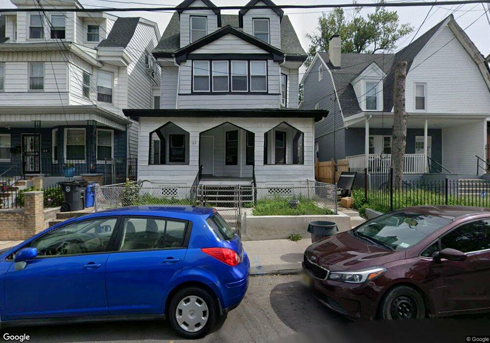
165 N 12th St Newark, NJ 07107
Lower Roseville NeighborhoodEstimated Value: $294,000 - $676,000
--
Bed
--
Bath
4,494
Sq Ft
$117/Sq Ft
Est. Value
About This Home
This home is located at 165 N 12th St, Newark, NJ 07107 and is currently estimated at $526,214, approximately $117 per square foot. 165 N 12th St is a home located in Essex County with nearby schools including Dr. William H. Horton School, First Avenue Elementary School, and Franklin School.
Ownership History
Date
Name
Owned For
Owner Type
Purchase Details
Closed on
Mar 26, 2025
Sold by
Lasenberry Emma
Bought by
165 N 12Th St Newark Llc
Current Estimated Value
Home Financials for this Owner
Home Financials are based on the most recent Mortgage that was taken out on this home.
Original Mortgage
$450,000
Outstanding Balance
$448,045
Interest Rate
6.76%
Mortgage Type
New Conventional
Estimated Equity
$78,169
Purchase Details
Closed on
Nov 13, 2001
Purchase Details
Closed on
Aug 16, 1989
Sold by
Lasenberry Emma and Lasenberry Terrel,Garrett
Bought by
Lasenberry Emma and Lasenberry Terrell,Emma
Create a Home Valuation Report for This Property
The Home Valuation Report is an in-depth analysis detailing your home's value as well as a comparison with similar homes in the area
Home Values in the Area
Average Home Value in this Area
Purchase History
| Date | Buyer | Sale Price | Title Company |
|---|---|---|---|
| 165 N 12Th St Newark Llc | $300,000 | None Listed On Document | |
| -- | $100 | -- | |
| Lasenberry Emma | $100 | -- |
Source: Public Records
Mortgage History
| Date | Status | Borrower | Loan Amount |
|---|---|---|---|
| Open | 165 N 12Th St Newark Llc | $450,000 |
Source: Public Records
Tax History Compared to Growth
Tax History
| Year | Tax Paid | Tax Assessment Tax Assessment Total Assessment is a certain percentage of the fair market value that is determined by local assessors to be the total taxable value of land and additions on the property. | Land | Improvement |
|---|---|---|---|---|
| 2025 | $6,729 | $180,500 | $28,800 | $151,700 |
| 2024 | $6,729 | $180,500 | $28,800 | $151,700 |
| 2022 | $6,743 | $180,500 | $28,800 | $151,700 |
| 2021 | $6,740 | $180,500 | $28,800 | $151,700 |
| 2020 | $6,859 | $180,500 | $28,800 | $151,700 |
| 2019 | $6,789 | $180,500 | $28,800 | $151,700 |
| 2018 | $6,666 | $180,500 | $28,800 | $151,700 |
| 2017 | $6,426 | $180,500 | $28,800 | $151,700 |
| 2016 | $6,209 | $180,500 | $28,800 | $151,700 |
| 2015 | $5,973 | $180,500 | $28,800 | $151,700 |
| 2014 | $5,597 | $180,500 | $28,800 | $151,700 |
Source: Public Records
Map
Nearby Homes
- 167 N 12th St
- 169 N 12th St
- 159 N 12th St Unit 2
- 159 N 12th St Unit 2
- 159 N 12th St
- 159 N 12th St Unit 3
- 171 N 12th St Unit 173
- 194 N 11th St
- 192 N 11th St
- 196 N 11th St
- 168 170 N 12th Unit 3
- 157 N 12th St
- 190 N 11th St
- 198 N 11th St
- 175 N 12th St
- 188 N 11th St
- 179 12th Ave Unit 181
- 179 12th Ave Unit 1
- 186 N 11th St
- 177-179 N 12th St