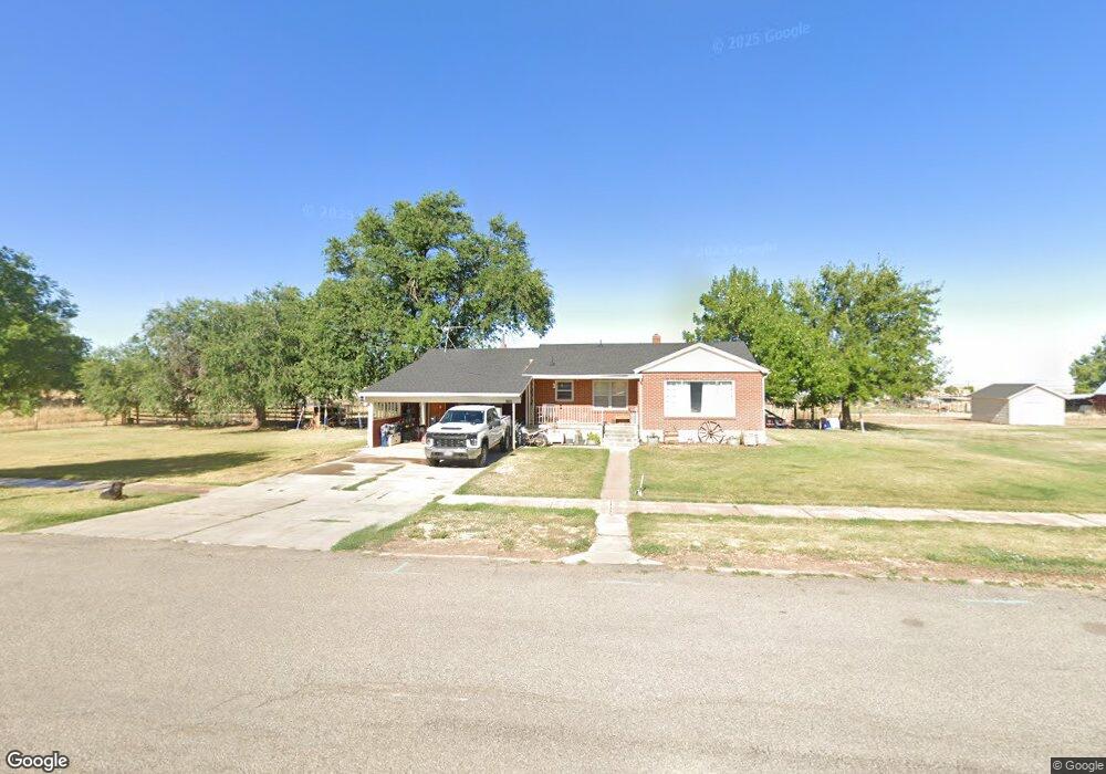
165 N Main St Kanosh, UT 84637
Estimated Value: $323,000 - $724,000
--
Bed
--
Bath
--
Sq Ft
1.77
Acres
About This Home
This home is located at 165 N Main St, Kanosh, UT 84637 and is currently estimated at $465,980. 165 N Main St is a home.
Ownership History
Date
Name
Owned For
Owner Type
Purchase Details
Closed on
Jul 21, 2018
Sold by
Taft Watts Family Llc
Bought by
Whitaker Deniann and Whitaker Cameron N
Current Estimated Value
Home Financials for this Owner
Home Financials are based on the most recent Mortgage that was taken out on this home.
Original Mortgage
$127,645
Outstanding Balance
$110,639
Interest Rate
4.6%
Mortgage Type
FHA
Estimated Equity
$355,341
Create a Home Valuation Report for This Property
The Home Valuation Report is an in-depth analysis detailing your home's value as well as a comparison with similar homes in the area
Home Values in the Area
Average Home Value in this Area
Purchase History
| Date | Buyer | Sale Price | Title Company |
|---|---|---|---|
| Whitaker Deniann | -- | First American Title |
Source: Public Records
Mortgage History
| Date | Status | Borrower | Loan Amount |
|---|---|---|---|
| Open | Whitaker Deniann | $127,645 |
Source: Public Records
Tax History Compared to Growth
Tax History
| Year | Tax Paid | Tax Assessment Tax Assessment Total Assessment is a certain percentage of the fair market value that is determined by local assessors to be the total taxable value of land and additions on the property. | Land | Improvement |
|---|---|---|---|---|
| 2025 | $1,436 | $188,159 | $46,200 | $141,959 |
| 2024 | $1,436 | $218,902 | $57,921 | $160,981 |
| 2023 | $1,982 | $218,902 | $57,921 | $160,981 |
| 2022 | $1,419 | $133,271 | $46,337 | $86,934 |
| 2021 | $1,336 | $121,012 | $40,293 | $80,719 |
| 2020 | $1,168 | $106,862 | $36,630 | $70,232 |
| 2019 | $1,062 | $97,714 | $34,155 | $63,559 |
| 2018 | $1,004 | $94,609 | $31,050 | $63,559 |
| 2017 | $1,050 | $94,609 | $31,050 | $63,559 |
| 2016 | $868 | $81,595 | $22,913 | $58,682 |
| 2015 | $868 | $81,595 | $22,913 | $58,682 |
| 2014 | -- | $81,595 | $22,913 | $58,682 |
| 2013 | -- | $81,595 | $22,913 | $58,682 |
Source: Public Records
Map
Nearby Homes
- 135 E 200 N
- 115 W 200 S
- 58 E 300 South St
- 8610 S Highway 91
- 5098 W Hatton Rd
- Parcel # 8816
- 60 W Center St
- 145 N 200 E
- 50 N 100 Rd E
- 1565 W Sunflower Ln Unit 3
- 1615 W Sunflower Ln
- 1615 W Sunflower Ln Unit 4
- 1565 W Sunflower Ln
- 0 Tbd Black Rock Rd Unit LotWP001
- 2000 N West Frontage I-15
- 1100 S 725 Rd W
- 310 S 500 West Rd
- 190 W 400 St S
- 760 E 700 St S
- 155 E 500 St S