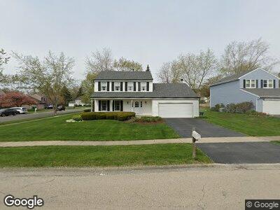
1650 Lind Ln Gurnee, IL 60031
Estimated Value: $330,304 - $400,000
--
Bed
3
Baths
1,806
Sq Ft
$206/Sq Ft
Est. Value
About This Home
This home is located at 1650 Lind Ln, Gurnee, IL 60031 and is currently estimated at $372,576, approximately $206 per square foot. 1650 Lind Ln is a home located in Lake County with nearby schools including Spaulding Elementary School, Viking Middle School, and Warren Township High School.
Ownership History
Date
Name
Owned For
Owner Type
Purchase Details
Closed on
Jan 9, 2020
Sold by
Haas Susan D and Haas John K
Bought by
Haas Susan D and Haas John K
Current Estimated Value
Purchase Details
Closed on
Mar 2, 2007
Sold by
Haas J Kevin and Haas Susan D
Bought by
Haas Susan D
Create a Home Valuation Report for This Property
The Home Valuation Report is an in-depth analysis detailing your home's value as well as a comparison with similar homes in the area
Home Values in the Area
Average Home Value in this Area
Purchase History
| Date | Buyer | Sale Price | Title Company |
|---|---|---|---|
| Haas Susan D | -- | None Available | |
| Haas Susan D | -- | None Available |
Source: Public Records
Mortgage History
| Date | Status | Borrower | Loan Amount |
|---|---|---|---|
| Closed | Haas Susan D | $178,000 | |
| Closed | Haas Susan D | $188,200 | |
| Closed | Haas Susan D | $220,000 | |
| Closed | Haas J Kevin | $200,615 | |
| Closed | Haas Kevin | $223,900 | |
| Closed | Haas J Kevin | $220,700 | |
| Closed | Haas J Kevin | $202,500 |
Source: Public Records
Tax History Compared to Growth
Tax History
| Year | Tax Paid | Tax Assessment Tax Assessment Total Assessment is a certain percentage of the fair market value that is determined by local assessors to be the total taxable value of land and additions on the property. | Land | Improvement |
|---|---|---|---|---|
| 2024 | $7,834 | $100,428 | $16,235 | $84,193 |
| 2023 | $8,371 | $93,239 | $15,073 | $78,166 |
| 2022 | $8,371 | $94,296 | $13,967 | $80,329 |
| 2021 | $7,590 | $90,513 | $13,407 | $77,106 |
| 2020 | $7,345 | $88,288 | $13,077 | $75,211 |
| 2019 | $7,155 | $85,724 | $12,697 | $73,027 |
| 2018 | $6,477 | $78,083 | $18,684 | $59,399 |
| 2017 | $6,402 | $75,846 | $18,149 | $57,697 |
| 2016 | $6,189 | $72,469 | $17,341 | $55,128 |
| 2015 | $5,987 | $68,730 | $16,446 | $52,284 |
| 2014 | $6,859 | $74,394 | $16,308 | $58,086 |
| 2012 | $6,501 | $74,964 | $16,433 | $58,531 |
Source: Public Records
Map
Nearby Homes
- 1629 Deer Run Rd
- 1701 Wausau Ln
- 1999 N Fuller Rd
- 5033 Boulders Dr
- 5118 Carol Ln Unit 16
- 5042 Boulders Dr
- 5156 Eau Claire Ct
- 5133 Carol Ln Unit 31
- 5177 Coventry Ln Unit D
- 5116 Beechwood Ave
- 1723 Victor Terrace
- 1338 Stratford Dr Unit 13A1
- 1328 Sunrise Ln Unit 16C1
- 5317 Cypress Cir
- 36396 N Skokie Hwy
- 1012 Elsie Ave
- 5416 Ebony Ct
- 1577 N Dilleys Rd
- 2107 Lawson Blvd
- 5423 Ashwood Ln