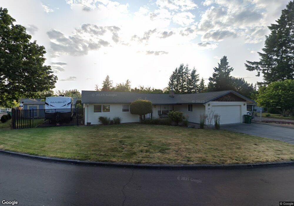
1650 SW Kings Byway Troutdale, OR 97060
Sunrise NeighborhoodEstimated Value: $457,991 - $496,000
3
Beds
2
Baths
1,398
Sq Ft
$342/Sq Ft
Est. Value
About This Home
This home is located at 1650 SW Kings Byway, Troutdale, OR 97060 and is currently estimated at $477,998, approximately $341 per square foot. 1650 SW Kings Byway is a home located in Multnomah County with nearby schools including Troutdale Elementary School, Walt Morey Middle School, and Reynolds High School.
Ownership History
Date
Name
Owned For
Owner Type
Purchase Details
Closed on
Jan 31, 2025
Sold by
Wilkerson Rodney Landon and Wilkerson Mary Christine
Bought by
Wilkerson Family Trust and Wilkerson
Current Estimated Value
Purchase Details
Closed on
May 29, 1996
Sold by
James Rodney Bryan
Bought by
Wilkerson Rodney Landon and Wilkerson Mary Christine
Home Financials for this Owner
Home Financials are based on the most recent Mortgage that was taken out on this home.
Original Mortgage
$108,500
Interest Rate
7.97%
Mortgage Type
Purchase Money Mortgage
Create a Home Valuation Report for This Property
The Home Valuation Report is an in-depth analysis detailing your home's value as well as a comparison with similar homes in the area
Home Values in the Area
Average Home Value in this Area
Purchase History
| Date | Buyer | Sale Price | Title Company |
|---|---|---|---|
| Wilkerson Family Trust | -- | None Listed On Document | |
| Wilkerson Rodney Landon | $114,900 | First American Title Ins Co |
Source: Public Records
Mortgage History
| Date | Status | Borrower | Loan Amount |
|---|---|---|---|
| Previous Owner | Wilkerson Rodney Landon | $108,500 |
Source: Public Records
Tax History Compared to Growth
Tax History
| Year | Tax Paid | Tax Assessment Tax Assessment Total Assessment is a certain percentage of the fair market value that is determined by local assessors to be the total taxable value of land and additions on the property. | Land | Improvement |
|---|---|---|---|---|
| 2025 | $4,399 | $237,850 | -- | -- |
| 2024 | $4,157 | $230,930 | -- | -- |
| 2023 | $4,049 | $224,210 | $0 | $0 |
| 2022 | $3,952 | $217,680 | $0 | $0 |
| 2021 | $3,859 | $211,340 | $0 | $0 |
| 2020 | $3,609 | $205,190 | $0 | $0 |
| 2019 | $3,464 | $199,220 | $0 | $0 |
| 2018 | $3,441 | $193,420 | $0 | $0 |
| 2017 | $3,433 | $187,790 | $0 | $0 |
| 2016 | $3,319 | $182,330 | $0 | $0 |
| 2015 | $3,236 | $177,020 | $0 | $0 |
| 2014 | $3,147 | $171,870 | $0 | $0 |
Source: Public Records
Map
Nearby Homes
- 839 SW Grant Way
- 1226 SW Hensley Rd
- 2020 SW Laura Ct
- 821 SW 14th St
- 665 SW 24th St
- 809 SW Crestview Way
- 735 SW Sunset Way
- 2154 SE Sandy Ct
- 1021 SW 24th St
- 1212 SW Edgefield Ave
- 2511 S Troutdale Rd
- 1427 SW 24th St
- 2326 SW Mcginnis Ave
- 1106 SW Dottie Ct
- 724 SW 28th St
- 2846 SW Faith Ct
- 1392 SW Berryessa Place
- 1018 SW Halsey St
- 1953 SW Northstar Way
- 2505 SE Clark Ct
- 1645 SW Clara St
- 1665 SW Kings Byway
- 1645 SW Kings Byway
- 1615 SW Clara St
- 1635 SW Kings Byway
- 1590 SW Kings Byway
- 1760 SW Clara St
- 0 Corner Clara Ave & Vernon Ave Ave Unit G4676815
- 1585 SW Clara St
- 1615 SW Kings Byway
- 1640 SW Clara St
- 1550 SW Kings Byway
- 1667 SW Kendall Ct
- 1756 SW Clara St
- 1663 SW Kendall Ct
- 1575 SW Kings Byway
- 1565 SW Clara St
- 1620 SW Clara St
- 1669 SW Kendall Ct
- 1659 SW Kendall Ct