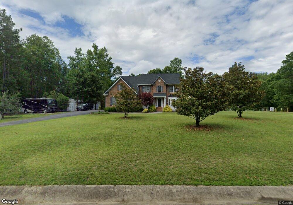
16500 Brattice Mill Rd Chesterfield, VA 23838
South Chesterfield County NeighborhoodEstimated Value: $818,873 - $969,000
5
Beds
4
Baths
3,678
Sq Ft
$244/Sq Ft
Est. Value
About This Home
This home is located at 16500 Brattice Mill Rd, Chesterfield, VA 23838 and is currently estimated at $897,958, approximately $244 per square foot. 16500 Brattice Mill Rd is a home located in Chesterfield County with nearby schools including Grange Hall Elementary School, Bailey Bridge Middle School, and Cosby High School.
Ownership History
Date
Name
Owned For
Owner Type
Purchase Details
Closed on
May 16, 2007
Sold by
Wv Mcclure Inc
Bought by
Parks Patrick
Current Estimated Value
Home Financials for this Owner
Home Financials are based on the most recent Mortgage that was taken out on this home.
Original Mortgage
$417,000
Outstanding Balance
$253,787
Interest Rate
6.18%
Mortgage Type
New Conventional
Estimated Equity
$644,171
Create a Home Valuation Report for This Property
The Home Valuation Report is an in-depth analysis detailing your home's value as well as a comparison with similar homes in the area
Home Values in the Area
Average Home Value in this Area
Purchase History
| Date | Buyer | Sale Price | Title Company |
|---|---|---|---|
| Parks Patrick | $594,323 | -- |
Source: Public Records
Mortgage History
| Date | Status | Borrower | Loan Amount |
|---|---|---|---|
| Open | Parks Patrick | $417,000 |
Source: Public Records
Tax History Compared to Growth
Tax History
| Year | Tax Paid | Tax Assessment Tax Assessment Total Assessment is a certain percentage of the fair market value that is determined by local assessors to be the total taxable value of land and additions on the property. | Land | Improvement |
|---|---|---|---|---|
| 2025 | $5,574 | $623,500 | $84,300 | $539,200 |
| 2024 | $5,574 | $596,300 | $81,300 | $515,000 |
| 2023 | $5,179 | $569,100 | $79,300 | $489,800 |
| 2022 | $5,263 | $572,100 | $79,300 | $492,800 |
| 2021 | $4,904 | $513,600 | $77,300 | $436,300 |
| 2020 | $4,822 | $507,600 | $77,300 | $430,300 |
| 2019 | $4,803 | $505,600 | $75,300 | $430,300 |
| 2018 | $4,803 | $505,600 | $75,300 | $430,300 |
| 2017 | $4,493 | $468,000 | $72,300 | $395,700 |
| 2016 | $4,151 | $432,400 | $67,300 | $365,100 |
| 2015 | $4,407 | $459,100 | $107,600 | $351,500 |
| 2014 | $3,966 | $413,100 | $105,600 | $307,500 |
Source: Public Records
Map
Nearby Homes
- 10601 Beaver Bridge Rd
- 16912 Farthing Ct
- NANTUCKET Plan at Copper Grove at Harpers Mill
- Hampshire Plan at Copper Grove at Harpers Mill
- Hadley Plan at Copper Grove at Harpers Mill
- Westerly Plan at Copper Grove at Harpers Mill
- Tillman Plan at Copper Grove at Harpers Mill
- Jamestown Plan at Copper Grove at Harpers Mill
- Summit Plan at Copper Grove at Harpers Mill
- 8918 Glen Royal Dr
- 11121 Coalboro Rd
- 9101 Verneham Ct
- 16906 Farthing Ct
- 9118 Saxsawn Ln
- 16813 Copperland Point
- 16801 Copperland Point
- 16825 Chalet Ct
- 8849 Farthing Dr
- 8843 Farthing Dr
- 8825 Farthing Dr
- 16512 Brattice Mill Rd
- 16507 Brattice Mill Rd
- 16501 Brattice Mill Rd
- 16513 Brattice Mill Rd
- 10118 Coalboro Rd
- 10112 Coalboro Rd
- 16518 Brattice Mill Rd
- 10201 Coalboro Rd
- 10201 Brattice Mill Ct
- 16519 Brattice Mill Rd
- 10020 Coalboro Rd
- 10300 Coalboro Rd
- 10040 Coalboro Rd
- 10101 Coalboro Rd
- 10132 Coalboro Rd
- 16600 Brattice Mill Rd
- 10010 Coalboro Rd
- 10106 Coalboro Rd
- 10200 Brattice Mill Ct
- 10213 Brattice Mill Ct