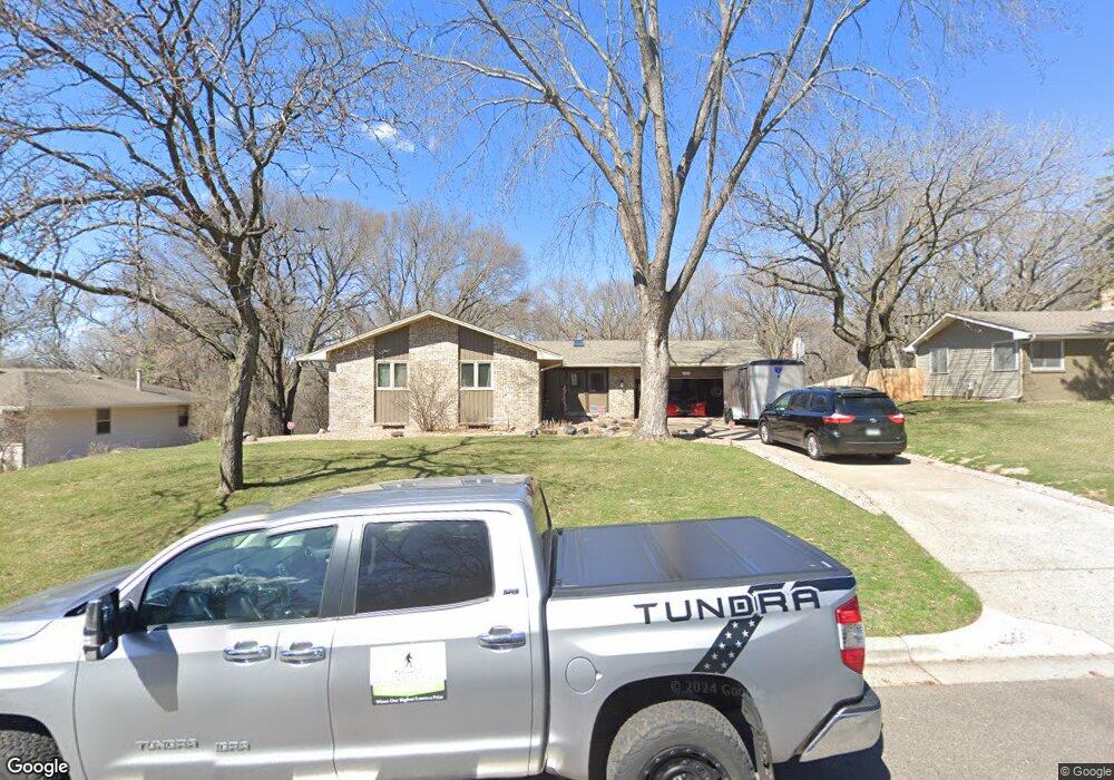
1651 127th Ave NW Coon Rapids, MN 55448
Estimated Value: $361,000 - $462,179
5
Beds
3
Baths
2,714
Sq Ft
$152/Sq Ft
Est. Value
About This Home
This home is located at 1651 127th Ave NW, Coon Rapids, MN 55448 and is currently estimated at $411,545, approximately $151 per square foot. 1651 127th Ave NW is a home located in Anoka County with nearby schools including Morris Bye Elementary School, Coon Rapids Middle School, and Coon Rapids Senior High School.
Ownership History
Date
Name
Owned For
Owner Type
Purchase Details
Closed on
Jun 15, 2021
Sold by
Dexter Patricia Ann and Dexter Tricia A
Bought by
Nelson Blake and Nelson Lacie
Current Estimated Value
Home Financials for this Owner
Home Financials are based on the most recent Mortgage that was taken out on this home.
Original Mortgage
$396,000
Interest Rate
3.05%
Mortgage Type
New Conventional
Purchase Details
Closed on
Sep 22, 2006
Sold by
Kurtz Norma J and Kurtz Emmet C
Bought by
Dexter Robert C and Dexter Tricia A
Home Financials for this Owner
Home Financials are based on the most recent Mortgage that was taken out on this home.
Original Mortgage
$292,871
Interest Rate
6.49%
Mortgage Type
New Conventional
Create a Home Valuation Report for This Property
The Home Valuation Report is an in-depth analysis detailing your home's value as well as a comparison with similar homes in the area
Home Values in the Area
Average Home Value in this Area
Purchase History
| Date | Buyer | Sale Price | Title Company |
|---|---|---|---|
| Nelson Blake | $443,000 | Rgs Title Llc | |
| Dexter Robert C | $308,286 | -- |
Source: Public Records
Mortgage History
| Date | Status | Borrower | Loan Amount |
|---|---|---|---|
| Previous Owner | Nelson Blake | $396,000 | |
| Previous Owner | Dexter Robert C | $292,871 |
Source: Public Records
Tax History Compared to Growth
Tax History
| Year | Tax Paid | Tax Assessment Tax Assessment Total Assessment is a certain percentage of the fair market value that is determined by local assessors to be the total taxable value of land and additions on the property. | Land | Improvement |
|---|---|---|---|---|
| 2025 | $4,264 | $389,500 | $108,900 | $280,600 |
| 2024 | $4,264 | $382,900 | $105,300 | $277,600 |
| 2023 | $3,909 | $373,800 | $87,100 | $286,700 |
| 2022 | $3,696 | $374,700 | $87,100 | $287,600 |
| 2021 | $3,622 | $315,600 | $67,800 | $247,800 |
| 2020 | $3,602 | $302,400 | $67,800 | $234,600 |
| 2019 | $3,460 | $288,800 | $67,800 | $221,000 |
| 2018 | $3,116 | $269,900 | $0 | $0 |
| 2017 | $2,887 | $236,700 | $0 | $0 |
| 2016 | $2,942 | $215,700 | $0 | $0 |
| 2015 | $2,659 | $215,700 | $50,000 | $165,700 |
| 2014 | -- | $182,600 | $35,400 | $147,200 |
Source: Public Records
Map
Nearby Homes
- 12554 Grouse St NW
- 1593 126th Ln NW
- 1450 126th Ln NW
- 1520 129th Ave NW
- 12859 Grouse St NW
- 1930 127th Cir NW
- 12796 Bluebird St NW
- 1625 124th Ave NW
- 12365 Jay St NW
- 12463 Drake St NW
- 1234 128th Cir NW
- 1687 131st Ln NW
- 2068 124th Ln NW
- 2147 125th Ln NW
- 12760 Raven St NW
- 1727 121st Ln NW
- 1776 133rd Ave NW
- 12488 Unity St NW
- 12010 Eagle St NW
- 13416 Swallow St NW
- 1641 127th Ave NW
- 1661 127th Ave NW
- 12660 Grouse St NW
- 1644 127th Ave NW
- 1644 1644 127th Ave NW
- 1656 127th Ave NW
- 1631 127th Ave NW
- 12650 Grouse St NW
- 12700 Hummingbird St NW
- 12710 Hummingbird St NW
- 12651 Hummingbird St NW
- 1615 127th Ave NW
- 1620 127th Ave NW
- 12660 Hummingbird St NW
- 12640 Grouse St NW
- 12651 Grouse St NW
- 12641 Hummingbird St NW
- 12650 Hummingbird St NW
- 1601 127th Ave NW
- 1600 127th Ave NW