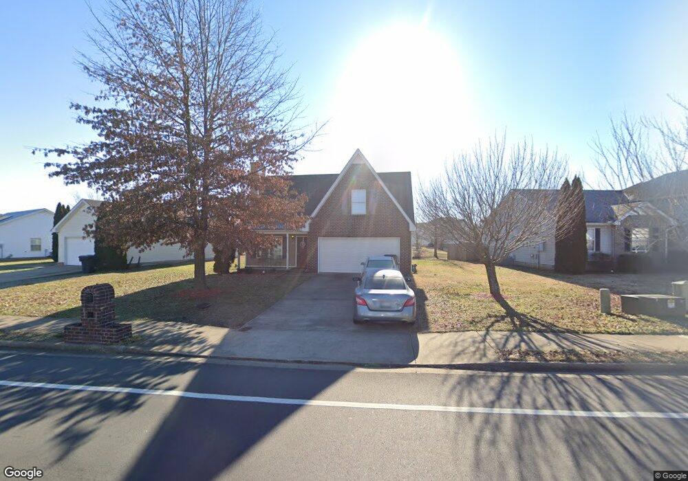
1651 Saint Andrews Dr Murfreesboro, TN 37128
Estimated Value: $358,237 - $388,000
--
Bed
3
Baths
1,735
Sq Ft
$217/Sq Ft
Est. Value
About This Home
This home is located at 1651 Saint Andrews Dr, Murfreesboro, TN 37128 and is currently estimated at $376,559, approximately $217 per square foot. 1651 Saint Andrews Dr is a home located in Rutherford County with nearby schools including Cason Lane Academy, Rockvale Middle School, and Rockvale High School.
Ownership History
Date
Name
Owned For
Owner Type
Purchase Details
Closed on
Oct 25, 2006
Sold by
Curtis Gibson
Bought by
Gibson and Meichelle
Current Estimated Value
Home Financials for this Owner
Home Financials are based on the most recent Mortgage that was taken out on this home.
Original Mortgage
$143,840
Interest Rate
6.27%
Purchase Details
Closed on
Aug 9, 2004
Sold by
Ole South Properties Inc
Bought by
Curtis Gibson
Home Financials for this Owner
Home Financials are based on the most recent Mortgage that was taken out on this home.
Original Mortgage
$26,198
Interest Rate
5.96%
Purchase Details
Closed on
Aug 6, 2004
Sold by
Ole South Properties Inc
Bought by
Curtis Gibson
Home Financials for this Owner
Home Financials are based on the most recent Mortgage that was taken out on this home.
Original Mortgage
$26,198
Interest Rate
5.96%
Create a Home Valuation Report for This Property
The Home Valuation Report is an in-depth analysis detailing your home's value as well as a comparison with similar homes in the area
Home Values in the Area
Average Home Value in this Area
Purchase History
| Date | Buyer | Sale Price | Title Company |
|---|---|---|---|
| Gibson | -- | -- | |
| Curtis Gibson | $130,990 | -- | |
| Curtis Gibson | $130,990 | -- |
Source: Public Records
Mortgage History
| Date | Status | Borrower | Loan Amount |
|---|---|---|---|
| Open | Curtis Gibson | $153,611 | |
| Closed | Curtis Gibson | $143,840 | |
| Previous Owner | Curtis Gibson | $26,198 | |
| Previous Owner | Curtis Gibson | $104,792 | |
| Previous Owner | Curtis Gibson | $104,792 |
Source: Public Records
Tax History Compared to Growth
Tax History
| Year | Tax Paid | Tax Assessment Tax Assessment Total Assessment is a certain percentage of the fair market value that is determined by local assessors to be the total taxable value of land and additions on the property. | Land | Improvement |
|---|---|---|---|---|
| 2025 | $2,079 | $73,475 | $13,750 | $59,725 |
| 2024 | $2,079 | $73,475 | $13,750 | $59,725 |
| 2023 | $1,377 | $73,375 | $13,750 | $59,625 |
| 2022 | $1,186 | $73,375 | $13,750 | $59,625 |
| 2021 | $1,169 | $52,650 | $9,375 | $43,275 |
| 2020 | $1,169 | $52,650 | $9,375 | $43,275 |
| 2019 | $1,169 | $52,650 | $9,375 | $43,275 |
| 2018 | $1,605 | $52,650 | $0 | $0 |
| 2017 | $1,455 | $37,425 | $0 | $0 |
| 2016 | $1,455 | $37,425 | $0 | $0 |
| 2015 | $1,455 | $37,425 | $0 | $0 |
| 2014 | $931 | $37,425 | $0 | $0 |
| 2013 | -- | $38,325 | $0 | $0 |
Source: Public Records
Map
Nearby Homes
- 1541 Teresa Ln
- 1421 Rebecca Johns Dr
- 1442 Rebecca Johns Dr Unit V20
- 1518 Saint Andrews Dr
- 1725 Satterfield Ct
- 1417 Ovaldale Dr
- 1712 Odessa Ave
- 3216 Terrapin Ct
- 1919 Debonair Ln
- 1736 Bellamy Ln
- 1710 Locerbie Dr
- 3307 Perlino Dr
- 2012 Victory Gallop Ln
- 2017 Victory Gallop Ln
- 3331 Alta Ln
- 2307 Katie Ct
- 3315 Alta Ln
- 1943 Odessa Ave
- 1823 Joben Dr
- 1315 Elevation ABC Plan at Evergreen Farms
- 1647 Saint Andrews Dr
- 1655 St Andrews
- 1655 Saint Andrews Dr
- 1643 Saint Andrews Dr
- 1665 Saint Andrews Dr
- 1656 Saint Andrews Dr
- 1652 Saint Andrews Dr
- 3144 Sherborne Ct
- 1648 Saint Andrews Dr
- 1639 Saint Andrews Dr
- 1660 Saint Andrews Dr
- 3134 Donard Ct
- 1644 Saint Andrews Dr
- 3135 Donard Ct
- 1664 Saint Andrews Dr
- 1669 St Andrews Dr
- 1669 Saint Andrews Dr
- 3140 Sherborne Ct
- 1640 Saint Andrews Dr
- 1668 Saint Andrews Dr