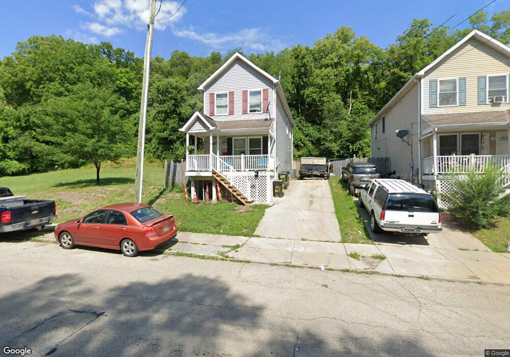
1651 State Ave Cincinnati, OH 45204
East Price Hill NeighborhoodEstimated Value: $74,527 - $116,000
3
Beds
2
Baths
1,408
Sq Ft
$64/Sq Ft
Est. Value
About This Home
This home is located at 1651 State Ave, Cincinnati, OH 45204 and is currently estimated at $90,132, approximately $64 per square foot. 1651 State Ave is a home located in Hamilton County with nearby schools including Oyler School, Robert A. Taft Information Technology High School, and Gilbert A. Dater High School.
Ownership History
Date
Name
Owned For
Owner Type
Purchase Details
Closed on
Sep 26, 2025
Sold by
Reckman Properties Ltd
Bought by
Price Hill Will
Current Estimated Value
Purchase Details
Closed on
May 14, 2025
Sold by
Jones Rachel Nicole and Roberts Jay Edward
Bought by
Reckman Properties Ltd
Purchase Details
Closed on
Sep 9, 2022
Sold by
Baker David L and Baker Melissa L
Bought by
Jones Rachel Nicole and Roberts Jay Edward
Purchase Details
Closed on
Sep 25, 2009
Sold by
Lower Price Hill Llc
Bought by
Baker David L and Cornelius Melissa L
Home Financials for this Owner
Home Financials are based on the most recent Mortgage that was taken out on this home.
Original Mortgage
$60,000
Interest Rate
5.38%
Mortgage Type
Future Advance Clause Open End Mortgage
Purchase Details
Closed on
May 1, 2007
Sold by
Lower Price Hill Llc
Bought by
Lower Price Hill Llc
Purchase Details
Closed on
Dec 27, 2006
Sold by
Bussell Kim M and Leach Karen A
Bought by
Lower Price Hill Llc
Purchase Details
Closed on
Jul 31, 2006
Sold by
Lot King Development Co
Bought by
Lower Price Hill Llc
Purchase Details
Closed on
May 27, 1999
Sold by
Estate Of Howard E Klare
Bought by
Bussell Kim M and Leach Karen A
Create a Home Valuation Report for This Property
The Home Valuation Report is an in-depth analysis detailing your home's value as well as a comparison with similar homes in the area
Home Values in the Area
Average Home Value in this Area
Purchase History
| Date | Buyer | Sale Price | Title Company |
|---|---|---|---|
| Price Hill Will | $75,000 | None Listed On Document | |
| Reckman Properties Ltd | $60,000 | None Listed On Document | |
| Reckman Properties Ltd | $60,000 | None Listed On Document | |
| Jones Rachel Nicole | $60,000 | -- | |
| Baker David L | -- | Attorney | |
| Lower Price Hill Llc | -- | None Available | |
| Lower Price Hill Llc | $42,900 | None Available | |
| Lower Price Hill Llc | $7,900 | None Available | |
| Bussell Kim M | -- | -- |
Source: Public Records
Mortgage History
| Date | Status | Borrower | Loan Amount |
|---|---|---|---|
| Previous Owner | Baker David L | $60,000 |
Source: Public Records
Tax History
| Year | Tax Paid | Tax Assessment Tax Assessment Total Assessment is a certain percentage of the fair market value that is determined by local assessors to be the total taxable value of land and additions on the property. | Land | Improvement |
|---|---|---|---|---|
| 2025 | $1,314 | $21,001 | $1,600 | $19,401 |
| 2024 | $1,275 | $21,001 | $1,600 | $19,401 |
| 2023 | $1,303 | $21,001 | $1,600 | $19,401 |
| 2022 | $1,820 | $26,436 | $1,411 | $25,025 |
| 2021 | $1,746 | $26,436 | $1,411 | $25,025 |
| 2020 | $1,796 | $26,436 | $1,411 | $25,025 |
| 2019 | $1,785 | $24,031 | $1,281 | $22,750 |
| 2018 | $111 | $24,031 | $1,281 | $22,750 |
| 2017 | $105 | $24,031 | $1,281 | $22,750 |
| 2016 | $106 | $20,448 | $1,292 | $19,156 |
| 2015 | $97 | $20,448 | $1,292 | $19,156 |
| 2014 | $98 | $20,448 | $1,292 | $19,156 |
| 2013 | $123 | $26,216 | $1,656 | $24,560 |
Source: Public Records
Map
Nearby Homes
- 1671 State Ave
- 1669 State Ave
- 1708 State Ave
- 1900 State Ave
- 1948 State Ave
- 2182 Grand Ave
- 1646 State Ave
- 2173 Clara St
- 2169 Clara St
- 2165 Clara St
- 2281 Northside Ave
- 2832 Claypole Ave
- 1699 Westwood Ave
- 2227 Grand Ave
- 1114 Wing St
- 1724 Esmonde St
- 2829 Glenway Ave
- 1741 Grand Ave
- 2540 Ring Place
- 1712 Queen City Ave
Your Personal Tour Guide
Ask me questions while you tour the home.