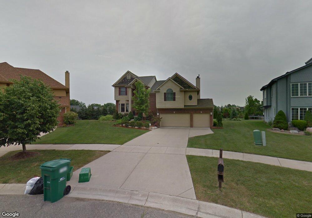
1651 Wake Robin Ct Ann Arbor, MI 48103
Estimated Value: $645,000 - $787,000
4
Beds
3
Baths
2,709
Sq Ft
$260/Sq Ft
Est. Value
About This Home
This home is located at 1651 Wake Robin Ct, Ann Arbor, MI 48103 and is currently estimated at $703,505, approximately $259 per square foot. 1651 Wake Robin Ct is a home located in Washtenaw County with nearby schools including Dicken Elementary School, Slauson Middle School, and Pioneer High School.
Ownership History
Date
Name
Owned For
Owner Type
Purchase Details
Closed on
Mar 22, 2023
Sold by
Sood Manak
Bought by
Manak Sood Trust
Current Estimated Value
Purchase Details
Closed on
Dec 30, 2022
Sold by
Manak Sood Trust
Bought by
Sood Manak
Home Financials for this Owner
Home Financials are based on the most recent Mortgage that was taken out on this home.
Original Mortgage
$370,000
Interest Rate
6.25%
Mortgage Type
New Conventional
Purchase Details
Closed on
Mar 7, 2006
Sold by
Sood Manak and Sood Lucienne M
Bought by
Sood Manak and Sood Lucienne Marie
Purchase Details
Closed on
Apr 8, 1998
Sold by
Bsi Land Co
Bought by
Upland Homes Llc
Create a Home Valuation Report for This Property
The Home Valuation Report is an in-depth analysis detailing your home's value as well as a comparison with similar homes in the area
Home Values in the Area
Average Home Value in this Area
Purchase History
| Date | Buyer | Sale Price | Title Company |
|---|---|---|---|
| Manak Sood Trust | -- | -- | |
| Sood Manak | -- | Preferred Title | |
| Sood Manak | -- | None Available | |
| Upland Homes Llc | $52,380 | -- |
Source: Public Records
Mortgage History
| Date | Status | Borrower | Loan Amount |
|---|---|---|---|
| Previous Owner | Sood Manak | $370,000 |
Source: Public Records
Tax History Compared to Growth
Tax History
| Year | Tax Paid | Tax Assessment Tax Assessment Total Assessment is a certain percentage of the fair market value that is determined by local assessors to be the total taxable value of land and additions on the property. | Land | Improvement |
|---|---|---|---|---|
| 2025 | -- | $340,600 | $0 | $0 |
| 2024 | $5,913 | $337,100 | $0 | $0 |
| 2023 | $5,682 | $319,500 | $0 | $0 |
| 2022 | $7,936 | $283,400 | $0 | $0 |
| 2021 | $7,545 | $277,600 | $0 | $0 |
| 2020 | $7,726 | $275,300 | $0 | $0 |
| 2019 | $7,136 | $259,900 | $259,900 | $0 |
| 2018 | $6,947 | $238,900 | $0 | $0 |
| 2017 | $6,697 | $241,200 | $0 | $0 |
| 2016 | $4,723 | $185,696 | $0 | $0 |
| 2015 | -- | $185,141 | $0 | $0 |
| 2014 | -- | $179,357 | $0 | $0 |
| 2013 | -- | $179,357 | $0 | $0 |
Source: Public Records
Map
Nearby Homes
- 1419 N Bay Dr Unit 73
- 1860 Chicory Ridge
- 1366 N Bay Dr Unit 144
- 1770 Harley Dr
- 1599 Scio Ridge Rd
- 1929 Harley Dr
- 2512 Jade Ct Unit 18
- 1740 S Maple Rd Unit 2
- 2126 Pauline Blvd Unit 104
- 1225 S Maple Rd Unit 307
- 1235 S Maple Rd Unit 202
- 813 E Summerfield Glen Cir
- 2120 Pauline Blvd Unit 305
- 1265 S Maple Rd Unit 207
- 2165 Pauline Ct Unit 14
- 1053 Bluestem Ln
- 2147 Pauline Ct Unit 17
- 2104 Pauline Blvd Unit 305
- 2033 Pauline Ct
- 609 Liberty Pointe Dr Unit 45
- 1645 Wake Robin Ct
- 1677 Chicory Ridge
- 1657 Wake Robin Ct
- 1639 Wake Robin Ct
- 1691 Chicory Ridge
- 1548 Chapleau Dr Unit 33
- 1540 Chapleau Dr Unit 32
- 1556 Chapleau Dr
- 1633 Wake Robin Ct
- 1532 Chapleau Dr
- 1621 Wake Robin Ct Unit 79
- 1662 Chicory Ridge
- 1572 Chapleau Dr Unit 36
- 1676 Chicory Ridge
- 1524 Chapleau Dr Unit 30
- 1648 Chicory Ridge
- 1705 Chicory Ridge
- 1580 Chapleau Dr Unit 37
- 1698 Chicory Ridge
- 1516 Chapleau Dr Unit 29