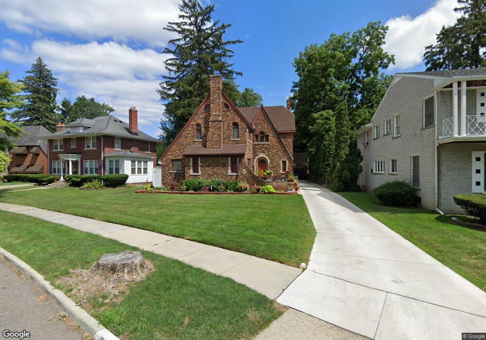
16516 Westmoreland Rd Detroit, MI 48219
North Rosedale Park NeighborhoodEstimated Value: $214,000 - $352,346
5
Beds
4
Baths
1,924
Sq Ft
$154/Sq Ft
Est. Value
About This Home
This home is located at 16516 Westmoreland Rd, Detroit, MI 48219 and is currently estimated at $295,337, approximately $153 per square foot. 16516 Westmoreland Rd is a home located in Wayne County with nearby schools including Cooke STEM Academy, Ralph W. Emerson Elementary-Middle School, and Charles L. Spain Elementary-Middle School.
Ownership History
Date
Name
Owned For
Owner Type
Purchase Details
Closed on
Aug 6, 2008
Sold by
Franklin Credit Management Corp
Bought by
Tribeca Lending Corp
Current Estimated Value
Purchase Details
Closed on
Jun 25, 2008
Sold by
Franklin Credit Management Corp
Bought by
Tribeca Lending Corp
Purchase Details
Closed on
Sep 6, 2006
Sold by
Whitfield Stewart Jayme M and Stewart Ronald
Bought by
Franklin Credit Management Corp
Create a Home Valuation Report for This Property
The Home Valuation Report is an in-depth analysis detailing your home's value as well as a comparison with similar homes in the area
Home Values in the Area
Average Home Value in this Area
Purchase History
| Date | Buyer | Sale Price | Title Company |
|---|---|---|---|
| Tribeca Lending Corp | -- | Attorneys Title Agency Llc | |
| Tribeca Lending Corp | -- | First American Title | |
| Franklin Credit Management Corp | $262,162 | None Available |
Source: Public Records
Tax History Compared to Growth
Tax History
| Year | Tax Paid | Tax Assessment Tax Assessment Total Assessment is a certain percentage of the fair market value that is determined by local assessors to be the total taxable value of land and additions on the property. | Land | Improvement |
|---|---|---|---|---|
| 2025 | $2,402 | $214,300 | $0 | $0 |
| 2024 | $2,402 | $203,500 | $0 | $0 |
| 2023 | $2,092 | $162,400 | $0 | $0 |
| 2022 | $2,579 | $112,300 | $0 | $0 |
| 2021 | $2,267 | $78,200 | $0 | $0 |
| 2020 | $2,477 | $66,300 | $0 | $0 |
| 2019 | $2,436 | $51,300 | $0 | $0 |
| 2018 | $2,033 | $42,400 | $0 | $0 |
| 2017 | $567 | $39,200 | $0 | $0 |
| 2016 | $2,335 | $43,500 | $0 | $0 |
| 2015 | $3,480 | $34,800 | $0 | $0 |
| 2013 | $6,043 | $60,428 | $0 | $0 |
| 2010 | -- | $2,368 | $2,367 | $1 |
Source: Public Records
Map
Nearby Homes
- 16555 Edinborough Rd
- 19520 Bretton Dr
- 16540 Evergreen Rd
- 9355 W Outer Dr
- 16742 Huntington Rd
- 16762 Evergreen Rd
- 19209 Bretton Dr
- 9161 W Outer Dr
- 9531 W Outer Dr
- 15829 Minock St
- 15766 Plainview Ave
- 16888 Huntington Rd
- 16887 Evergreen Rd
- 19191 Lancashire St
- 16777 Kentfield St
- 16194 Fielding St
- 16870 Shaftsbury Ave
- 16614 Sunderland Rd
- 16209 Stahelin Ave
- 16718 Sunderland Rd
- 16516 Westmoreland Rd
- 16500 Westmoreland Rd
- 16528 Westmoreland Rd
- 16515 Edinborough Rd
- 16505 Edinborough Rd
- 16540 Westmoreland Rd
- 16545 Edinborough Rd
- 16545 Edinborough Rd
- 16525 Edinborough Rd
- 16535 Edinborough Rd
- 16552 Westmoreland Rd
- 19532 Bretton Dr
- 19544 Bretton Dr
- 16558 Westmoreland Rd
- 16521 Westmoreland Rd
- 16501 Westmoreland Rd
- 16565 Edinborough Rd
- 19504 Bretton Dr
- 19556 Bretton Dr
- 16575 Edinborough Rd