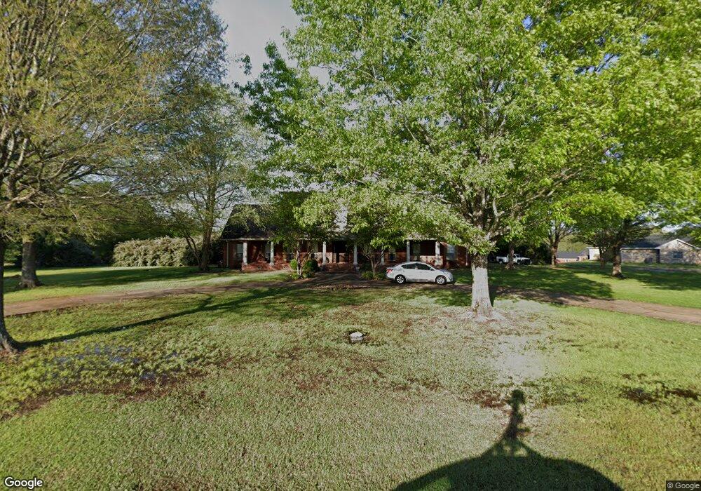
1652 Taylor Thurston Rd Columbus, MS 39701
Estimated Value: $437,000 - $595,000
--
Bed
--
Bath
3,808
Sq Ft
$135/Sq Ft
Est. Value
About This Home
This home is located at 1652 Taylor Thurston Rd, Columbus, MS 39701 and is currently estimated at $513,866, approximately $134 per square foot. 1652 Taylor Thurston Rd is a home.
Ownership History
Date
Name
Owned For
Owner Type
Purchase Details
Closed on
Feb 16, 2022
Sold by
Dowdle Howle Elizabeth J and Dowdle Ray
Bought by
Robertson Dale A and Robertson Evie L
Current Estimated Value
Home Financials for this Owner
Home Financials are based on the most recent Mortgage that was taken out on this home.
Original Mortgage
$400,900
Outstanding Balance
$362,549
Interest Rate
3.69%
Mortgage Type
New Conventional
Estimated Equity
$151,317
Purchase Details
Closed on
Dec 19, 2012
Sold by
Skelton Stan
Bought by
Howle Elizabeth J Dowdle
Create a Home Valuation Report for This Property
The Home Valuation Report is an in-depth analysis detailing your home's value as well as a comparison with similar homes in the area
Home Values in the Area
Average Home Value in this Area
Purchase History
| Date | Buyer | Sale Price | Title Company |
|---|---|---|---|
| Robertson Dale A | -- | None Listed On Document | |
| Howle Elizabeth J Dowdle | -- | -- |
Source: Public Records
Mortgage History
| Date | Status | Borrower | Loan Amount |
|---|---|---|---|
| Open | Robertson Dale A | $400,900 |
Source: Public Records
Tax History Compared to Growth
Tax History
| Year | Tax Paid | Tax Assessment Tax Assessment Total Assessment is a certain percentage of the fair market value that is determined by local assessors to be the total taxable value of land and additions on the property. | Land | Improvement |
|---|---|---|---|---|
| 2025 | $3,264 | $37,055 | $0 | $0 |
| 2024 | $3,234 | $37,055 | $0 | $0 |
| 2023 | $2,832 | $32,970 | $0 | $0 |
| 2022 | $4,701 | $49,455 | $0 | $0 |
| 2021 | $2,716 | $32,970 | $0 | $0 |
| 2020 | $2,034 | $27,027 | $0 | $0 |
| 2019 | $2,113 | $26,899 | $0 | $0 |
| 2018 | $2,113 | $27,089 | $0 | $0 |
| 2017 | $2,004 | $27,089 | $0 | $0 |
| 2016 | $2,004 | $27,089 | $0 | $0 |
| 2015 | $2,071 | $27,867 | $0 | $0 |
| 2014 | $2,071 | $27,867 | $0 | $0 |
Source: Public Records
Map
Nearby Homes
- 49 Billy Casper Dr
- 1291 S Frontage Rd
- 23 Breezeway Cove
- 28 Breezeway Cove
- 100 Breezeway Cove
- 112 Breezeway Cove
- 96 Breezeway Cove
- 110 Breezeway Cove
- 0 Golden Horn Rd
- 0 S Frontage Road Lot #5 Unit 25-583
- 0 S Frontage Road Lot #3 Unit 25-581
- 0 S Frontage Road Lot #1 Unit 25-579
- 1381 S Frontage Rd
- 3267 Old West Point Rd
- 2 S Frontage Rd
- 4 S Frontage Rd
- 0 Hwy 45 N Unit 25-1761
- 541 Mount Airey Church Rd
- 5 Clisby Rd
- 13 Clisby Rd
- 1624 Taylor Thurston Rd
- 1708 Taylor Thurston Rd
- 1717 Taylor Thurston Rd
- 1751 Taylor Thurston Rd
- 1571 Taylor Thurston Rd
- 1750 Taylor Thurston Rd
- 1562 Taylor Thurston Rd
- 1781 Taylor Thurston Rd
- 1543 Taylor Thurston Rd
- 1801 Taylor Thurston Rd
- 1501 Taylor Thurston Rd
- 1790 Taylor Thurston Rd
- 9 Cobh Ln
- 1495 Taylor Thurston Rd
- 1837 Taylor Thurston Rd
- 17 Cobh Ln
- 27 Cobh Ln
- 1824 Taylor Thurston Rd
- 37 Cobh Ln
- 41 Cobh Ln