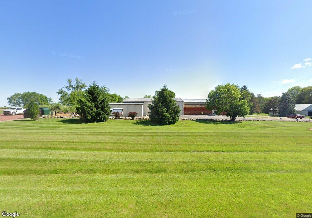
1652 Whetstone St Bucyrus, OH 44820
Estimated Value: $106,260
--
Bed
--
Bath
5,740
Sq Ft
$19/Sq Ft
Est. Value
About This Home
This home is located at 1652 Whetstone St, Bucyrus, OH 44820 and is currently estimated at $106,260, approximately $18 per square foot. 1652 Whetstone St is a home located in Crawford County with nearby schools including Hannah Crawford Elementary School (PK-2), Hannah Crawford Elementary School (3 - 5), and William Crawford Intermediate School.
Ownership History
Date
Name
Owned For
Owner Type
Purchase Details
Closed on
Jan 13, 2020
Sold by
Rasp Real Estate Llc
Bought by
King Kenneth W and King Michelle S
Current Estimated Value
Purchase Details
Closed on
Aug 1, 2018
Sold by
First Federal Bank Of Ohio
Bought by
Rasp Real Estate Llc
Purchase Details
Closed on
Jul 15, 2013
Sold by
The Estate Of D D Charity Llc
Bought by
First Federal Bank Of Ohio
Purchase Details
Closed on
Nov 29, 2006
Sold by
Sharrock David R and Sharrock
Bought by
Dd Charity Llc
Purchase Details
Closed on
Apr 3, 2006
Sold by
Shawber Ronny J
Bought by
Bucyrus Christian Center and Sharrock David R
Purchase Details
Closed on
Mar 6, 2004
Bought by
Sharrock David R and Sharrock Doris
Create a Home Valuation Report for This Property
The Home Valuation Report is an in-depth analysis detailing your home's value as well as a comparison with similar homes in the area
Home Values in the Area
Average Home Value in this Area
Purchase History
| Date | Buyer | Sale Price | Title Company |
|---|---|---|---|
| King Kenneth W | $65,000 | Acs Title Bucyrus | |
| Rasp Real Estate Llc | $35,000 | Acs Title Bucyrus | |
| First Federal Bank Of Ohio | $75,000 | American Mid Ohio Title | |
| Dd Charity Llc | -- | -- | |
| Bucyrus Christian Center | $94,000 | -- | |
| Sharrock David R | $94,000 | -- |
Source: Public Records
Tax History Compared to Growth
Tax History
| Year | Tax Paid | Tax Assessment Tax Assessment Total Assessment is a certain percentage of the fair market value that is determined by local assessors to be the total taxable value of land and additions on the property. | Land | Improvement |
|---|---|---|---|---|
| 2024 | $1,196 | $22,710 | $3,330 | $19,380 |
| 2023 | $1,196 | $12,250 | $2,290 | $9,960 |
| 2022 | $717 | $12,250 | $2,290 | $9,960 |
| 2021 | $734 | $12,250 | $2,290 | $9,960 |
| 2020 | $703 | $12,250 | $2,290 | $9,960 |
| 2019 | $728 | $12,250 | $2,290 | $9,960 |
| 2018 | $4,980 | $83,280 | $3,050 | $80,230 |
| 2017 | $2,128 | $33,250 | $2,290 | $30,960 |
| 2016 | $2,080 | $33,250 | $2,290 | $30,960 |
| 2015 | $2,049 | $33,250 | $2,290 | $30,960 |
| 2014 | $3,379 | $33,250 | $2,290 | $30,960 |
| 2013 | $3,379 | $56,000 | $2,290 | $53,710 |
Source: Public Records
Map
Nearby Homes
- 1465 Oakridge Dr
- 1267 N Dundee Trail
- 111 Kincora Dr
- 1320 E Southern Ave
- 948 S Highland Ave
- 318 Charlotte St
- 419 Short St
- 2208 State Route 19
- 1211 S Sandusky Ave
- 1021 S Sandusky Ave
- 346 Hopley Ave
- 583 Rogers St
- 708 S Sandusky Ave
- 900 S Spring St
- 1220 E Warren St
- 444 Woodlawn Ave
- 924 E Warren St
- 550 S Walnut St
- 452 Pleasant Ln
- 412 E Rensselaer St
- 1663 Whetstone St
- 0 Beal Ave Unit H122951
- 0 Beal Ave
- 1620 Whetstone St
- 1590 Whetstone St
- 1331 E Beal Ave
- 1575 Whetstone St
- 1323 Oakridge Dr
- 1333 Oakridge Dr
- 1337 E Beal Ave
- 1353 Oakridge Dr
- 1373 Oakridge Dr
- 1393 Oakridge Dr
- 1343 E Beal Ave
- 1423 Oakridge Dr
- 1533 Whetstone St
- 1349 E Beal Ave
- 1443 Oakridge Dr
- 1779 Whetstone St