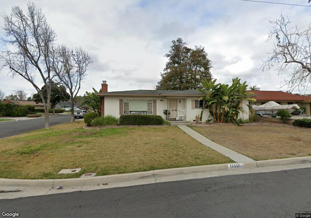
16537 Nearside St Whittier, CA 90603
South Whittier NeighborhoodEstimated Value: $907,000 - $1,054,000
3
Beds
2
Baths
1,942
Sq Ft
$496/Sq Ft
Est. Value
About This Home
This home is located at 16537 Nearside St, Whittier, CA 90603 and is currently estimated at $964,183, approximately $496 per square foot. 16537 Nearside St is a home located in Los Angeles County with nearby schools including Macy Elementary School, Rancho-Starbuck Intermediate School, and La Habra High School.
Ownership History
Date
Name
Owned For
Owner Type
Purchase Details
Closed on
Jun 6, 2011
Sold by
Walker Janine L and Rozanek Richard L
Bought by
Walker Gary E and Walker Janine L
Current Estimated Value
Home Financials for this Owner
Home Financials are based on the most recent Mortgage that was taken out on this home.
Original Mortgage
$140,000
Interest Rate
3.94%
Mortgage Type
New Conventional
Create a Home Valuation Report for This Property
The Home Valuation Report is an in-depth analysis detailing your home's value as well as a comparison with similar homes in the area
Home Values in the Area
Average Home Value in this Area
Purchase History
| Date | Buyer | Sale Price | Title Company |
|---|---|---|---|
| Walker Gary E | -- | Stewart Title Of California | |
| Rozanek Richard L | -- | Stewart Title Of California | |
| Rozanek Gary W | -- | Stewart Title Of California |
Source: Public Records
Mortgage History
| Date | Status | Borrower | Loan Amount |
|---|---|---|---|
| Closed | Rozanek Gary W | $140,000 |
Source: Public Records
Tax History Compared to Growth
Tax History
| Year | Tax Paid | Tax Assessment Tax Assessment Total Assessment is a certain percentage of the fair market value that is determined by local assessors to be the total taxable value of land and additions on the property. | Land | Improvement |
|---|---|---|---|---|
| 2025 | $2,830 | $200,921 | $104,759 | $96,162 |
| 2024 | $2,830 | $196,982 | $102,705 | $94,277 |
| 2023 | $2,923 | $193,121 | $100,692 | $92,429 |
| 2022 | $2,915 | $189,335 | $98,718 | $90,617 |
| 2021 | $2,840 | $185,624 | $96,783 | $88,841 |
| 2019 | $2,748 | $180,120 | $93,913 | $86,207 |
| 2018 | $2,575 | $176,589 | $92,072 | $84,517 |
| 2016 | $2,359 | $169,734 | $88,498 | $81,236 |
| 2015 | $2,359 | $167,185 | $87,169 | $80,016 |
| 2014 | $2,316 | $163,911 | $85,462 | $78,449 |
Source: Public Records
Map
Nearby Homes
- 10303 Pounds Ave
- 16540 Whittier Blvd
- 10418 Bogardus Ave
- 2401 Canfield Dr
- 2311 Canfield Dr
- 2611 Gregory Ln
- 9331 Mikinda Ave
- 16635 Monte Oro Dr
- 16164 Leffco Rd
- 16046 Gables Loop
- 9422 Canfield Dr
- 1436 La Riata Dr
- 16121 Lisco St
- 16875 Sausalito Dr
- 9915 Corella Ave
- 1000 Dolores St
- 2100 Gregory Ln
- 1525 Bonnie Jean Ln
- 0 Cloister Dr Unit OC24116252
- 10931 Groveside Ave
- 16543 Nearside St
- 16534 Shady Valley Ln
- 16540 Shady Valley Ln
- 16551 Nearside St
- 10423 Maybrook Ave
- 10429 Maybrook Ave
- 16534 Nearside St
- 10411 Maybrook Ave
- 16548 Shady Valley Ln
- 16540 Nearside St
- 10435 Maybrook Ave
- 16546 Nearside St
- 16557 Nearside St
- 10503 Maybrook Ave
- 10405 Maybrook Ave
- 16554 Shady Valley Ln
- 16552 Nearside St
- 10511 Maybrook Ave
- 10355 Maybrook Ave
- 16535 Shady Valley Ln