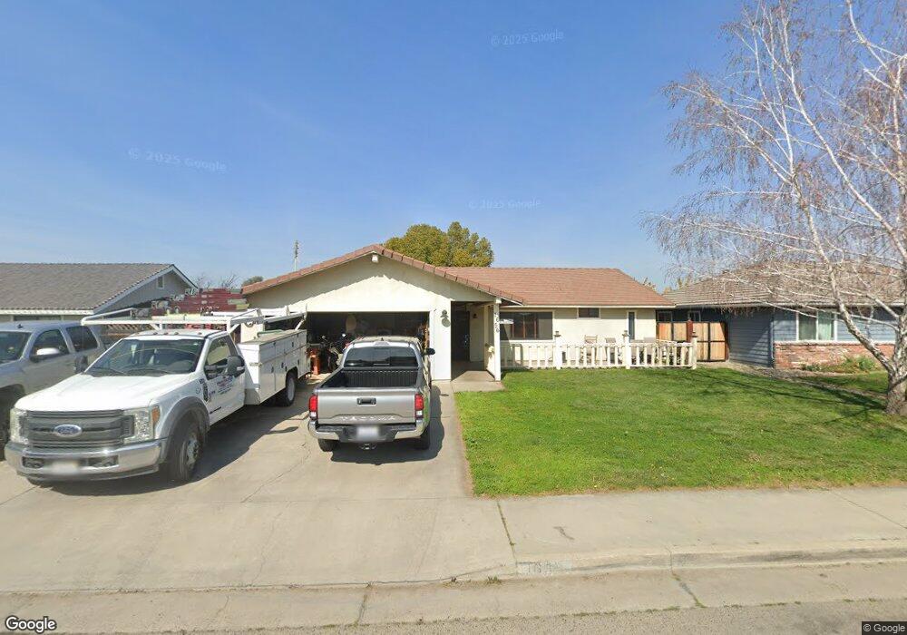
1656 Bel Aire Ave Porterville, CA 93257
Porterville Northwest NeighborhoodEstimated Value: $325,166 - $351,000
3
Beds
2
Baths
1,738
Sq Ft
$197/Sq Ft
Est. Value
About This Home
This home is located at 1656 Bel Aire Ave, Porterville, CA 93257 and is currently estimated at $341,792, approximately $196 per square foot. 1656 Bel Aire Ave is a home located in Tulare County with nearby schools including Oak Grove Elementary School, Burton Middle School, and Monache High School.
Ownership History
Date
Name
Owned For
Owner Type
Purchase Details
Closed on
Jun 8, 2001
Sold by
Nelson Clifford A
Bought by
Kusnierek Dale M and Kusnierek Lorey M
Current Estimated Value
Home Financials for this Owner
Home Financials are based on the most recent Mortgage that was taken out on this home.
Original Mortgage
$107,100
Outstanding Balance
$41,154
Interest Rate
7.26%
Mortgage Type
VA
Estimated Equity
$300,638
Create a Home Valuation Report for This Property
The Home Valuation Report is an in-depth analysis detailing your home's value as well as a comparison with similar homes in the area
Home Values in the Area
Average Home Value in this Area
Purchase History
| Date | Buyer | Sale Price | Title Company |
|---|---|---|---|
| Kusnierek Dale M | $105,000 | Fidelity National Title Co |
Source: Public Records
Mortgage History
| Date | Status | Borrower | Loan Amount |
|---|---|---|---|
| Open | Kusnierek Dale M | $107,100 |
Source: Public Records
Tax History Compared to Growth
Tax History
| Year | Tax Paid | Tax Assessment Tax Assessment Total Assessment is a certain percentage of the fair market value that is determined by local assessors to be the total taxable value of land and additions on the property. | Land | Improvement |
|---|---|---|---|---|
| 2025 | $1,555 | $155,124 | $44,321 | $110,803 |
| 2024 | $1,555 | $152,083 | $43,452 | $108,631 |
| 2023 | $1,557 | $149,101 | $42,600 | $106,501 |
| 2022 | $1,496 | $146,178 | $41,765 | $104,413 |
| 2021 | $1,472 | $143,312 | $40,946 | $102,366 |
| 2020 | $1,444 | $141,842 | $40,526 | $101,316 |
| 2019 | $1,442 | $139,060 | $39,731 | $99,329 |
| 2018 | $1,376 | $136,333 | $38,952 | $97,381 |
| 2017 | $1,353 | $133,660 | $38,188 | $95,472 |
| 2016 | $1,288 | $131,039 | $37,439 | $93,600 |
| 2015 | $1,223 | $129,071 | $36,877 | $92,194 |
| 2014 | $1,223 | $125,000 | $31,000 | $94,000 |
Source: Public Records
Map
Nearby Homes
- 1691 Terry Ct
- 1750 W Terry Cir
- 1041 Greenfield Dr
- 1644 Mccomb Ave
- 1681 W Wall Ln
- 1076 N Beverly St
- 1857 W Westfield Ave
- 1121 N Lindale Way
- 1690 Memory Ln
- 1730 W Grand Ave
- 1926 W Nancy Ave
- 595 N Salisbury St
- 1045 N Westside St
- 1245 Atkins St
- 0 Pioneer Ave Unit 233651
- 1370 Lindale Place
- 1771 W Aurora Ct
- 1421 Pamela Cir
- 700 N Prospect St
- 1450 W Brian Ln
- 1666 Bel Aire Ave
- 1646 Bel Aire Ave
- 1671 Terry Ct
- 1661 Terry Ct
- 1681 Terry Ct
- 1653 Bel Aire Ave
- 1680 Bel Aire Ave
- 1636 Bel Aire Ave
- 1639 Bel Aire Ave
- 1651 Terry Ct
- 1635 Bel Aire Ave
- 1661 Bel Aire Ave
- 1685 Bel Aire Ave
- 1626 Bel Aire Ave
- 1633 Bel Aire Ave
- 1641 Terry Ct
- 1660 W Terry Ct
- 1664 Theta Ct Unit 1
- 1664 Theta Ct
- 1670 Terry Ct