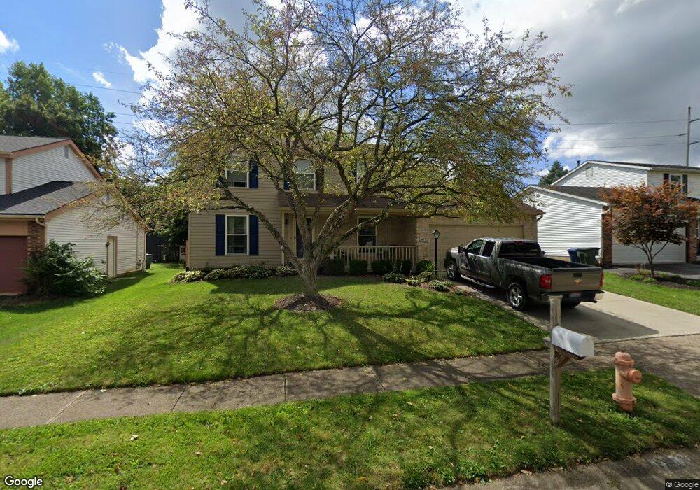
1657 Flat Rock Ct Columbus, OH 43235
Brookside Village NeighborhoodEstimated Value: $374,710 - $405,000
3
Beds
3
Baths
1,776
Sq Ft
$220/Sq Ft
Est. Value
About This Home
This home is located at 1657 Flat Rock Ct, Columbus, OH 43235 and is currently estimated at $390,928, approximately $220 per square foot. 1657 Flat Rock Ct is a home located in Franklin County with nearby schools including Brookside Elementary School, McCord Middle School, and Worthington Kilbourne High School.
Ownership History
Date
Name
Owned For
Owner Type
Purchase Details
Closed on
Feb 15, 2000
Sold by
Hud
Bought by
Luttinger David A
Current Estimated Value
Purchase Details
Closed on
Aug 12, 1999
Sold by
Tunnat Robert M and Bank United
Bought by
Hud
Purchase Details
Closed on
Sep 18, 1995
Sold by
Weaver John B
Bought by
Tunnat Robert M and Tunnat Donna E
Home Financials for this Owner
Home Financials are based on the most recent Mortgage that was taken out on this home.
Original Mortgage
$114,136
Interest Rate
7.81%
Mortgage Type
FHA
Purchase Details
Closed on
Oct 3, 1991
Purchase Details
Closed on
Jun 1, 1986
Create a Home Valuation Report for This Property
The Home Valuation Report is an in-depth analysis detailing your home's value as well as a comparison with similar homes in the area
Home Values in the Area
Average Home Value in this Area
Purchase History
| Date | Buyer | Sale Price | Title Company |
|---|---|---|---|
| Luttinger David A | -- | -- | |
| Hud | $120,000 | -- | |
| Tunnat Robert M | $117,500 | -- | |
| -- | $104,900 | -- | |
| -- | $87,000 | -- |
Source: Public Records
Mortgage History
| Date | Status | Borrower | Loan Amount |
|---|---|---|---|
| Previous Owner | Tunnat Robert M | $114,136 |
Source: Public Records
Tax History
| Year | Tax Paid | Tax Assessment Tax Assessment Total Assessment is a certain percentage of the fair market value that is determined by local assessors to be the total taxable value of land and additions on the property. | Land | Improvement |
|---|---|---|---|---|
| 2025 | $6,073 | $98,920 | $28,600 | $70,320 |
| 2024 | $6,073 | $98,920 | $28,600 | $70,320 |
| 2023 | $5,808 | $98,920 | $28,600 | $70,320 |
| 2022 | $5,952 | $80,440 | $18,450 | $61,990 |
| 2021 | $5,491 | $80,440 | $18,450 | $61,990 |
| 2020 | $5,289 | $80,440 | $18,450 | $61,990 |
| 2019 | $4,859 | $66,680 | $15,370 | $51,310 |
| 2018 | $4,461 | $66,680 | $15,370 | $51,310 |
| 2017 | $4,284 | $66,680 | $15,370 | $51,310 |
| 2016 | $4,214 | $59,360 | $13,650 | $45,710 |
| 2015 | $4,215 | $59,360 | $13,650 | $45,710 |
| 2014 | $4,214 | $59,360 | $13,650 | $45,710 |
| 2013 | $2,096 | $59,360 | $13,650 | $45,710 |
Source: Public Records
Map
Nearby Homes
- 6747 Merwin Rd
- 7370 Coldstream Dr
- 7164 Durness Place
- 6623 Millbrae Rd
- 1354 Lorine Place
- 6876 Spruce Pine Dr
- 2062 Decker Ct
- 1930 Shallowford Ave
- 7034 Rockhaven Place
- 1278 Amol Ln
- 1978 Shallowford Ave
- 6904 Clydeway Ct
- 2001 Sawbury Blvd Unit 2001
- 1327 Donahey St
- 1096 Woodman Dr
- 7456 Mapleleaf Ct
- 2026 Sawbury Blvd
- 2024 Sawbury Blvd
- 1760 Fallhaven Dr
- 2074 Hard Rd
- 1665 Flat Rock Ct
- 1643 Flat Rock Ct
- 1635 Flat Rock Ct
- 1673 Flat Rock Ct
- 1664 Flat Rock Ct
- 1627 Flat Rock Ct
- 1640 Flat Rock Ct
- 1681 Flat Rock Ct
- 1632 Flat Rock Ct
- 1619 Flat Rock Ct
- 7127 Stone Ct
- 7136 Donahue Ct
- 2665 Snouffer Rd
- 1688 Flat Rock Ct
- 1661 Rushing Way
- 1624 Flat Rock Ct
- 7200 Swift Way
- 7151 Donahue Ct
- 1667 Rushing Way
- 1611 Flat Rock Ct
Your Personal Tour Guide
Ask me questions while you tour the home.