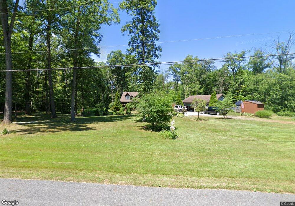
1657 Mahoning Rd Deerfield, OH 44411
Estimated Value: $222,000 - $341,000
3
Beds
3
Baths
1,608
Sq Ft
$186/Sq Ft
Est. Value
About This Home
This home is located at 1657 Mahoning Rd, Deerfield, OH 44411 and is currently estimated at $299,130, approximately $186 per square foot. 1657 Mahoning Rd is a home located in Portage County with nearby schools including Southeast High School.
Ownership History
Date
Name
Owned For
Owner Type
Purchase Details
Closed on
Aug 3, 2004
Sold by
Nagle Lewis L and Nagle Rebecca A
Bought by
Nagle Lewis L and Nagle Rebecca A
Current Estimated Value
Purchase Details
Closed on
Oct 6, 2003
Sold by
Brunner Carolyn S and Brunner David R
Bought by
Nagle Lewis L and Nagle Rebecca A
Home Financials for this Owner
Home Financials are based on the most recent Mortgage that was taken out on this home.
Original Mortgage
$105,500
Interest Rate
6.43%
Mortgage Type
Purchase Money Mortgage
Purchase Details
Closed on
Jul 2, 2002
Sold by
Boles Carolyn S and Brunner Carolyn S
Bought by
Brunner Carolyn S and Brunner David R
Create a Home Valuation Report for This Property
The Home Valuation Report is an in-depth analysis detailing your home's value as well as a comparison with similar homes in the area
Home Values in the Area
Average Home Value in this Area
Purchase History
| Date | Buyer | Sale Price | Title Company |
|---|---|---|---|
| Nagle Lewis L | -- | Approved Statewide Title | |
| Nagle Lewis L | $171,000 | Approved Statewide Title Age | |
| Brunner Carolyn S | -- | -- |
Source: Public Records
Mortgage History
| Date | Status | Borrower | Loan Amount |
|---|---|---|---|
| Closed | Nagle Lewis L | $105,500 |
Source: Public Records
Tax History Compared to Growth
Tax History
| Year | Tax Paid | Tax Assessment Tax Assessment Total Assessment is a certain percentage of the fair market value that is determined by local assessors to be the total taxable value of land and additions on the property. | Land | Improvement |
|---|---|---|---|---|
| 2024 | $2,916 | $93,490 | $15,890 | $77,600 |
| 2023 | $2,671 | $69,580 | $11,340 | $58,240 |
| 2022 | $2,775 | $69,580 | $11,340 | $58,240 |
| 2021 | $2,800 | $69,580 | $11,340 | $58,240 |
| 2020 | $2,296 | $54,810 | $11,340 | $43,470 |
| 2019 | $2,301 | $54,810 | $11,340 | $43,470 |
| 2018 | $2,263 | $50,930 | $10,890 | $40,040 |
| 2017 | $2,263 | $50,930 | $10,890 | $40,040 |
| 2016 | $2,255 | $50,930 | $10,890 | $40,040 |
| 2015 | $2,260 | $50,930 | $10,890 | $40,040 |
| 2014 | $2,305 | $50,930 | $10,890 | $40,040 |
| 2013 | $2,282 | $50,930 | $10,890 | $40,040 |
Source: Public Records
Map
Nearby Homes
- 1864 State Route 225
- 1731 Ohio 225
- 2332 McClintocksburg Rd
- 1060 State Route 14
- 9663 Berlin Heights Dr
- 0 Ohio 14
- 5925 Bedell Rd
- 10569 Shadyside Ln
- 10745 Leffingwell Rd
- 2953 State Route 225
- 17801 Ellsworth Rd
- 105 Hartzell Rd
- 3330 Jones Rd
- V/L State Route 225
- 3595 McClintocksburg Rd
- 20871 N Benton Rd W
- 2171 Alliance Rd
- 3609 State Route 225
- 3642 State Route 225
- 15862 W Akron-Canfield Rd
- 1623 Mahoning Rd
- 1552 Mahoning Rd
- 1530 Mahoning Rd
- 1516 Mahoning Rd
- 1504 Mahoning Rd
- 1773 Mahoning Rd
- 1470 Mahoning Rd
- 1450 Mahoning Rd
- 1386 Mahoning Rd
- 1372 Mahoning Ave
- 1879 Mahoning Rd
- 1888 Mahoning Rd
- 10037 State Route 224
- 10005 State Route 224
- 1910 Mahoning Rd
- 9973 State Route 224
- 10129 State Route 224
- 1918 Mahoning Rd
- 10104 State Route 224
- 9923 State Route 224