Estimated Value: $495,839 - $537,000
4
Beds
3
Baths
1,350
Sq Ft
$377/Sq Ft
Est. Value
About This Home
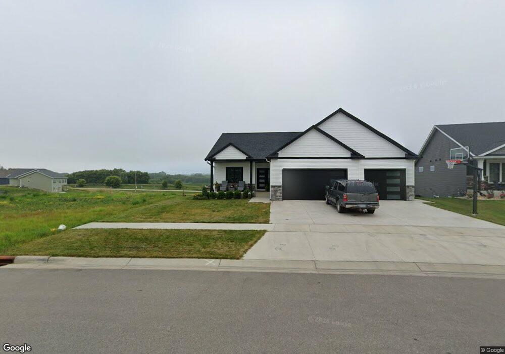
This home is located at 1659 Brandt Dr NE, Byron, MN 55920 and is currently estimated at $508,460, approximately $376 per square foot. 1659 Brandt Dr NE is a home located in Olmsted County with nearby schools including Byron Intermediate School, Byron Middle School, and Byron Senior High School.
Ownership History
Date
Name
Owned For
Owner Type
Purchase Details
Closed on
Sep 30, 2021
Sold by
Sanneman David M and Sanneman Jennifer
Bought by
Rizzo Jason and Sanneman Brooke
Current Estimated Value
Home Financials for this Owner
Home Financials are based on the most recent Mortgage that was taken out on this home.
Original Mortgage
$328,000
Outstanding Balance
$299,105
Interest Rate
2.8%
Mortgage Type
New Conventional
Estimated Equity
$209,355
Purchase Details
Closed on
Sep 4, 2020
Bought by
Sanneman Jennifer Jennifer
Home Financials for this Owner
Home Financials are based on the most recent Mortgage that was taken out on this home.
Interest Rate
2.93%
Purchase Details
Closed on
Nov 19, 2019
Sold by
Decook Bryce and Decook Brenda
Bought by
The East Village Byrom Llc
Create a Home Valuation Report for This Property
The Home Valuation Report is an in-depth analysis detailing your home's value as well as a comparison with similar homes in the area
Home Values in the Area
Average Home Value in this Area
Purchase History
| Date | Buyer | Sale Price | Title Company |
|---|---|---|---|
| Rizzo Jason | $410,000 | Rochester Title | |
| Sanneman Jennifer Jennifer | $81,500 | -- | |
| The East Village Byrom Llc | -- | None Available |
Source: Public Records
Mortgage History
| Date | Status | Borrower | Loan Amount |
|---|---|---|---|
| Open | Rizzo Jason | $328,000 | |
| Previous Owner | Sanneman Jennifer Jennifer | -- |
Source: Public Records
Tax History Compared to Growth
Tax History
| Year | Tax Paid | Tax Assessment Tax Assessment Total Assessment is a certain percentage of the fair market value that is determined by local assessors to be the total taxable value of land and additions on the property. | Land | Improvement |
|---|---|---|---|---|
| 2024 | $7,442 | $464,600 | $85,000 | $379,600 |
| 2023 | $7,338 | $464,200 | $85,000 | $379,200 |
| 2022 | $928 | $455,600 | $85,000 | $370,600 |
| 2021 | $1,584 | $78,000 | $75,000 | $3,000 |
| 2020 | $55 | $75,000 | $75,000 | $0 |
| 2019 | $55 | $3,500 | $3,500 | $0 |
Source: Public Records
Map
Nearby Homes
- 1705 Brandt Dr NE
- 1676 Brandt Dr NE
- 1644 Brandt Dr NE
- 1792 (L3,B1) Brandt Dr NE
- 1764 Brandt Dr NE
- 1582 Brandt Dr NE
- 1886 (L11,B2) Robinson Ln NE
- 1872 (L10,B2) Robinson Ln NE
- 1860 (L9,B2) Robinson Ln NE
- 1844 (L8,B2) Robinson Ln NE
- 1863 (L13,B2) Robinson Ln NE
- 1830 (L7,B2) Robinson Ln NE
- 1807 (L14,B2) Robinson Ln NE
- 1806 Brandt Dr NE
- 1812 Brandt Dr NE
- 1884 Ashley Dr NE
- 1805 Brandt Dr NE
- 1824 Brandt Dr NE
- 1830 Brandt Dr NE
- 1847 4th St NE
- 1651 Brandt Dr NE
- 1667 Brandt Dr NE
- 1643 Brandt Dr NE
- 1675 Brandt Dr NE
- 1668 Brandt Dr NE
- 1635 Brandt Dr NE
- 673 Steenhoek Ln NE
- 1702 Brandt Dr NE
- 1656 Brandt Dr NE
- 681 Steenhoek Ln NE
- L2 B1 the East Village 2nd Addition NE
- 682 Simmons Place NE
- 1818 (L6,B1) Brandt Dr NE
- 1830 (L8,B1) Brandt Dr NE
- 1824 (L7,B1) Brandt Dr NE
- 1785 (L2,B2) Brandt Dr NE
- 1812 (L5,B1) Brandt Dr NE
- 1848 (L11,B1) Brandt Dr NE
- 1781 (L1,B2) Brandt Dr NE
- 1842 (L10,B1) Brandt Dr NE