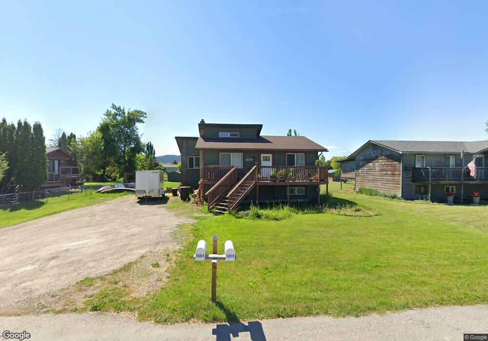
1659 Stag Ln Kalispell, MT 59901
Estimated Value: $450,000 - $487,000
3
Beds
1
Bath
1,960
Sq Ft
$237/Sq Ft
Est. Value
About This Home
This home is located at 1659 Stag Ln, Kalispell, MT 59901 and is currently estimated at $464,937, approximately $237 per square foot. 1659 Stag Ln is a home located in Flathead County with nearby schools including Elrod School, Kalispell Middle School, and Flathead High School.
Ownership History
Date
Name
Owned For
Owner Type
Purchase Details
Closed on
Feb 24, 2021
Sold by
Nelson Christine M
Bought by
Nelson Christine M and Spring Taylor Mackenzie
Current Estimated Value
Home Financials for this Owner
Home Financials are based on the most recent Mortgage that was taken out on this home.
Original Mortgage
$252,000
Interest Rate
2.7%
Mortgage Type
New Conventional
Purchase Details
Closed on
Oct 23, 2020
Sold by
Nelson Perry Edson
Bought by
Nelson Christine M
Purchase Details
Closed on
Oct 18, 2018
Sold by
Spring Christine M and Nelson Christine Marie
Bought by
Nelson Christine N and Nelson Perry Edson
Home Financials for this Owner
Home Financials are based on the most recent Mortgage that was taken out on this home.
Original Mortgage
$200,651
Interest Rate
5.5%
Mortgage Type
FHA
Create a Home Valuation Report for This Property
The Home Valuation Report is an in-depth analysis detailing your home's value as well as a comparison with similar homes in the area
Purchase History
| Date | Buyer | Sale Price | Title Company |
|---|---|---|---|
| Nelson Christine M | -- | None Available | |
| Nelson Christine M | -- | None Available | |
| Nelson Christine N | -- | None Available |
Source: Public Records
Mortgage History
| Date | Status | Borrower | Loan Amount |
|---|---|---|---|
| Closed | Nelson Christine M | $252,000 | |
| Closed | Nelson Christine N | $200,651 |
Source: Public Records
Tax History
| Year | Tax Paid | Tax Assessment Tax Assessment Total Assessment is a certain percentage of the fair market value that is determined by local assessors to be the total taxable value of land and additions on the property. | Land | Improvement |
|---|---|---|---|---|
| 2025 | $1,581 | $419,900 | $0 | $0 |
| 2024 | $2,159 | $328,700 | $0 | $0 |
| 2023 | $2,201 | $328,700 | $0 | $0 |
| 2022 | $2,284 | $252,200 | $0 | $0 |
| 2021 | $2,226 | $252,200 | $0 | $0 |
| 2020 | $1,934 | $209,400 | $0 | $0 |
| 2019 | $1,929 | $209,400 | $0 | $0 |
| 2018 | $1,552 | $160,000 | $0 | $0 |
| 2017 | $1,559 | $160,000 | $0 | $0 |
| 2016 | $1,418 | $160,900 | $0 | $0 |
| 2015 | $1,438 | $160,900 | $0 | $0 |
| 2014 | $1,451 | $97,732 | $0 | $0 |
Source: Public Records
Map
Nearby Homes
- 1509 Eagle Dr
- 141 Beargrass Ln
- 305 Kelly Rd Unit F-22
- 1717 S Woodland Dr Unit SPC -21
- 1683 Bull Run
- 2455 Us Highway 93 S
- 1340 Willow Glen Dr Unit 23
- 1340 Willow Glen Dr Unit 31
- NHN U S 93 S
- 1519 Woodland Ave
- 1403 & 1405 4th Ave E
- 1305 4th Ave E
- 2082 Willow Glen Trail
- 826 11th St E
- 51 Selders Ln
- 1229 3rd Ave E
- 1024 Woodland Ave
- 3943 Lower Valley Rd
- 1312 2nd Ave E
- 1227 1st Ave E
Your Personal Tour Guide
Ask me questions while you tour the home.