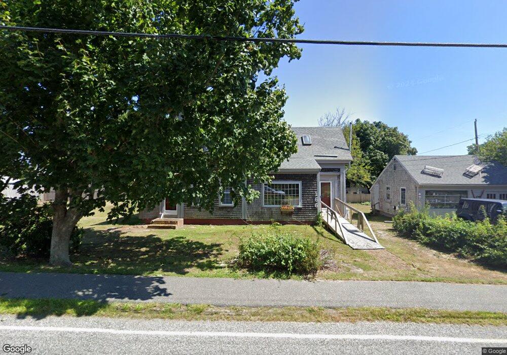
166 Depot St Dennis Port, MA 02639
Dennis Port NeighborhoodEstimated Value: $622,307 - $712,000
4
Beds
2
Baths
1,575
Sq Ft
$427/Sq Ft
Est. Value
About This Home
This home is located at 166 Depot St, Dennis Port, MA 02639 and is currently estimated at $672,077, approximately $426 per square foot. 166 Depot St is a home located in Barnstable County with nearby schools including Dennis-Yarmouth Regional High School and St. Pius X. School.
Ownership History
Date
Name
Owned For
Owner Type
Purchase Details
Closed on
Apr 11, 2018
Sold by
Siepietowski Frederick J and Siepietowski Josette L
Bought by
Siepietowski Ret
Current Estimated Value
Purchase Details
Closed on
Oct 28, 1985
Bought by
Siepietowski Josette L and Siepietowski Frederick J
Create a Home Valuation Report for This Property
The Home Valuation Report is an in-depth analysis detailing your home's value as well as a comparison with similar homes in the area
Home Values in the Area
Average Home Value in this Area
Purchase History
| Date | Buyer | Sale Price | Title Company |
|---|---|---|---|
| Siepietowski Ret | -- | -- | |
| Siepietowski Josette L | $159,500 | -- |
Source: Public Records
Mortgage History
| Date | Status | Borrower | Loan Amount |
|---|---|---|---|
| Previous Owner | Siepietowski Josette L | $121,000 | |
| Previous Owner | Siepietowski Josette L | $10,000 | |
| Previous Owner | Siepietowski Josette L | $10,000 |
Source: Public Records
Tax History Compared to Growth
Tax History
| Year | Tax Paid | Tax Assessment Tax Assessment Total Assessment is a certain percentage of the fair market value that is determined by local assessors to be the total taxable value of land and additions on the property. | Land | Improvement |
|---|---|---|---|---|
| 2025 | $2,169 | $501,000 | $200,700 | $300,300 |
| 2024 | $2,101 | $478,500 | $193,000 | $285,500 |
| 2023 | $2,033 | $435,400 | $175,400 | $260,000 |
| 2022 | $1,968 | $351,400 | $158,000 | $193,400 |
| 2021 | $6,871 | $343,800 | $154,900 | $188,900 |
| 2020 | $2,012 | $329,800 | $143,000 | $186,800 |
| 2019 | $2,064 | $334,600 | $140,200 | $194,400 |
| 2018 | $5,973 | $315,000 | $144,600 | $170,400 |
| 2017 | $5,906 | $309,600 | $133,500 | $176,100 |
| 2016 | $1,865 | $285,600 | $139,000 | $146,600 |
| 2015 | $1,828 | $285,600 | $139,000 | $146,600 |
| 2014 | $1,737 | $273,600 | $122,400 | $151,200 |
Source: Public Records
Map
Nearby Homes
- 159 Center St Unit 22
- 12 Cross St
- 26 Manning Rd
- 73 Division St
- 221 Upper County Rd Unit 2A
- 221 Upper County Rd Unit 2A
- 10 Candlewood Ln Unit 2-1
- 12 Candlewood Ln Unit 2-9
- 47 Telegraph Rd Unit 1
- 148 Belmont Rd
- 9 Country Ln
- 166 Upper County Rd Unit 1-4
- 141 Division St
- 40 Willow St
- 141 Division St
- 102 Sea St
- 3 Fairbanks Dr
- 11 Ocean Park W
- 45 Route 28
- 73 Pleasant St
- 69 Pleasant St
- 172 Depot St
- 155 Depot St
- 156 Depot St Unit 2
- 156 Depot St Unit 1
- 156 Depot St
- 174 Depot St
- 161 Depot St Unit 1
- 161 Depot St Unit 2
- 161 Depot St
- 161 Depot St Unit 3+4
- 161 Depot St Unit 3
- 152 Depot St Unit 2
- 152 Depot St
- 152 Depot St Unit 1
- 63 Pleasant St
- 157 Depot St Unit 161
- 157 Depot St Unit 161
- 157 Depot St Unit 161