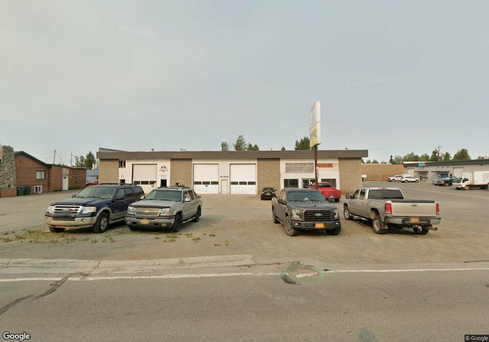
166 E Potter Dr Anchorage, AK 99518
Taku-Campbell Neighborhood
Studio
--
Bath
20,403
Sq Ft
42,253
Sq Ft Lot
About This Home
This home is located at 166 E Potter Dr, Anchorage, AK 99518. 166 E Potter Dr is a home located in Anchorage Municipality with nearby schools including Taku Elementary School, Romig Middle School, and West High School.
Ownership History
Date
Name
Owned For
Owner Type
Purchase Details
Closed on
Jul 13, 2021
Sold by
Carl Loran Thomas
Bought by
Stephan Lands Llc
Purchase Details
Closed on
Aug 2, 2012
Sold by
Loran Thomas C and Johnson Michelle A
Bought by
Kodiak Land Management Llc
Purchase Details
Closed on
Oct 10, 2008
Sold by
Bannon Robert Patrick and Bannon Scott Kelsey
Bought by
Loran Thomas C and Johnson Michelle A
Home Financials for this Owner
Home Financials are based on the most recent Mortgage that was taken out on this home.
Original Mortgage
$1,780,000
Interest Rate
6.31%
Mortgage Type
Commercial
Purchase Details
Closed on
Jul 6, 2004
Sold by
Bannon Marcia Lynn
Bought by
Bannon Scott Kelsey
Create a Home Valuation Report for This Property
The Home Valuation Report is an in-depth analysis detailing your home's value as well as a comparison with similar homes in the area
Home Values in the Area
Average Home Value in this Area
Purchase History
| Date | Buyer | Sale Price | Title Company |
|---|---|---|---|
| Stephan Lands Llc | -- | None Listed On Document | |
| Kodiak Land Management Llc | -- | None Available | |
| Loran Thomas C | -- | Ftaa | |
| Bannon Scott Kelsey | -- | -- |
Source: Public Records
Mortgage History
| Date | Status | Borrower | Loan Amount |
|---|---|---|---|
| Previous Owner | Loran Thomas C | $1,780,000 |
Source: Public Records
Tax History
| Year | Tax Paid | Tax Assessment Tax Assessment Total Assessment is a certain percentage of the fair market value that is determined by local assessors to be the total taxable value of land and additions on the property. | Land | Improvement |
|---|---|---|---|---|
| 2025 | $29,962 | $1,923,600 | $573,000 | $1,350,600 |
| 2024 | $29,962 | $1,855,800 | $573,000 | $1,282,800 |
| 2023 | $25,119 | $1,475,000 | $551,300 | $923,700 |
| 2022 | $24,839 | $1,475,000 | $546,000 | $929,000 |
| 2021 | $34,570 | $1,918,400 | $535,300 | $1,383,100 |
| 2020 | $32,433 | $1,907,800 | $524,700 | $1,383,100 |
| 2019 | $31,167 | $1,905,100 | $514,100 | $1,391,000 |
| 2018 | $30,470 | $1,857,900 | $514,100 | $1,343,800 |
| 2017 | $29,411 | $1,878,100 | $514,100 | $1,364,000 |
| 2016 | $26,246 | $1,982,100 | $514,100 | $1,468,000 |
| 2015 | $26,246 | $1,923,000 | $514,100 | $1,408,900 |
| 2014 | $26,246 | $1,869,100 | $514,100 | $1,355,000 |
Source: Public Records
Map
Nearby Homes
- 5687 Denali St Unit A-B
- N/A Silverado Tract 2a
- 311 Lynnwood Dr Unit 4
- 6243 Eula St
- 000 Business Park Blvd
- 4810 C St
- 638 King Arthur Cir Unit F06
- 102 Sweetgale Ct Unit 102
- 6405 Old Seward Hwy
- 420 E 46th Place
- 5003 Buckingham Way
- 1200 Southampton Dr
- 7827 Old Seward Hwy
- 1642 E Dowling Rd
- 300 W Tudor Rd
- 1250 E 70th Ave
- 638 W 74th Ave
- 7560 Foxridge Way Unit C
- 639 W 75th Ave
- 5360 Windflower St
- 166 E Potter Dr Unit 5
- 166 E Potter Dr Unit 3
- 166 E Potter Dr Unit 1
- 166 E Potter Dr Unit 2
- 202 E Potter Dr
- L1A&2 B1 E Potter &L2 Dr
- 144 E Potter Dr
- 144 E Potter Dr Unit D
- L9 B1 E Potter Dr
- 220 Center Ct
- 159 E Potter Dr
- 155 E Potter Dr
- 155 E Potter Dr
- 230 Center Ct
- 130 E Potter Dr
- 203 E Potter Dr
- 5735 B St
- 5745 B St
- 200 Center Ct
- 211 E Potter Dr
Your Personal Tour Guide
Ask me questions while you tour the home.