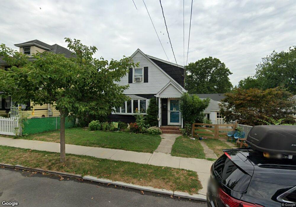
166 Fiske Ave Staten Island, NY 10314
Westerleigh NeighborhoodEstimated Value: $649,191 - $780,000
--
Bed
4
Baths
1,043
Sq Ft
$696/Sq Ft
Est. Value
About This Home
This home is located at 166 Fiske Ave, Staten Island, NY 10314 and is currently estimated at $726,048, approximately $696 per square foot. 166 Fiske Ave is a home located in Richmond County with nearby schools including P.S. 30 Westerleigh, I.S. 51 Edwin Markham, and Port Richmond High School.
Ownership History
Date
Name
Owned For
Owner Type
Purchase Details
Closed on
Feb 26, 2015
Sold by
Nelson Susan Catherine and Bowers Walter Leonard
Bought by
Salerno Michael Anthony and Pesce Toni Marie
Current Estimated Value
Home Financials for this Owner
Home Financials are based on the most recent Mortgage that was taken out on this home.
Original Mortgage
$310,400
Outstanding Balance
$237,647
Interest Rate
3.67%
Mortgage Type
New Conventional
Estimated Equity
$488,401
Create a Home Valuation Report for This Property
The Home Valuation Report is an in-depth analysis detailing your home's value as well as a comparison with similar homes in the area
Home Values in the Area
Average Home Value in this Area
Purchase History
| Date | Buyer | Sale Price | Title Company |
|---|---|---|---|
| Salerno Michael Anthony | $388,000 | Fidelity Natl Title Ins Co |
Source: Public Records
Mortgage History
| Date | Status | Borrower | Loan Amount |
|---|---|---|---|
| Open | Salerno Michael Anthony | $310,400 |
Source: Public Records
Tax History Compared to Growth
Tax History
| Year | Tax Paid | Tax Assessment Tax Assessment Total Assessment is a certain percentage of the fair market value that is determined by local assessors to be the total taxable value of land and additions on the property. | Land | Improvement |
|---|---|---|---|---|
| 2025 | $6,395 | $41,460 | $11,677 | $29,783 |
| 2024 | $6,408 | $36,840 | $12,398 | $24,442 |
| 2023 | $6,346 | $32,645 | $11,396 | $21,249 |
| 2022 | $6,097 | $33,120 | $13,740 | $19,380 |
| 2021 | $6,046 | $34,380 | $13,740 | $20,640 |
| 2020 | $5,919 | $29,640 | $13,740 | $15,900 |
| 2019 | $5,456 | $32,040 | $13,740 | $18,300 |
| 2018 | $5,248 | $27,204 | $13,340 | $13,864 |
| 2017 | $5,133 | $26,648 | $13,324 | $13,324 |
| 2016 | $4,716 | $25,140 | $13,740 | $11,400 |
| 2015 | $3,364 | $24,469 | $13,409 | $11,060 |
| 2014 | $3,364 | $23,085 | $13,922 | $9,163 |
Source: Public Records
Map
Nearby Homes
- 0 Willard Ave
- 262 Maine Ave
- 751 Jewett Ave Unit 17
- 751 Jewett Ave
- 349 College Ave
- 325 College Ave
- 204 Demorest Ave
- 159 North Ave
- 14 Leonard Ave
- 615 Jewett Ave
- 116 Bidwell Ave
- 304 Kingsley Ave
- 142 Margaretta Ct
- 279 Saint John Ave
- 36 Shaw Place
- 282 Willard Ave
- 249 Dickie Ave
- 307 Clinton B Fiske Ave
- 307 Fiske Ave
- 284 Bidwell Ave
- 172 Fiske Ave
- 154 Clinton B Fisk Ave
- 154 Fiske Ave
- 176 Fiske Ave
- 165 Willard Ave
- 159 Willard Ave
- 167 Willard Ave
- 180 Fiske Ave
- 161 Clinton B Fiske Ave
- 165 Clinton B Fiske Ave
- 180 Clinton B Fiske Ave Unit 1
- 180 Clinton B Fiske Ave
- 161 Fiske Ave
- 157 Clinton B Fiske Ave
- 165 Fiske Ave
- 157 Fiske Ave
- 171 Willard Ave
- 173 Fiske Ave
- 148 Fiske Ave
- 153 Fiske Ave