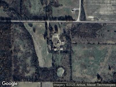
166 Hubbard Rd Searcy, AR 72143
Estimated Value: $200,000 - $292,871
4
Beds
2
Baths
2,400
Sq Ft
$101/Sq Ft
Est. Value
About This Home
This home is located at 166 Hubbard Rd, Searcy, AR 72143 and is currently estimated at $242,218, approximately $100 per square foot. 166 Hubbard Rd is a home located in White County with nearby schools including Kensett Elementary School and Riverview High School.
Ownership History
Date
Name
Owned For
Owner Type
Purchase Details
Closed on
Jul 16, 2021
Sold by
Ibc Llc
Bought by
Jones Harry B and Jones Jennifer S
Current Estimated Value
Home Financials for this Owner
Home Financials are based on the most recent Mortgage that was taken out on this home.
Original Mortgage
$247,450
Outstanding Balance
$227,035
Interest Rate
2.93%
Mortgage Type
Future Advance Clause Open End Mortgage
Estimated Equity
-$2,404
Purchase Details
Closed on
Jun 7, 2017
Sold by
Herekamp Sarah and Herekamp Scotty
Bought by
Ibc Llc
Home Financials for this Owner
Home Financials are based on the most recent Mortgage that was taken out on this home.
Original Mortgage
$220,000
Interest Rate
4.03%
Mortgage Type
Future Advance Clause Open End Mortgage
Purchase Details
Closed on
Sep 27, 2001
Bought by
Herekamp Sarah
Create a Home Valuation Report for This Property
The Home Valuation Report is an in-depth analysis detailing your home's value as well as a comparison with similar homes in the area
Home Values in the Area
Average Home Value in this Area
Purchase History
| Date | Buyer | Sale Price | Title Company |
|---|---|---|---|
| Jones Harry B | -- | Wilbourn Title & Closing | |
| Jones Harry B | -- | None Listed On Document | |
| Ibc Llc | $120,000 | None Available | |
| Herekamp Sarah | -- | -- |
Source: Public Records
Mortgage History
| Date | Status | Borrower | Loan Amount |
|---|---|---|---|
| Open | Jones Harry B | $247,450 | |
| Previous Owner | Ibc Llc | $129,925 | |
| Previous Owner | Ibc Llc | $220,000 | |
| Previous Owner | Klp Farms Llc | $1,928,000 | |
| Previous Owner | Klp Farms Llc | $1,900,000 |
Source: Public Records
Tax History Compared to Growth
Tax History
| Year | Tax Paid | Tax Assessment Tax Assessment Total Assessment is a certain percentage of the fair market value that is determined by local assessors to be the total taxable value of land and additions on the property. | Land | Improvement |
|---|---|---|---|---|
| 2024 | $980 | $24,430 | $3,180 | $21,250 |
| 2023 | $985 | $24,430 | $3,180 | $21,250 |
| 2022 | $985 | $24,430 | $3,180 | $21,250 |
| 2021 | $985 | $24,430 | $3,180 | $21,250 |
| 2020 | $1,061 | $26,460 | $3,620 | $22,840 |
| 2019 | $1,061 | $26,460 | $3,620 | $22,840 |
| 2018 | $1,061 | $26,460 | $3,620 | $22,840 |
| 2017 | $1,269 | $31,650 | $3,620 | $28,030 |
| 2016 | $1,269 | $31,650 | $3,620 | $28,030 |
| 2015 | $1,734 | $43,240 | $10,140 | $33,100 |
| 2014 | $1,710 | $42,650 | $10,140 | $32,510 |
Source: Public Records
Map
Nearby Homes
- 104 Landing St
- 0 Morrow Church Rd Unit 21252749
- 130 Ray Talbert Rd
- 414 Luttrell
- 284 Walker Rd
- 201 Len Ave
- 00 Sunset Dr
- 000 S River Rd & Mail Route Rd
- 112 E Dandridge St
- 000 Central In 500 Block
- 104 W Searcy St
- 290 Walker Rd
- 221 Baker
- 105 Joy St
- 506 W Barnett St
- 106 Y St
- 128 Y St
- 340 Walker Rd
- 000 N Maple St
- 000 Tree Lakes Dr