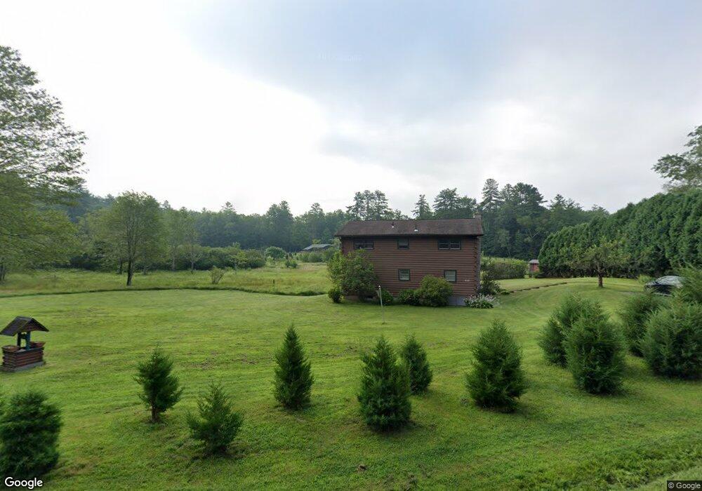
166 Linseed Rd West Hatfield, MA 01088
Estimated Value: $404,000 - $443,000
3
Beds
2
Baths
1,352
Sq Ft
$317/Sq Ft
Est. Value
About This Home
This home is located at 166 Linseed Rd, West Hatfield, MA 01088 and is currently estimated at $428,922, approximately $317 per square foot. 166 Linseed Rd is a home located in Hampshire County with nearby schools including Browerville Elementary School, Brooklyn Center Middle School, and The Montessori School of Northampton.
Create a Home Valuation Report for This Property
The Home Valuation Report is an in-depth analysis detailing your home's value as well as a comparison with similar homes in the area
Home Values in the Area
Average Home Value in this Area
Tax History Compared to Growth
Tax History
| Year | Tax Paid | Tax Assessment Tax Assessment Total Assessment is a certain percentage of the fair market value that is determined by local assessors to be the total taxable value of land and additions on the property. | Land | Improvement |
|---|---|---|---|---|
| 2025 | $5,140 | $371,400 | $178,100 | $193,300 |
| 2024 | $5,172 | $337,800 | $161,700 | $176,100 |
| 2023 | $3,726 | $276,400 | $110,500 | $165,900 |
| 2022 | $3,551 | $259,800 | $106,400 | $153,400 |
| 2021 | $3,469 | $244,500 | $102,300 | $142,200 |
| 2020 | $3,284 | $242,700 | $102,300 | $140,400 |
| 2019 | $2,967 | $213,600 | $81,900 | $131,700 |
| 2018 | $2,937 | $216,300 | $81,900 | $134,400 |
| 2017 | $2,825 | $213,700 | $77,800 | $135,900 |
| 2016 | $2,763 | $209,600 | $73,700 | $135,900 |
| 2015 | $2,767 | $210,100 | $73,700 | $136,400 |
| 2014 | $2,708 | $213,700 | $73,700 | $140,000 |
Source: Public Records
Map
Nearby Homes
- 121 West St
- 0 Old Stage Rd Unit 73394977
- 0 Pantry Rd Unit 73430264
- 2B Linseed Rd
- 37 N Farms Rd
- 45 N Farms Rd
- 34 Gore Ave
- LOT D Mountain Rd
- 147 Pantry Rd
- 151 Pantry Rd
- 21 Dwight St
- 43 Laurel Park Unit 43
- 66 Laurel Park Unit 66
- 93 Laurel Park Unit 93
- 12 Dwight St
- 320 West St
- 0 Straits Rd
- 32 Stonewall Dr
- 18 Elm St
- 96 Rick Dr