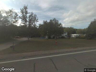
166 State Highway M35 Negaunee, MI 49866
Estimated Value: $218,000 - $321,000
--
Bed
--
Bath
1,312
Sq Ft
$202/Sq Ft
Est. Value
About This Home
This home is located at 166 State Highway M35, Negaunee, MI 49866 and is currently estimated at $264,435, approximately $201 per square foot. 166 State Highway M35 is a home located in Marquette County with nearby schools including Lakeview Elementary School, Negaunee Middle School, and Negaunee High School.
Ownership History
Date
Name
Owned For
Owner Type
Purchase Details
Closed on
Oct 22, 2021
Sold by
Anderson Robert S
Bought by
Anderson Robert S and Reaves-Anderson Shannon
Current Estimated Value
Home Financials for this Owner
Home Financials are based on the most recent Mortgage that was taken out on this home.
Original Mortgage
$201,875
Outstanding Balance
$188,819
Interest Rate
2.8%
Mortgage Type
New Conventional
Purchase Details
Closed on
Oct 18, 2021
Sold by
Barningham Curtis J
Bought by
Anderson Robert S
Home Financials for this Owner
Home Financials are based on the most recent Mortgage that was taken out on this home.
Original Mortgage
$201,875
Outstanding Balance
$188,819
Interest Rate
2.8%
Mortgage Type
New Conventional
Purchase Details
Closed on
Jun 24, 1999
Bought by
Barningham Curtis and Barningham Diane
Create a Home Valuation Report for This Property
The Home Valuation Report is an in-depth analysis detailing your home's value as well as a comparison with similar homes in the area
Home Values in the Area
Average Home Value in this Area
Purchase History
| Date | Buyer | Sale Price | Title Company |
|---|---|---|---|
| Anderson Robert S | -- | None Listed On Document | |
| Anderson Robert S | $212,500 | None Listed On Document | |
| Barningham Curtis | $85,000 | -- |
Source: Public Records
Mortgage History
| Date | Status | Borrower | Loan Amount |
|---|---|---|---|
| Open | Anderson Robert S | $201,875 |
Source: Public Records
Tax History Compared to Growth
Tax History
| Year | Tax Paid | Tax Assessment Tax Assessment Total Assessment is a certain percentage of the fair market value that is determined by local assessors to be the total taxable value of land and additions on the property. | Land | Improvement |
|---|---|---|---|---|
| 2024 | $19 | $108,900 | $0 | $0 |
| 2023 | $1,788 | $93,100 | $0 | $0 |
| 2022 | $2,529 | $69,800 | $0 | $0 |
| 2021 | $1,787 | $73,900 | $0 | $0 |
| 2020 | $1,705 | $69,800 | $0 | $0 |
| 2019 | $1,654 | $66,200 | $0 | $0 |
| 2018 | $1,639 | $67,600 | $0 | $0 |
| 2017 | $1,522 | $71,300 | $0 | $0 |
| 2016 | $1,484 | $69,300 | $0 | $0 |
| 2015 | -- | $69,300 | $0 | $0 |
| 2014 | -- | $68,800 | $0 | $0 |
| 2012 | -- | $65,200 | $0 | $0 |
Source: Public Records
Map
Nearby Homes
- 79 County Road 480 Unit Jarvi Road
- 83 County Road 480
- TBD E Us41 M28 Hwy
- 362 E Us41 M28 Hwy
- 360 E Us41 M28 Hwy
- 362-368 E Us41 M28 Hwy
- 131 Midway Dr
- 0000 County Road 492
- TBD County Road 492
- TBD Us Highway 41
- 4205 Us Highway 41
- Parcel B Michigan 28
- TBD Sunset (Foxglove Floor Plan) Dr
- TBD Sunset (Tulip Floor Plan) Dr
- TBD Sunset (Lot 2) Dr
- TBD Sunset (Lot 1) Dr
- 121 Truscott St
- TBD McClure Dam Rd
- 150 Meco Ct
- 117 Queen St
- 166 State Highway M35
- 152 Michigan 35
- 168 State Highway M35
- 164 State Highway M35
- 147 Michigan 35
- 167 State Highway M35
- 170 State Highway M35
- 165 State Highway M35
- 145 Michigan 35
- 162 State Highway M35
- 165 Michigan 35
- 163 State Highway M35 Unit A
- 161 State Highway M35
- 172 State Highway M35
- 160 State Highway M35
- 141 Michigan 35
- 159 State Highway M35
- 158 State Highway M35
- 139 Michigan 35
- 166 Michigan 35
