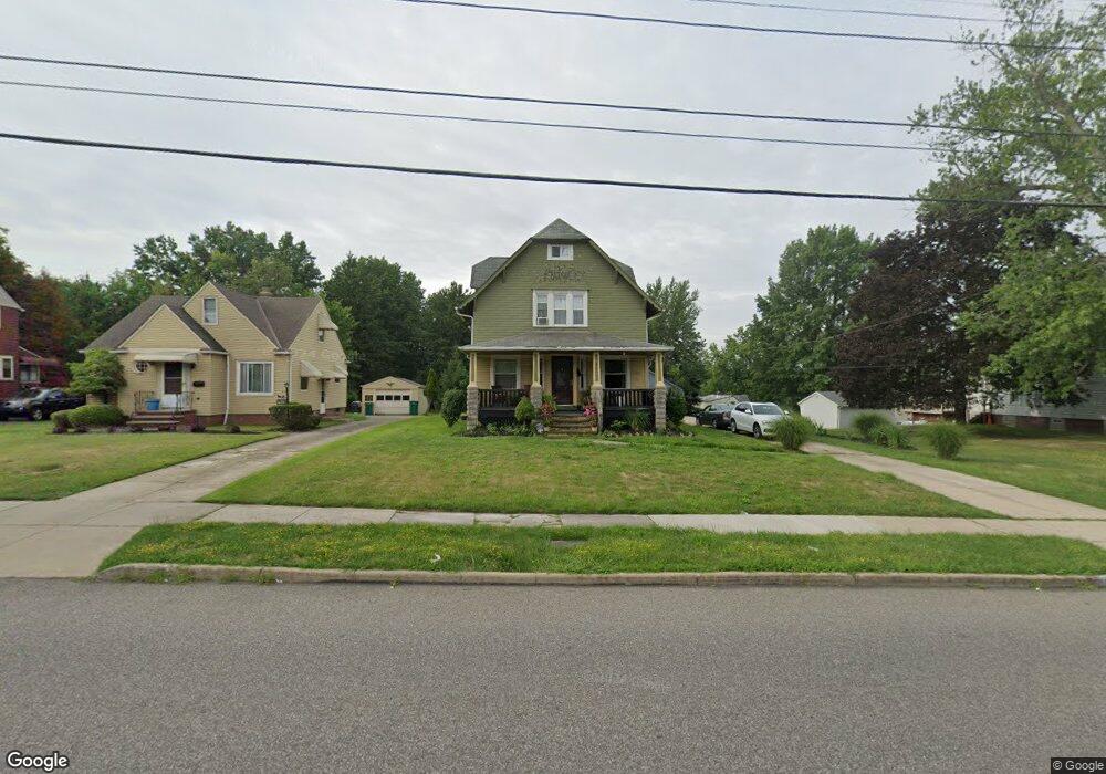
16600 Libby Rd Maple Heights, OH 44137
Estimated Value: $142,000 - $169,000
3
Beds
3
Baths
1,780
Sq Ft
$88/Sq Ft
Est. Value
About This Home
This home is located at 16600 Libby Rd, Maple Heights, OH 44137 and is currently estimated at $156,327, approximately $87 per square foot. 16600 Libby Rd is a home located in Cuyahoga County with nearby schools including Abraham Lincoln Elementary School, Rockside/ J.F. Kennedy School, and Barack Obama School.
Ownership History
Date
Name
Owned For
Owner Type
Purchase Details
Closed on
Jun 1, 2009
Sold by
Secretary Of Housing & Urban Development
Bought by
Guy Nikayla C
Current Estimated Value
Purchase Details
Closed on
Feb 4, 2009
Sold by
Wells Fargo Bank Na
Bought by
Secretary Of Housing & Urban Development
Purchase Details
Closed on
Jan 2, 2008
Sold by
Cistrunk Shaabani T
Bought by
Wells Fargo Bank Na
Purchase Details
Closed on
Nov 21, 2003
Sold by
Gunn Arlene T
Bought by
Cistrunk Shaabani T
Home Financials for this Owner
Home Financials are based on the most recent Mortgage that was taken out on this home.
Original Mortgage
$116,176
Interest Rate
6.07%
Mortgage Type
FHA
Purchase Details
Closed on
Jan 1, 1975
Bought by
Gunn Ralph J and Gunn Arlene T
Create a Home Valuation Report for This Property
The Home Valuation Report is an in-depth analysis detailing your home's value as well as a comparison with similar homes in the area
Home Values in the Area
Average Home Value in this Area
Purchase History
| Date | Buyer | Sale Price | Title Company |
|---|---|---|---|
| Guy Nikayla C | $16,101 | Lakeside Title & Escrow Agen | |
| Secretary Of Housing & Urban Development | -- | Attorney | |
| Wells Fargo Bank Na | $50,000 | None Available | |
| Cistrunk Shaabani T | $118,000 | Executive Title Agency | |
| Gunn Ralph J | -- | -- |
Source: Public Records
Mortgage History
| Date | Status | Borrower | Loan Amount |
|---|---|---|---|
| Previous Owner | Cistrunk Shaabani T | $116,176 |
Source: Public Records
Tax History
| Year | Tax Paid | Tax Assessment Tax Assessment Total Assessment is a certain percentage of the fair market value that is determined by local assessors to be the total taxable value of land and additions on the property. | Land | Improvement |
|---|---|---|---|---|
| 2025 | $4,826 | $45,815 | $10,430 | $35,385 |
| 2024 | $4,244 | $45,815 | $10,430 | $35,385 |
| 2023 | $2,540 | $22,230 | $7,390 | $14,840 |
| 2022 | $2,531 | $22,225 | $7,385 | $14,840 |
| 2021 | $2,693 | $22,230 | $7,390 | $14,840 |
| 2020 | $2,316 | $16,840 | $5,600 | $11,240 |
| 2019 | $2,296 | $48,100 | $16,000 | $32,100 |
| 2018 | $2,285 | $16,840 | $5,600 | $11,240 |
| 2017 | $1,872 | $12,750 | $5,990 | $6,760 |
| 2016 | $1,804 | $12,750 | $5,990 | $6,760 |
| 2015 | $21,495 | $12,750 | $5,990 | $6,760 |
| 2014 | $21,495 | $16,980 | $7,980 | $9,000 |
Source: Public Records
Map
Nearby Homes
- 5210 Theodore St
- 17005 Mapleboro Ave
- 16174 Friend Ave
- 16029 Friend Ave
- 5246 Philip Ave
- 5231 Philip Ave
- 5062 Lee Rd
- 17409 Mapleboro Ave
- 16101 Raymond St
- 5550 Grasmere Ave
- 5481 Dalewood Ave
- 5137 Miller Ave
- 5082 Philip Ave
- 16351 Glenburn Ave
- 16241 Glenburn Ave
- 5177 Cato St
- 16406 Home St
- 17282 Mccracken Rd
- 5650 Lafayette Ave
- 5239 Arch St
Your Personal Tour Guide
Ask me questions while you tour the home.