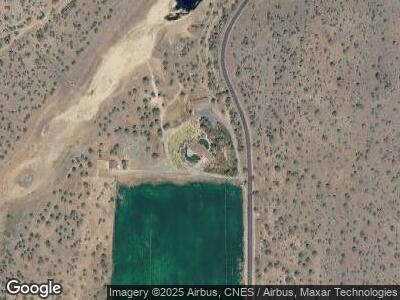
16600 SW Lower Bridge Way Terrebonne, OR 97760
3
Beds
3
Baths
3,605
Sq Ft
157
Acres
About This Home
This home is located at 16600 SW Lower Bridge Way, Terrebonne, OR 97760. 16600 SW Lower Bridge Way is a home located in Jefferson County with nearby schools including Culver Elementary School, Culver Middle School, and Culver High School.
Ownership History
Date
Name
Owned For
Owner Type
Purchase Details
Closed on
Apr 7, 2022
Sold by
Kronsberg Robert C and Kronsberg Vicki K
Bought by
Rob And Vicki Kronsberg Joint Trust
Purchase Details
Closed on
Aug 7, 2014
Sold by
Deutsche Bank Na Trust Co
Bought by
Kronsberg Robert C and Kronsberg Vicki L
Home Financials for this Owner
Home Financials are based on the most recent Mortgage that was taken out on this home.
Original Mortgage
$361,390
Interest Rate
4.11%
Mortgage Type
New Conventional
Purchase Details
Closed on
May 27, 2014
Sold by
Simpson Kathy T and Simpson Steven K
Bought by
Deutsche Bank National Trust Co
Create a Home Valuation Report for This Property
The Home Valuation Report is an in-depth analysis detailing your home's value as well as a comparison with similar homes in the area
Home Values in the Area
Average Home Value in this Area
Purchase History
| Date | Buyer | Sale Price | Title Company |
|---|---|---|---|
| Rob And Vicki Kronsberg Joint Trust | $101 | None Listed On Document | |
| Kronsberg Robert C | $432,000 | Amerititle | |
| Deutsche Bank National Trust Co | $770,000 | None Available |
Source: Public Records
Mortgage History
| Date | Status | Borrower | Loan Amount |
|---|---|---|---|
| Previous Owner | Kronsberg Robert C | $361,390 | |
| Previous Owner | Simpson Steven K | $750,000 |
Source: Public Records
Tax History Compared to Growth
Tax History
| Year | Tax Paid | Tax Assessment Tax Assessment Total Assessment is a certain percentage of the fair market value that is determined by local assessors to be the total taxable value of land and additions on the property. | Land | Improvement |
|---|---|---|---|---|
| 2024 | $7,859 | $595,895 | -- | -- |
| 2023 | $7,717 | $578,666 | $0 | $0 |
| 2022 | $7,499 | $561,944 | $0 | $0 |
| 2021 | $7,105 | $545,709 | $0 | $0 |
| 2020 | $6,952 | $529,940 | $0 | $0 |
| 2019 | $6,750 | $514,627 | $0 | $0 |
| 2018 | $5,426 | $415,961 | $0 | $0 |
| 2017 | $5,080 | $387,229 | $0 | $0 |
| 2016 | $2,937 | $221,839 | $0 | $0 |
| 2015 | $2,502 | $193,610 | $0 | $0 |
| 2014 | $2,502 | $188,095 | $0 | $0 |
| 2013 | $2,671 | $195,763 | $0 | $0 |
Source: Public Records
Map
Nearby Homes
- TL 800 SW Box Canyon Place
- 7721 SW River Rd
- 0 SW Dove Rd Unit 42 220199981
- 14308 SW Buckhorn Place
- 13871 SW Sheltered Place
- 9354 SW Shad Rd
- 70420 McKenzie Canyon Rd
- 7107 SW Fox Ct
- 13812 SW Canyon Dr
- 13934 SW Cinder Dr
- 7150 Nighthawk Ln
- 8356 SW Basalt Dr
- 13568 SW Cinder Dr
- 15055 SW Rainbow Rd
- 8065 SW High Cone Dr
- 8111 SW High Cone Dr
- 12700 SW Eagle Vista Place
- 10570 SW Shad Rd
- 14075 SW Chickadee Rd
- 12453 SW Snug Place