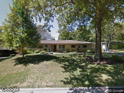
1661 Brunnerwood Dr Cincinnati, OH 45238
Covedale NeighborhoodEstimated Value: $276,000 - $350,570
4
Beds
3
Baths
2,675
Sq Ft
$119/Sq Ft
Est. Value
About This Home
This home is located at 1661 Brunnerwood Dr, Cincinnati, OH 45238 and is currently estimated at $319,643, approximately $119 per square foot. 1661 Brunnerwood Dr is a home located in Hamilton County with nearby schools including Covedale School, Gilbert A. Dater High School, and Western Hills High School.
Ownership History
Date
Name
Owned For
Owner Type
Purchase Details
Closed on
Feb 19, 2001
Sold by
Kraft Jane C and Kraft Gary L
Bought by
Siegel Dale A and Siegel Julianne M
Current Estimated Value
Home Financials for this Owner
Home Financials are based on the most recent Mortgage that was taken out on this home.
Original Mortgage
$134,700
Interest Rate
6.91%
Purchase Details
Closed on
May 22, 1998
Sold by
Hiltenbeitel Judith Ann
Bought by
Kraft Jane C and Kraft Gary L
Create a Home Valuation Report for This Property
The Home Valuation Report is an in-depth analysis detailing your home's value as well as a comparison with similar homes in the area
Home Values in the Area
Average Home Value in this Area
Purchase History
| Date | Buyer | Sale Price | Title Company |
|---|---|---|---|
| Siegel Dale A | $158,500 | Title First Agency Inc | |
| Kraft Jane C | $143,000 | -- |
Source: Public Records
Mortgage History
| Date | Status | Borrower | Loan Amount |
|---|---|---|---|
| Closed | Siegel Julianne M | $28,500 | |
| Open | Siegel Dale A | $134,000 | |
| Closed | Siegel Dale A | $134,700 |
Source: Public Records
Tax History Compared to Growth
Tax History
| Year | Tax Paid | Tax Assessment Tax Assessment Total Assessment is a certain percentage of the fair market value that is determined by local assessors to be the total taxable value of land and additions on the property. | Land | Improvement |
|---|---|---|---|---|
| 2024 | $5,461 | $92,908 | $19,100 | $73,808 |
| 2023 | $5,570 | $92,908 | $19,100 | $73,808 |
| 2022 | $4,538 | $63,270 | $15,295 | $47,975 |
| 2021 | $4,119 | $63,270 | $15,295 | $47,975 |
| 2020 | $4,178 | $63,270 | $15,295 | $47,975 |
| 2019 | $4,145 | $56,490 | $13,657 | $42,833 |
| 2018 | $4,154 | $56,490 | $13,657 | $42,833 |
| 2017 | $3,966 | $56,490 | $13,657 | $42,833 |
| 2016 | $4,254 | $59,483 | $14,049 | $45,434 |
| 2015 | $3,832 | $59,483 | $14,049 | $45,434 |
| 2014 | $3,858 | $59,483 | $14,049 | $45,434 |
| 2013 | $3,776 | $60,085 | $14,193 | $45,892 |
Source: Public Records
Map
Nearby Homes
- 1650 Colonial Dr
- 1629 Pasadena Ave
- 5304 Sidney Rd
- 5207 Willowood Ave
- 5121 Leona Dr
- 1358 Le Mar Dr
- 1331 Le Mar Dr
- 5232 Relluk Dr
- 5391 Quailwood Ct
- 5429 Lever Ct
- 2043 Faycrest Dr
- 5128 Willnet Dr
- 4971 Western Hills Ave
- 2028 Rollingridge Ln
- 5346 Rawhide Ct
- 5350 Lilibet Ct
- 5009 Cleves Warsaw Pike
- 4947 Ralph Ave
- 5490 Glenway Ave
- 4928 Western Hills Ave