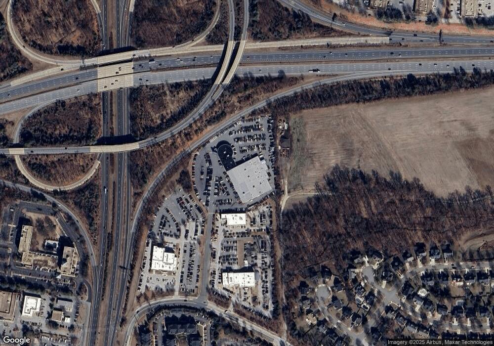
Estimated Value: $12,739,841
--
Bed
--
Bath
39,242
Sq Ft
$325/Sq Ft
Est. Value
About This Home
This home is located at 16610 Governor Bridge Rd, Bowie, MD 20716 and is currently estimated at $12,739,841, approximately $324 per square foot. 16610 Governor Bridge Rd is a home located in Prince George's County with nearby schools including Yorktown Elementary School, Samuel Ogle Middle School, and Bowie High School.
Ownership History
Date
Name
Owned For
Owner Type
Purchase Details
Closed on
May 30, 2014
Sold by
Rogers Charles V and Rogers William A
Bought by
Whitro Bowie #2 Llc
Current Estimated Value
Home Financials for this Owner
Home Financials are based on the most recent Mortgage that was taken out on this home.
Original Mortgage
$8,700,000
Outstanding Balance
$6,615,505
Interest Rate
4.27%
Mortgage Type
Commercial
Estimated Equity
$6,124,336
Purchase Details
Closed on
Aug 14, 2001
Sold by
Rogerswilliam A Iii Trustee Etal
Bought by
Rogers Living Trust Etal
Purchase Details
Closed on
Jan 30, 1998
Sold by
Rogers William A
Bought by
Rogers William A and Rogers Hirley V
Create a Home Valuation Report for This Property
The Home Valuation Report is an in-depth analysis detailing your home's value as well as a comparison with similar homes in the area
Home Values in the Area
Average Home Value in this Area
Purchase History
| Date | Buyer | Sale Price | Title Company |
|---|---|---|---|
| Whitro Bowie #2 Llc | $6,670,317 | First American Title | |
| Rogers Living Trust Etal | -- | -- | |
| Rogers William A | -- | -- |
Source: Public Records
Mortgage History
| Date | Status | Borrower | Loan Amount |
|---|---|---|---|
| Open | Whitro Bowie #2 Llc | $8,700,000 |
Source: Public Records
Tax History Compared to Growth
Tax History
| Year | Tax Paid | Tax Assessment Tax Assessment Total Assessment is a certain percentage of the fair market value that is determined by local assessors to be the total taxable value of land and additions on the property. | Land | Improvement |
|---|---|---|---|---|
| 2025 | $74,697 | $6,935,900 | $3,338,800 | $3,597,100 |
| 2024 | $74,697 | $6,826,633 | $0 | $0 |
| 2023 | $74,697 | $6,717,367 | $0 | $0 |
| 2022 | $107,236 | $6,608,100 | $3,402,500 | $3,205,600 |
| 2021 | $119,251 | $7,216,733 | $0 | $0 |
| 2020 | $114,762 | $6,914,667 | $0 | $0 |
| 2019 | $110,273 | $6,612,600 | $3,402,500 | $3,210,100 |
| 2018 | $99,252 | $5,870,900 | $0 | $0 |
| 2017 | $88,230 | $5,129,200 | $0 | $0 |
| 2016 | -- | $4,387,500 | $0 | $0 |
| 2015 | $81,125 | $4,387,500 | $0 | $0 |
| 2014 | $81,125 | $4,387,500 | $0 | $0 |
Source: Public Records
Map
Nearby Homes
- 17006 Longleaf Dr
- 17105 Aspen Leaf Dr
- 12801 Hadley Ln
- 2504 Kinderbrook Ln
- 2228 Hindle Ln
- 2217 Harwood Ln
- 17313 Hardisty Way Unit 7F
- 17309 Hardisty Way Unit 5F
- 2229 Harwood Ln
- 12847 Holiday Ln
- 5016 Henry King Way Unit 20F
- Chelsea Plan at Melford Town Center
- Greenwich Townhomes Plan at Melford Town Center
- Gramercy Plan at Melford Town Center
- 5020 Henry King Way Unit 22F
- 5022 Henry King Way Unit 23F
- 12805 Kendale Ln
- 16202 Ellipse Terrace
- 3800 Europe Ln
- 16418 Elysian Ln
- 16620 Governor Bridge Rd
- 16700 Governor Bridge Rd
- 16600 Governor Bridge Rd
- 16899 Governor Bridge Rd
- 16702 Governor Bridge Rd
- 16900 Aspen Leaf Ct
- 16901 Aspen Leaf Ct
- 16902 Aspen Leaf Ct
- 16903 Aspen Leaf Ct
- 16900 Birch Leaf Ct
- 16901 Birch Leaf Ct
- 16904 Aspen Leaf Ct
- 16905 Aspen Leaf Ct
- 16906 Aspen Leaf Ct
- 16902 Birch Leaf Ct
- 16800 Governor Bridge Rd
- 16903 Birch Leaf Ct
- 16907 Aspen Leaf Ct
- 16908 Aspen Leaf Ct
- 16904 Birch Leaf Ct
