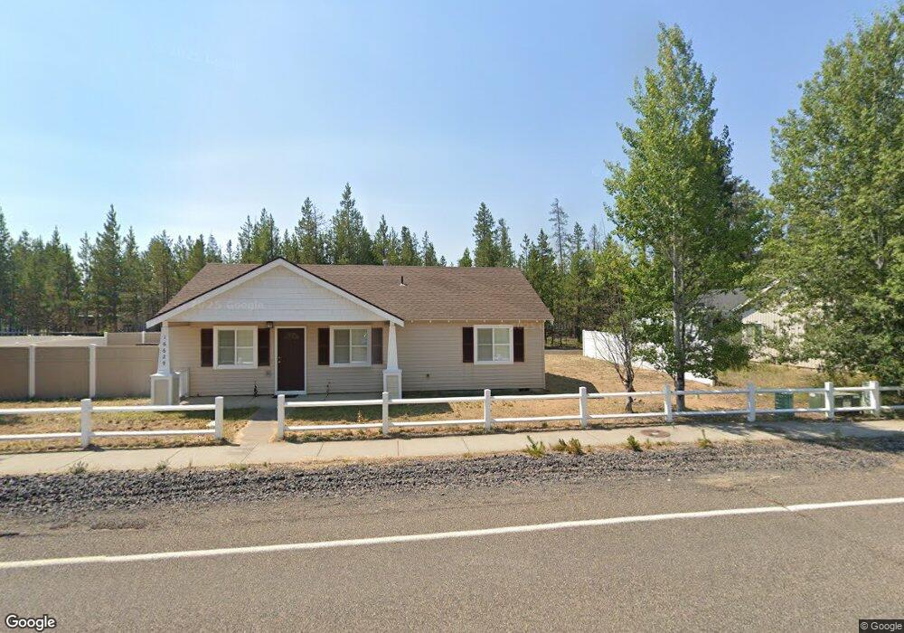
16629 William Foss Rd La Pine, OR 97739
Estimated Value: $304,000 - $394,000
3
Beds
2
Baths
1,132
Sq Ft
$305/Sq Ft
Est. Value
About This Home
This home is located at 16629 William Foss Rd, La Pine, OR 97739 and is currently estimated at $344,811, approximately $304 per square foot. 16629 William Foss Rd is a home located in Deschutes County with nearby schools including Rosland Elementary School, La Pine Middle School, and La Pine Senior High School.
Ownership History
Date
Name
Owned For
Owner Type
Purchase Details
Closed on
Apr 10, 2017
Sold by
Arthur Joel and Arthur Carol
Bought by
Arthur Joel F and Arthur Carol J
Current Estimated Value
Purchase Details
Closed on
Oct 14, 2009
Sold by
U S Bank National Association
Bought by
Arthur Joel and Arthur Carol
Purchase Details
Closed on
Jan 20, 2009
Sold by
Miller Dennis R and Miller Sandra E
Bought by
U S Bank National Association and Abfc 2007-Wmc1 Trust
Create a Home Valuation Report for This Property
The Home Valuation Report is an in-depth analysis detailing your home's value as well as a comparison with similar homes in the area
Home Values in the Area
Average Home Value in this Area
Purchase History
| Date | Buyer | Sale Price | Title Company |
|---|---|---|---|
| Arthur Joel F | -- | None Available | |
| Arthur Joel | $55,000 | Fidelity Natl Title Co Of Or | |
| U S Bank National Association | $89,250 | Amerititle |
Source: Public Records
Tax History Compared to Growth
Tax History
| Year | Tax Paid | Tax Assessment Tax Assessment Total Assessment is a certain percentage of the fair market value that is determined by local assessors to be the total taxable value of land and additions on the property. | Land | Improvement |
|---|---|---|---|---|
| 2025 | $2,750 | $151,850 | -- | -- |
| 2024 | $2,638 | $147,430 | -- | -- |
| 2023 | $2,577 | $143,140 | $0 | $0 |
| 2022 | $2,300 | $134,940 | $0 | $0 |
| 2021 | $2,312 | $131,010 | $0 | $0 |
| 2020 | $2,194 | $131,010 | $0 | $0 |
| 2019 | $2,198 | $127,200 | $0 | $0 |
| 2018 | $2,136 | $123,500 | $0 | $0 |
| 2017 | $2,080 | $119,910 | $0 | $0 |
| 2016 | $1,988 | $116,420 | $0 | $0 |
| 2015 | $1,925 | $113,030 | $0 | $0 |
| 2014 | $1,659 | $99,570 | $0 | $0 |
Source: Public Records
Map
Nearby Homes
- 51423 Mac Ct
- 51505 Mitts Way
- 51420 Wheeler Rd
- 16676 Mcclintock Place
- 16540 William Foss Rd
- 16672 Shaw Pine Ct
- 16662 Cabin Lake Ln
- 0 Walling Ln Unit 3202 220188525
- 51395 Preble Way
- 16480 Carter Ct
- 51332 Preble Way
- 51455 Huntington Rd
- 51443 Morson St
- 51730 Jubilee Pine Dr
- 16485 Cassidy Dr
- 16470 Cassidy Dr
- 51734 Jubilee Pine Dr
- 51738 Jubilee Pine Dr
- 51742 Jubilee Pine Dr
- 51746 Jubilee Pine Dr
- 16629 Finley Butte Rd Unit WM
- 16621 Wm Foss Rd Rd
- 16637 William Foss Rd
- 51475 Wheeler Rd
- 16615 William Foss Rd
- 16645 William Foss Rd
- 16650 William Foss Rd
- 62 William Foss Rd
- 0 William Foss Rd
- 16605 William Foss Rd
- 51466 Hinkle Way
- 16625 Dillon Way
- 16623 Dillon Way
- 16655 Foss Rd
- 16655 William Foss Rd
- 16631 Dillon Way
- 16617 Dillon Way
- 51478 Lasso Ln
- 16613 Dillon Way
- 16641 Dillon Way