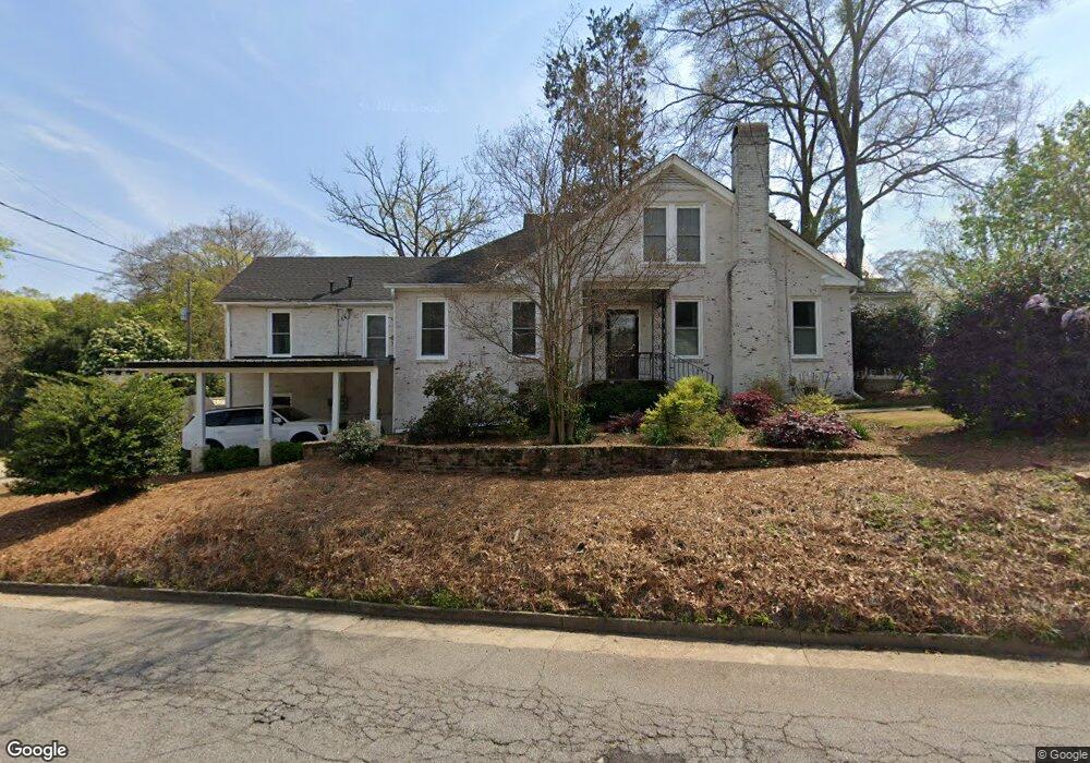
1664 Carter Ave Columbus, GA 31906
Wynnton Grove NeighborhoodEstimated Value: $315,642 - $394,000
3
Beds
3
Baths
2,248
Sq Ft
$156/Sq Ft
Est. Value
About This Home
This home is located at 1664 Carter Ave, Columbus, GA 31906 and is currently estimated at $351,161, approximately $156 per square foot. 1664 Carter Ave is a home located in Muscogee County with nearby schools including Richards Middle School, Hardaway High School, and Wynnton Elementary School.
Ownership History
Date
Name
Owned For
Owner Type
Purchase Details
Closed on
Jun 13, 2013
Sold by
Obrien John T
Bought by
Jeter Savannah and Jeter William D
Current Estimated Value
Home Financials for this Owner
Home Financials are based on the most recent Mortgage that was taken out on this home.
Original Mortgage
$134,910
Outstanding Balance
$96,138
Interest Rate
3.53%
Mortgage Type
New Conventional
Estimated Equity
$255,023
Create a Home Valuation Report for This Property
The Home Valuation Report is an in-depth analysis detailing your home's value as well as a comparison with similar homes in the area
Home Values in the Area
Average Home Value in this Area
Purchase History
| Date | Buyer | Sale Price | Title Company |
|---|---|---|---|
| Jeter Savannah | $149,900 | -- |
Source: Public Records
Mortgage History
| Date | Status | Borrower | Loan Amount |
|---|---|---|---|
| Open | Jeter Savannah | $134,910 |
Source: Public Records
Tax History
| Year | Tax Paid | Tax Assessment Tax Assessment Total Assessment is a certain percentage of the fair market value that is determined by local assessors to be the total taxable value of land and additions on the property. | Land | Improvement |
|---|---|---|---|---|
| 2025 | $1,831 | $109,360 | $19,120 | $90,240 |
| 2024 | $1,830 | $109,360 | $19,120 | $90,240 |
| 2023 | $1,147 | $109,360 | $19,120 | $90,240 |
| 2022 | $1,908 | $89,000 | $19,120 | $69,880 |
| 2021 | $1,901 | $82,388 | $19,120 | $63,268 |
| 2020 | $1,902 | $82,388 | $19,120 | $63,268 |
| 2019 | $1,910 | $82,388 | $19,120 | $63,268 |
| 2018 | $1,910 | $82,388 | $19,120 | $63,268 |
| 2017 | $1,918 | $82,388 | $19,120 | $63,268 |
| 2016 | $1,926 | $59,960 | $11,018 | $48,942 |
| 2015 | $1,929 | $59,960 | $11,018 | $48,942 |
| 2014 | $1,932 | $59,960 | $11,018 | $48,942 |
| 2013 | -- | $54,734 | $11,018 | $43,716 |
Source: Public Records
Map
Nearby Homes
- 1652 Carter Ave
- 1701 Stark Ave
- 1659 Carter Ave
- 1711 Stark Ave
- 1667 Carter Ave
- 1700 Carter Ave
- 1644 Carter Ave
- 1653 Carter Ave
- 2500 17th St
- 1708 Stark Ave
- 1643 Carter Ave
- 1660 Wildwood Ave
- 1708 Carter Ave
- 2505 17th St
- 1654 Wildwood Ave
- 1634 Carter Ave
- 1720 Stark Ave
- 1725 Stark Ave
- 2510 17th St
- 1672 Wildwood Ave
Your Personal Tour Guide
Ask me questions while you tour the home.