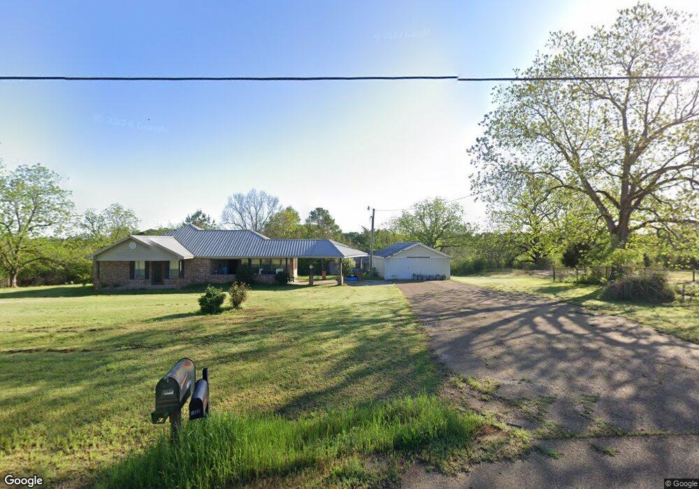
1664 Highway 550 NW Brookhaven, MS 39601
Estimated Value: $185,975 - $196,000
--
Bed
--
Bath
1,529
Sq Ft
$126/Sq Ft
Est. Value
About This Home
This home is located at 1664 Highway 550 NW, Brookhaven, MS 39601 and is currently estimated at $191,992, approximately $125 per square foot. 1664 Highway 550 NW is a home with nearby schools including Loyd Star School.
Ownership History
Date
Name
Owned For
Owner Type
Purchase Details
Closed on
Jul 18, 2025
Sold by
Case Bradley Scott and Case Clinton Day
Bought by
Ladner Jenna
Current Estimated Value
Home Financials for this Owner
Home Financials are based on the most recent Mortgage that was taken out on this home.
Original Mortgage
$6,000
Outstanding Balance
$5,631
Interest Rate
6.85%
Mortgage Type
New Conventional
Estimated Equity
$186,361
Purchase Details
Closed on
Dec 1, 2021
Sold by
Bryon Hamilton Darrell
Bought by
Case Thomas Ray
Home Financials for this Owner
Home Financials are based on the most recent Mortgage that was taken out on this home.
Original Mortgage
$40,000
Interest Rate
3.09%
Mortgage Type
Credit Line Revolving
Create a Home Valuation Report for This Property
The Home Valuation Report is an in-depth analysis detailing your home's value as well as a comparison with similar homes in the area
Home Values in the Area
Average Home Value in this Area
Purchase History
| Date | Buyer | Sale Price | Title Company |
|---|---|---|---|
| Ladner Jenna | -- | None Listed On Document | |
| Case Thomas Ray | -- | Allen Allen Breeland & Allen P |
Source: Public Records
Mortgage History
| Date | Status | Borrower | Loan Amount |
|---|---|---|---|
| Open | Ladner Jenna | $6,000 | |
| Open | Ladner Jenna | $162,011 | |
| Previous Owner | Case Thomas Ray | $40,000 |
Source: Public Records
Tax History Compared to Growth
Tax History
| Year | Tax Paid | Tax Assessment Tax Assessment Total Assessment is a certain percentage of the fair market value that is determined by local assessors to be the total taxable value of land and additions on the property. | Land | Improvement |
|---|---|---|---|---|
| 2024 | $1,846 | $17,361 | $0 | $0 |
| 2023 | $1,846 | $11,241 | $0 | $0 |
| 2022 | $360 | $11,847 | $0 | $0 |
| 2021 | $368 | $11,241 | $0 | $0 |
| 2020 | $370 | $10,827 | $0 | $0 |
| 2019 | $367 | $10,819 | $0 | $0 |
| 2018 | $390 | $11,119 | $0 | $0 |
| 2016 | $344 | $10,848 | $0 | $0 |
| 2015 | $345 | $10,818 | $0 | $0 |
| 2014 | $347 | $10,792 | $0 | $0 |
Source: Public Records
Map
Nearby Homes
- 2215 Hwy 550
- 00 Oil Field Ln NW
- 3050 James Dr NW
- 2657 James Dr NW
- Arthur Dr NW
- 986 Dunn Ratcliff Rd NW
- 3025 James Dr NW
- 1919 Arthur Dr NW
- TBD Poplar Ridge Ln NW
- 1378 Zetus Rd NW
- 00 Toy Dr NW
- TBD Mississippi 550
- 982 Dunn-Ratcliff Rd NW
- 3103 Durr-Case Trail NW
- Old Red Star Dr NW
- 1338 Brookway Blvd
- 621 Felder Ln NE
- 1965 Norman Trail NW
- 0 Norman Trail NW
- 0000 Mississippi 550
- 1727 Highway 550 NW
- 1702 Highway 550 NW
- 2325 Palamino Loop NW
- 1720 Highway 550 NW
- 1620 Highway 550 NW
- 2343 Palamino Loop NW
- 1598 Highway 550 NW
- 2276 Jackson Liberty Dr NW
- 2356 Palamino Loop NW
- 2361 Palamino Loop NW
- 0 Palomino Loop Unit 123831
- 2423 Palamino Loop NW
- 0000 Caseyville Rd
- 2391 Palamino Loop NW
- 1822 Highway 550 NW
- 1815 Highway 550 NW
- 1829 Highway 550 NW
- 2252 Jackson Liberty Dr NW
- 2373 Apaloosa Ln NW
- 2389 Apaloosa Ln NW