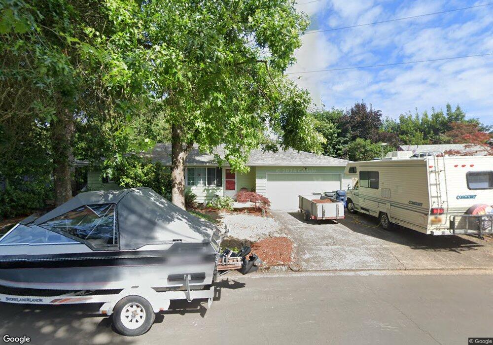
1664 W Quinalt St Springfield, OR 97477
West Springfield NeighborhoodEstimated Value: $366,000 - $398,000
3
Beds
1
Bath
1,042
Sq Ft
$368/Sq Ft
Est. Value
About This Home
This home is located at 1664 W Quinalt St, Springfield, OR 97477 and is currently estimated at $383,559, approximately $368 per square foot. 1664 W Quinalt St is a home located in Lane County with nearby schools including Centennial Elementary School, Hamlin Middle School, and Springfield High School.
Ownership History
Date
Name
Owned For
Owner Type
Purchase Details
Closed on
Dec 19, 2012
Sold by
Ketman Hollie
Bought by
Bray David
Current Estimated Value
Home Financials for this Owner
Home Financials are based on the most recent Mortgage that was taken out on this home.
Original Mortgage
$103,000
Outstanding Balance
$70,769
Interest Rate
3.27%
Mortgage Type
New Conventional
Estimated Equity
$312,790
Create a Home Valuation Report for This Property
The Home Valuation Report is an in-depth analysis detailing your home's value as well as a comparison with similar homes in the area
Home Values in the Area
Average Home Value in this Area
Purchase History
| Date | Buyer | Sale Price | Title Company |
|---|---|---|---|
| Bray David | $144,000 | Cascade Title Company |
Source: Public Records
Mortgage History
| Date | Status | Borrower | Loan Amount |
|---|---|---|---|
| Open | Bray David | $103,000 |
Source: Public Records
Tax History
| Year | Tax Paid | Tax Assessment Tax Assessment Total Assessment is a certain percentage of the fair market value that is determined by local assessors to be the total taxable value of land and additions on the property. | Land | Improvement |
|---|---|---|---|---|
| 2025 | $2,658 | $181,489 | -- | -- |
| 2024 | $2,586 | $176,203 | -- | -- |
| 2023 | $2,586 | $171,071 | $0 | $0 |
| 2022 | $2,459 | $166,089 | $0 | $0 |
| 2021 | $2,406 | $161,252 | $0 | $0 |
| 2020 | $2,336 | $156,556 | $0 | $0 |
| 2019 | $2,254 | $151,997 | $0 | $0 |
| 2018 | $2,168 | $143,272 | $0 | $0 |
| 2017 | $2,103 | $143,272 | $0 | $0 |
| 2016 | $2,056 | $139,099 | $0 | $0 |
| 2015 | $2,006 | $135,048 | $0 | $0 |
| 2014 | $1,922 | $131,115 | $0 | $0 |
Source: Public Records
Map
Nearby Homes
- 1450 W Quinalt St
- 1310 W Quinalt St
- 1130 Anderson Ln
- 1533 Sequoia Ave
- 1424 Wimbledon Place
- 446 Kodiak St
- 3579 Oxbow Way
- 898 Lochaven Ave
- 804 W N St
- 835 Anderson Ln
- 1074 Hamilton St
- 538 Lochaven Ave
- 3360 Chevy Chase St
- 451 Lochaven Ave
- 1505 Canal St
- 428 W Centennial Blvd
- 992 Sunset Dr
- 930 Prescott Ln
- 2727 Gateway St Unit 27
- 364 Scotts Glen Dr
- 1680 W Quinalt St
- 1648 W Quinalt St
- 1632 W Quinalt St
- 1700 Linden Ave
- 1696 W Quinalt St
- 1710 Linden Ave
- 1693 W Quinalt St
- 1616 W Quinalt St
- 1619 W Quinalt St
- 1682 Linden Ave
- 1669 Linden Ave
- 1600 W Quinalt St
- 1583 W Fairview Dr
- 1615 Anderson Ln
- 1670 Linden Ave
- 1588 W Quinalt St
- 1645 Linden Ave
- 1567 W Fairview Dr
- 1583 W Quinalt St
- 1545 Anderson Ln Unit VRM
Your Personal Tour Guide
Ask me questions while you tour the home.