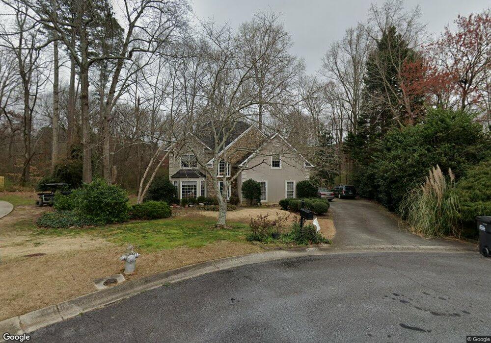
1664 Westport Point SW Unit 2 Marietta, GA 30064
West Cobb NeighborhoodEstimated Value: $468,152 - $580,000
4
Beds
3
Baths
3,177
Sq Ft
$165/Sq Ft
Est. Value
About This Home
This home is located at 1664 Westport Point SW Unit 2, Marietta, GA 30064 and is currently estimated at $525,288, approximately $165 per square foot. 1664 Westport Point SW Unit 2 is a home located in Cobb County with nearby schools including Cheatham Hill Elementary School, Lovinggood Middle School, and Hillgrove High School.
Ownership History
Date
Name
Owned For
Owner Type
Purchase Details
Closed on
Apr 25, 2000
Sold by
Easley Richard A and Easley Marie M
Bought by
Jordan Richard P and Jordan Michelle F
Current Estimated Value
Home Financials for this Owner
Home Financials are based on the most recent Mortgage that was taken out on this home.
Original Mortgage
$155,200
Outstanding Balance
$53,362
Interest Rate
8.28%
Mortgage Type
New Conventional
Estimated Equity
$471,926
Create a Home Valuation Report for This Property
The Home Valuation Report is an in-depth analysis detailing your home's value as well as a comparison with similar homes in the area
Home Values in the Area
Average Home Value in this Area
Purchase History
| Date | Buyer | Sale Price | Title Company |
|---|---|---|---|
| Jordan Richard P | $194,000 | -- |
Source: Public Records
Mortgage History
| Date | Status | Borrower | Loan Amount |
|---|---|---|---|
| Open | Jordan Richard P | $155,200 |
Source: Public Records
Tax History Compared to Growth
Tax History
| Year | Tax Paid | Tax Assessment Tax Assessment Total Assessment is a certain percentage of the fair market value that is determined by local assessors to be the total taxable value of land and additions on the property. | Land | Improvement |
|---|---|---|---|---|
| 2025 | $985 | $176,504 | $30,000 | $146,504 |
| 2024 | $4,102 | $176,504 | $30,000 | $146,504 |
| 2023 | $3,560 | $176,504 | $30,000 | $146,504 |
| 2022 | $3,660 | $154,784 | $30,000 | $124,784 |
| 2021 | $3,154 | $131,648 | $24,000 | $107,648 |
| 2020 | $2,647 | $108,496 | $24,000 | $84,496 |
| 2019 | $2,647 | $108,496 | $24,000 | $84,496 |
| 2018 | $2,647 | $108,496 | $24,000 | $84,496 |
| 2017 | $2,437 | $102,680 | $24,000 | $78,680 |
| 2016 | $2,135 | $88,792 | $28,000 | $60,792 |
| 2015 | $2,183 | $88,792 | $28,000 | $60,792 |
| 2014 | $2,198 | $88,792 | $0 | $0 |
Source: Public Records
Map
Nearby Homes
- 2093 Breconridge Dr SW
- 2040 Hardwood Cir SW Unit 3
- 1646 Desford Ct SW
- 1505 Old John Ward Rd SW
- 2403 Bonshaw Ln
- 1533 Fallen Leaf Dr SW
- 994 Gentry Ln SW
- 1239 Bonshaw Trail Unit 3
- 1227 Bonshaw Trail
- 1946 MacLand Rd SW
- 1214 Bonshaw Trail
- 1537 Mcadoo Dr SW
- 1830 MacLand Rd SW
- 2409 Caneridge Point SW
- 1985 Freestone Way
- 1265 Channel Park SW
- 1952 Freestone Way
- 2563 Irwin Lake Overlook Rd SW
- Monteluce Plan at Freestone Station
- Hillside Plan at Freestone Station
- 1662 Westport Point SW
- 1665 Westport Point SW Unit 1665
- 1665 Westport Point SW
- 1665 Westport Point SW
- 1663 Westport Point SW
- 1657 Westport Ct SW
- 1660 Westport Point SW
- 1661 Westport Point SW
- 1659 Westport Ct SW
- 2384 Westport Cir SW Unit 2
- 2376 Westport Cir SW
- 2376 Westport Cir SW Unit 2
- 2376 Westport Cir SW Unit 168
- 1658 Westport Ct SW
- 2379 Westport Cir SW Unit 2
- 2381 Westport Cir SW
- 2374 Westport Cir SW
- 2383 Westport Cir SW
- 1654 Westport Ct SW
- 2385 Westport Cir SW