G
Seller's Agent in 2017
Guy Tavares
La Pine Realty
(541) 306-0756
29 in this area
52 Total Sales

Estimated Value: $163,044 - $359,000
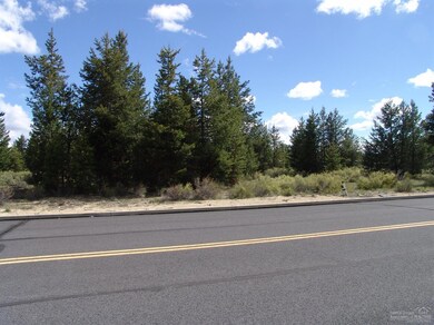
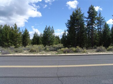
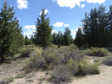
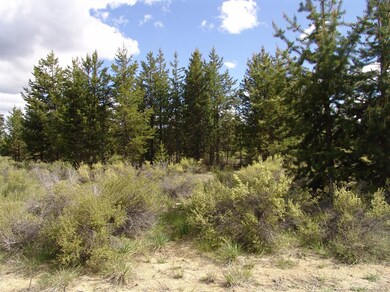
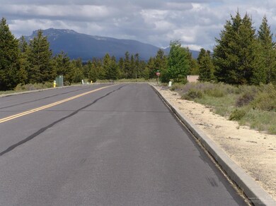
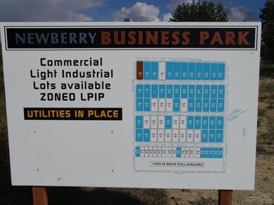
.43 acres of industrial land inside the City of La Pine. New Berry Business Park. Electric, sewer, and water at the street. Build your new business in this up and coming town of La Pine
| Date | Buyer | Sale Price | Title Company |
|---|---|---|---|
| Encompass Storage Of La Pine Llc | $155,000 | Western Title | |
| Green Machine Llc | $99,000 | None Listed On Document | |
| Zaccaro Gilbert A | $70,000 | Amerititle | |
| Rhodes Elam John | $66,000 | Western Title & Escrow Co |
| Date | Event | Price | List to Sale | Price per Sq Ft |
|---|---|---|---|---|
| 03/22/2017 03/22/17 | Sold | $35,000 | -22.2% | -- |
| 03/15/2017 03/15/17 | Pending | -- | -- | -- |
| 05/24/2016 05/24/16 | For Sale | $45,000 | -- | -- |
| Year | Tax Paid | Tax Assessment Tax Assessment Total Assessment is a certain percentage of the fair market value that is determined by local assessors to be the total taxable value of land and additions on the property. | Land | Improvement |
|---|---|---|---|---|
| 2025 | $816 | $52,910 | $52,910 | -- |
| 2024 | $781 | $51,370 | $51,370 | -- |
| 2023 | $765 | $49,880 | $49,880 | $0 |
| 2022 | $707 | $47,020 | $0 | $0 |
| 2021 | $711 | $45,660 | $0 | $0 |
| 2020 | $673 | $45,660 | $0 | $0 |
| 2019 | $337 | $22,170 | $0 | $0 |
| 2018 | $328 | $21,530 | $0 | $0 |
| 2017 | $320 | $20,910 | $0 | $0 |
| 2016 | $305 | $20,310 | $0 | $0 |
| 2015 | $297 | $19,720 | $0 | $0 |
| 2014 | $285 | $19,150 | $0 | $0 |
G
Seller's Agent in 2017
Guy Tavares
La Pine Realty
(541) 306-0756
29 in this area
52 Total Sales
Source: Oregon Datashare
MLS Number: 201605098
APN: 205421
Disclaimer: Certain information contained herein is derived from information provided by parties other than Homes.com. All information provided is deemed reliable, but is not guaranteed to be accurate and should be independently verified.
![]() © 2026 Oregon Datashare (KCAR | MLSCO | SOMLS). All rights reserved. The data relating to real estate for sale on this web site comes in part from the Internet Data Exchange Program of the Oregon Datashare. Real estate listings held by IDX Brokerage firms other than Ten-X are marked with the Internet Data Exchange logo or the Internet Data Exchange thumbnail logo and detailed information about them includes the name of the listing Brokers. Information provided is for consumers' personal, non-commercial use and may not be used for any purpose other than to identify prospective properties the viewer may be interested in purchasing. The consumer will not copy, retransmit nor redistribute any of the content from this website. Information provided is deemed reliable, but not guaranteed.
© 2026 Oregon Datashare (KCAR | MLSCO | SOMLS). All rights reserved. The data relating to real estate for sale on this web site comes in part from the Internet Data Exchange Program of the Oregon Datashare. Real estate listings held by IDX Brokerage firms other than Ten-X are marked with the Internet Data Exchange logo or the Internet Data Exchange thumbnail logo and detailed information about them includes the name of the listing Brokers. Information provided is for consumers' personal, non-commercial use and may not be used for any purpose other than to identify prospective properties the viewer may be interested in purchasing. The consumer will not copy, retransmit nor redistribute any of the content from this website. Information provided is deemed reliable, but not guaranteed.
Ask me questions while you tour the home.
