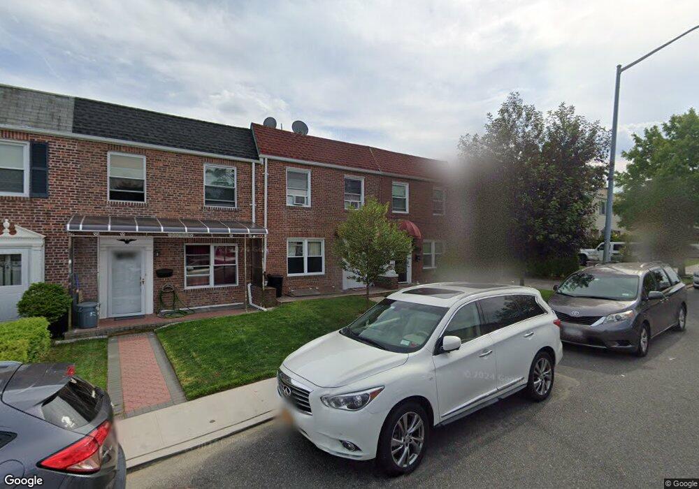
16648 22nd Ave Whitestone, NY 11357
Clearview NeighborhoodEstimated Value: $768,859 - $1,036,000
Studio
--
Bath
1,188
Sq Ft
$757/Sq Ft
Est. Value
About This Home
This home is located at 16648 22nd Ave, Whitestone, NY 11357 and is currently estimated at $899,465, approximately $757 per square foot. 16648 22nd Ave is a home located in Queens County with nearby schools including P.S. 184 Flushing Manor, J.H.S. 194 William Carr, and Bayside High School.
Ownership History
Date
Name
Owned For
Owner Type
Purchase Details
Closed on
Feb 27, 2020
Sold by
Sarli Ann
Bought by
Musella Jerry
Current Estimated Value
Purchase Details
Closed on
Sep 29, 2017
Sold by
Musella Jerry and Musella As Guardian Jerry
Bought by
Musella Jerry
Purchase Details
Closed on
Oct 10, 2007
Sold by
Miceli William and Musella Theresa
Bought by
Musella Jerry and Musella Theresa
Purchase Details
Closed on
Sep 9, 2000
Sold by
Miceli William and Musella Theresa
Bought by
Miceli William and Musella Theresa
Purchase Details
Closed on
Sep 12, 1995
Sold by
Miceli William
Bought by
William Miceli Living Trust
Purchase Details
Closed on
Jun 22, 1995
Sold by
Miceli William and Miceli Frances
Bought by
Miceli William
Create a Home Valuation Report for This Property
The Home Valuation Report is an in-depth analysis detailing your home's value as well as a comparison with similar homes in the area
Home Values in the Area
Average Home Value in this Area
Purchase History
| Date | Buyer | Sale Price | Title Company |
|---|---|---|---|
| Musella Jerry | $160,000 | -- | |
| Musella Jerry | $160,000 | -- | |
| Musella Jerry | -- | -- | |
| Musella Jerry | -- | -- | |
| Musella Jerry | -- | -- | |
| Musella Jerry | -- | -- | |
| Musella Jerry | -- | -- | |
| Miceli William | -- | First American Title Ins Co | |
| Miceli William | -- | First American Title Ins Co | |
| William Miceli Living Trust | -- | Commonwealth Land Title Ins | |
| William Miceli Living Trust | -- | Commonwealth Land Title Ins | |
| Miceli William | -- | Commonwealth Land Title Ins | |
| Miceli William | -- | Commonwealth Land Title Ins |
Source: Public Records
Tax History
| Year | Tax Paid | Tax Assessment Tax Assessment Total Assessment is a certain percentage of the fair market value that is determined by local assessors to be the total taxable value of land and additions on the property. | Land | Improvement |
|---|---|---|---|---|
| 2025 | $4,017 | $41,803 | $12,601 | $29,202 |
| 2024 | $4,017 | $40,004 | $11,918 | $28,086 |
| 2023 | $3,790 | $37,740 | $10,810 | $26,930 |
| 2022 | $3,686 | $45,900 | $13,800 | $32,100 |
| 2021 | $3,666 | $46,920 | $13,800 | $33,120 |
| 2020 | $7,374 | $46,380 | $13,800 | $32,580 |
| 2019 | $6,681 | $42,480 | $13,800 | $28,680 |
| 2018 | $6,113 | $31,450 | $9,801 | $21,649 |
| 2017 | $5,973 | $30,770 | $10,563 | $20,207 |
| 2016 | $5,494 | $30,770 | $10,563 | $20,207 |
| 2015 | $3,062 | $29,030 | $12,163 | $16,867 |
| 2014 | $3,062 | $27,781 | $10,776 | $17,005 |
Source: Public Records
Map
Nearby Homes
- 16662 22nd Ave
- 166-36 23rd Ave
- 21-47 Utopia Pkwy Unit 2
- 16366 23rd Ave
- 166-23 20th Rd
- 21-29 Utopia Pkwy Unit UPSTAIRS
- 199-15 21 Ave Unit 1-356
- 20-19 Utopia Pkwy Unit 1-371
- 199-05 21st Ave Unit 1st Floor
- 19916 21st Ave Unit 1336
- 24-65 Francis Lewis Blvd
- 168-12 19th Ave
- 17-83 166th St Unit Upper
- 168-3 19th Ave Unit 3-181
- 2533 Francis Lewis Blvd
- 199-01 19th Ave Unit 2-180
- 21-38 202nd St Unit 2
- 25-26 Bayside Ln
- 163-32 20th Ave
- 19918 19th Ave Unit 18
- 16650 22nd Ave
- 16642 22nd Ave
- 16652 22nd Ave
- 166-52 22nd Ave
- 16652 22nd Ave
- 166-54 22nd Ave
- 16654 22nd Ave
- 16656 22nd Ave
- 16636 22nd Ave
- 16643 23rd Ave
- 16647 23rd Ave
- 16658 22nd Ave
- 16651 23rd Ave
- 16637 23rd Ave
- 16660 22nd Ave
- 16632 22nd Ave
- 16655 23rd Ave
- 16633 23rd Ave
- 166-51 22nd Ave
- 16649 22nd Ave
Your Personal Tour Guide
Ask me questions while you tour the home.