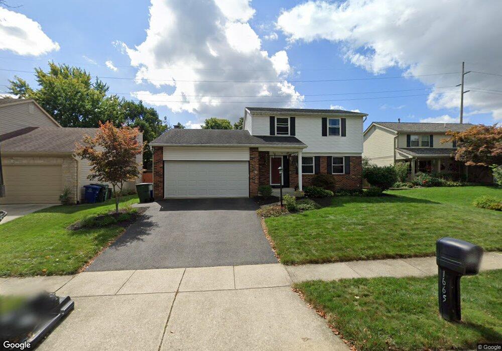
1665 Flat Rock Ct Columbus, OH 43235
Brookside Village NeighborhoodEstimated Value: $347,591 - $393,000
3
Beds
2
Baths
1,617
Sq Ft
$230/Sq Ft
Est. Value
About This Home
This home is located at 1665 Flat Rock Ct, Columbus, OH 43235 and is currently estimated at $371,398, approximately $229 per square foot. 1665 Flat Rock Ct is a home located in Franklin County with nearby schools including Brookside Elementary School, McCord Middle School, and Worthington Kilbourne High School.
Ownership History
Date
Name
Owned For
Owner Type
Purchase Details
Closed on
Oct 15, 2003
Sold by
Mcanarney Colby R and Mcanarney Cameron M
Bought by
Townsend Edgar A and Townsend Sandra J
Current Estimated Value
Home Financials for this Owner
Home Financials are based on the most recent Mortgage that was taken out on this home.
Original Mortgage
$158,746
Outstanding Balance
$70,848
Interest Rate
6.04%
Mortgage Type
FHA
Estimated Equity
$300,550
Purchase Details
Closed on
Jul 11, 1997
Sold by
Doll Adam M and Harwood Dawn M
Bought by
Mcanarney Colby R and Mcanarney Cameron M
Home Financials for this Owner
Home Financials are based on the most recent Mortgage that was taken out on this home.
Original Mortgage
$110,976
Interest Rate
7.81%
Mortgage Type
FHA
Purchase Details
Closed on
Apr 2, 1996
Sold by
Abraham Sharon L
Bought by
Harwood Adam M Doll and Harwood Dawn M
Home Financials for this Owner
Home Financials are based on the most recent Mortgage that was taken out on this home.
Original Mortgage
$109,918
Interest Rate
6.98%
Mortgage Type
FHA
Purchase Details
Closed on
Jan 11, 1993
Create a Home Valuation Report for This Property
The Home Valuation Report is an in-depth analysis detailing your home's value as well as a comparison with similar homes in the area
Home Values in the Area
Average Home Value in this Area
Purchase History
| Date | Buyer | Sale Price | Title Company |
|---|---|---|---|
| Townsend Edgar A | $160,000 | Real Living Title | |
| Mcanarney Colby R | $116,900 | Lender'S Service Inc | |
| Harwood Adam M Doll | $111,000 | -- | |
| -- | $89,000 | -- |
Source: Public Records
Mortgage History
| Date | Status | Borrower | Loan Amount |
|---|---|---|---|
| Open | Townsend Edgar A | $158,746 | |
| Closed | Mcanarney Colby R | $110,976 | |
| Previous Owner | Harwood Adam M Doll | $109,918 |
Source: Public Records
Tax History
| Year | Tax Paid | Tax Assessment Tax Assessment Total Assessment is a certain percentage of the fair market value that is determined by local assessors to be the total taxable value of land and additions on the property. | Land | Improvement |
|---|---|---|---|---|
| 2025 | $5,742 | $93,530 | $28,600 | $64,930 |
| 2024 | $5,742 | $93,530 | $28,600 | $64,930 |
| 2023 | $5,491 | $93,530 | $28,600 | $64,930 |
| 2022 | $5,543 | $74,910 | $18,450 | $56,460 |
| 2021 | $5,113 | $74,910 | $18,450 | $56,460 |
| 2020 | $4,925 | $74,910 | $18,450 | $56,460 |
| 2019 | $4,510 | $61,890 | $15,370 | $46,520 |
| 2018 | $4,189 | $61,890 | $15,370 | $46,520 |
| 2017 | $4,025 | $61,890 | $15,370 | $46,520 |
| 2016 | $4,009 | $56,460 | $13,650 | $42,810 |
| 2015 | $4,009 | $56,460 | $13,650 | $42,810 |
| 2014 | $4,008 | $56,460 | $13,650 | $42,810 |
| 2013 | $1,994 | $56,455 | $13,650 | $42,805 |
Source: Public Records
Map
Nearby Homes
- 7370 Coldstream Dr
- 6747 Merwin Rd
- 7164 Durness Place
- 1354 Lorine Place
- 6876 Spruce Pine Dr
- 1930 Shallowford Ave
- 7034 Rockhaven Place
- 1278 Amol Ln
- 2062 Decker Ct
- 1978 Shallowford Ave
- 2001 Sawbury Blvd Unit 2001
- 1327 Donahey St
- 6904 Clydeway Ct
- 2026 Sawbury Blvd
- 2024 Sawbury Blvd
- 1760 Fallhaven Dr
- 7456 Mapleleaf Ct
- 1096 Woodman Dr
- 2074 Hard Rd
- 7965 Boothbay Ct Unit 20
- 1657 Flat Rock Ct
- 1673 Flat Rock Ct
- 1643 Flat Rock Ct
- 1664 Flat Rock Ct
- 1681 Flat Rock Ct
- 1635 Flat Rock Ct
- 1688 Flat Rock Ct
- 1640 Flat Rock Ct
- 1627 Flat Rock Ct
- 7151 Donahue Ct
- 7136 Donahue Ct
- 7127 Stone Ct
- 1661 Rushing Way
- 1667 Rushing Way
- 7167 Pebble Way Ct
- 1632 Flat Rock Ct
- 1679 Rushing Way
- 1619 Flat Rock Ct
- 7137 Donahue Ct
- 2665 Snouffer Rd
Your Personal Tour Guide
Ask me questions while you tour the home.