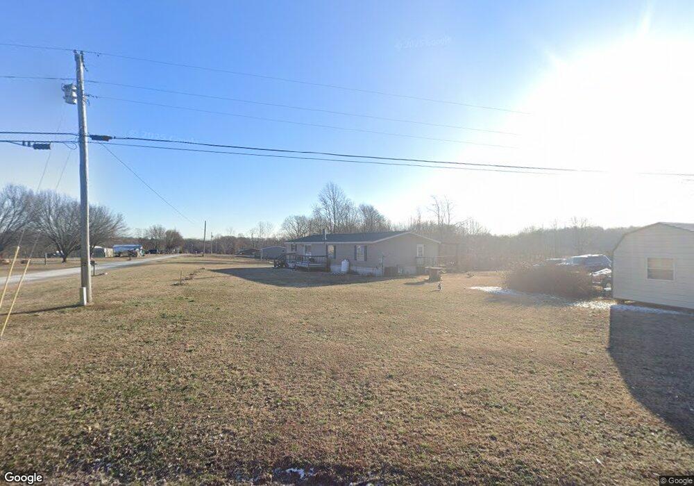
1666 Shrum Cemetery Rd Westmoreland, TN 37186
Estimated Value: $108,515 - $241,000
--
Bed
2
Baths
1,560
Sq Ft
$115/Sq Ft
Est. Value
About This Home
This home is located at 1666 Shrum Cemetery Rd, Westmoreland, TN 37186 and is currently estimated at $179,129, approximately $114 per square foot. 1666 Shrum Cemetery Rd is a home located in Macon County.
Ownership History
Date
Name
Owned For
Owner Type
Purchase Details
Closed on
Sep 12, 2017
Sold by
Qbrawner Barry and Brawner Lisa
Bought by
Gurrero Silva Rose R and Gurrero Silva Sara
Current Estimated Value
Purchase Details
Closed on
Mar 15, 2006
Sold by
Cothron Kerry R
Bought by
Brawner Barry
Home Financials for this Owner
Home Financials are based on the most recent Mortgage that was taken out on this home.
Original Mortgage
$46,100
Interest Rate
6.19%
Mortgage Type
Cash
Purchase Details
Closed on
Dec 27, 2005
Sold by
Vanderbilt Mortgage & Fina
Bought by
Cothron Kerry R
Purchase Details
Closed on
Nov 1, 2005
Bought by
Vanderbilt Mtg & Finance Inc
Create a Home Valuation Report for This Property
The Home Valuation Report is an in-depth analysis detailing your home's value as well as a comparison with similar homes in the area
Home Values in the Area
Average Home Value in this Area
Purchase History
| Date | Buyer | Sale Price | Title Company |
|---|---|---|---|
| Gurrero Silva Rose R | $55,000 | None Available | |
| Brawner Barry | $45,000 | -- | |
| Cothron Kerry R | $33,000 | -- | |
| Vanderbilt Mtg & Finance Inc | $58,500 | -- |
Source: Public Records
Mortgage History
| Date | Status | Borrower | Loan Amount |
|---|---|---|---|
| Previous Owner | Vanderbilt Mtg & Finance Inc | $46,100 |
Source: Public Records
Tax History Compared to Growth
Tax History
| Year | Tax Paid | Tax Assessment Tax Assessment Total Assessment is a certain percentage of the fair market value that is determined by local assessors to be the total taxable value of land and additions on the property. | Land | Improvement |
|---|---|---|---|---|
| 2024 | $551 | $39,450 | $6,725 | $32,725 |
| 2023 | $551 | $39,025 | $0 | $0 |
| 2022 | $414 | $17,250 | $3,100 | $14,150 |
| 2021 | $414 | $17,250 | $3,100 | $14,150 |
| 2020 | $414 | $17,250 | $3,100 | $14,150 |
| 2019 | $414 | $17,250 | $3,100 | $14,150 |
| 2018 | $362 | $16,350 | $3,100 | $13,250 |
| 2017 | $408 | $16,175 | $3,350 | $12,825 |
| 2016 | $388 | $16,175 | $3,350 | $12,825 |
| 2015 | $388 | $16,175 | $3,350 | $12,825 |
| 2014 | $388 | $16,168 | $0 | $0 |
Source: Public Records
Map
Nearby Homes
- 2134 Shrum Cemetery Rd
- 2166 Shrum Cemetery Rd
- 2192 Shrum Cemetery Rd
- 1733 Wixtown Rd
- 1701 Wixtown Rd
- 397 Lauren Ln
- 177 Lauren Ln
- 2838 Wixtown Rd
- 779 Oakdale Rd
- 98 Andrea Ln
- 8141 Old Highway 52
- 2486 Oakdale Rd
- 2134 Oakdale Rd
- 0 Highway 52 W Unit RTC2944821
- 10 Annie Hollow Rd
- 7 Annie Hollow Rd
- 5 Annie Hollow Rd
- 0 Annie Hollow Rd
- 10029 Old Highway 52
- 3290 Rocky Mound Rd
- 4 Shrum Cemetery Rd
- 3 Shrum Cemetery Rd
- 2 Shrum Cemetery Rd
- 5 Shrum Cemetery Rd
- 1 Shrum Cemetery Rd
- 47 Harper Ln
- 108 Harper Ln
- 103 Harper Ln
- 1784 Shrum Cemetery Rd
- 1697 Shrum Cemetery Rd
- 2 Harper Ln
- 150 Harper Ln
- 151 Harper Ln
- 187 Harper Ln
- 1895 Shrum Cemetery Rd
- 1934 Shrum Cemetery Rd
- 225 Harper Ln
- 539 Jones Hollow Rd
- 575 Jones Hollow Rd
- 431 Jones Hollow Rd
