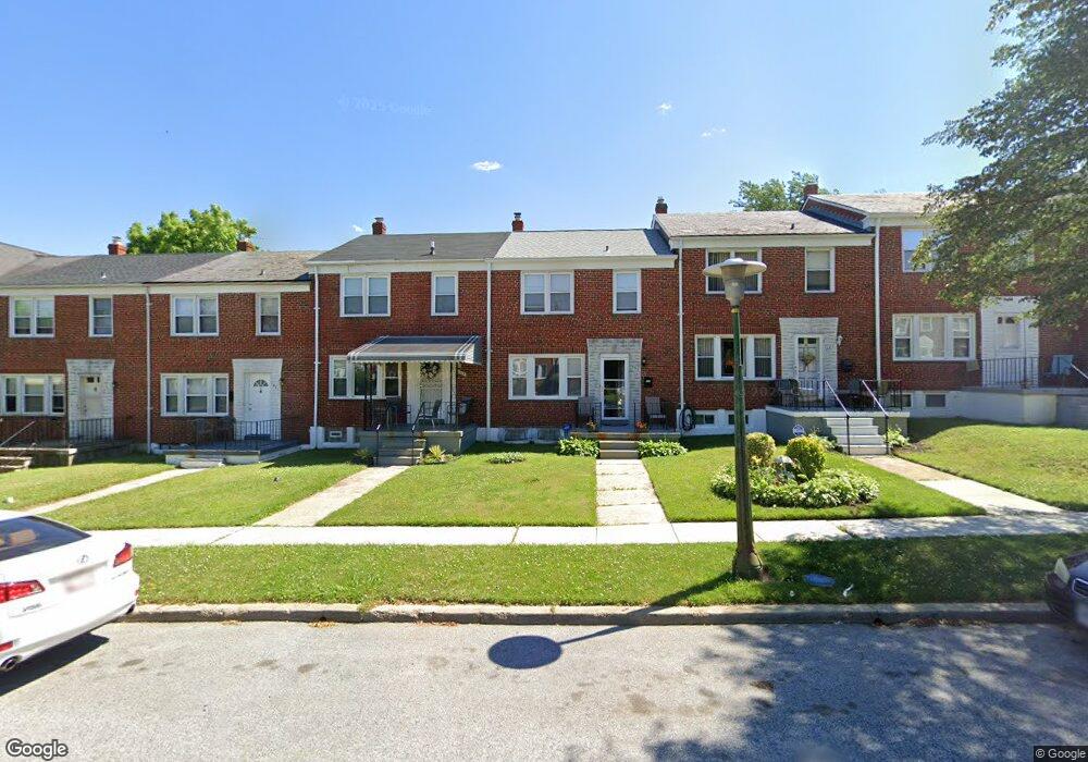
1667 Burnwood Rd Baltimore, MD 21239
Perring Loch NeighborhoodEstimated Value: $211,299 - $248,000
3
Beds
2
Baths
1,280
Sq Ft
$179/Sq Ft
Est. Value
About This Home
This home is located at 1667 Burnwood Rd, Baltimore, MD 21239 and is currently estimated at $229,650, approximately $179 per square foot. 1667 Burnwood Rd is a home located in Baltimore City with nearby schools including Northwood Elementary School, Booker T. Washington Middle School, and Paul Laurence Dunbar Community High School.
Ownership History
Date
Name
Owned For
Owner Type
Purchase Details
Closed on
May 3, 2019
Sold by
Dimaggio Joseph and The Assets Of Share The Land L
Bought by
Dimaggio Joseph
Current Estimated Value
Purchase Details
Closed on
Mar 26, 2009
Sold by
1207 Cedarcroft Llc
Bought by
Spence Radon and Isabelle Ashley N
Purchase Details
Closed on
Feb 5, 2008
Sold by
Lyons Derrick A
Bought by
1207 Cedarcroft Llc
Home Financials for this Owner
Home Financials are based on the most recent Mortgage that was taken out on this home.
Original Mortgage
$125,000
Interest Rate
6.18%
Mortgage Type
Purchase Money Mortgage
Purchase Details
Closed on
Oct 19, 2007
Sold by
Lyons Derrick A
Bought by
1207 Cedarcroft Llc
Home Financials for this Owner
Home Financials are based on the most recent Mortgage that was taken out on this home.
Original Mortgage
$125,000
Interest Rate
6.18%
Mortgage Type
Purchase Money Mortgage
Purchase Details
Closed on
Mar 8, 2001
Sold by
Share The Land Llc
Bought by
Lyons Derrick A
Purchase Details
Closed on
Jun 7, 2000
Sold by
Secretary Of Housing
Bought by
Share The Land Llc
Purchase Details
Closed on
Jun 29, 1999
Sold by
Thompson Joseph G
Bought by
Secretary Of Housing and Urban Development , The
Create a Home Valuation Report for This Property
The Home Valuation Report is an in-depth analysis detailing your home's value as well as a comparison with similar homes in the area
Home Values in the Area
Average Home Value in this Area
Purchase History
| Date | Buyer | Sale Price | Title Company |
|---|---|---|---|
| Dimaggio Joseph | -- | None Available | |
| Spence Radon | $162,000 | -- | |
| 1207 Cedarcroft Llc | $106,000 | -- | |
| 1207 Cedarcroft Llc | $106,000 | -- | |
| Lyons Derrick A | $79,900 | -- | |
| Share The Land Llc | $46,100 | -- | |
| Secretary Of Housing | $81,196 | -- |
Source: Public Records
Mortgage History
| Date | Status | Borrower | Loan Amount |
|---|---|---|---|
| Previous Owner | 1207 Cedarcroft Llc | $125,000 | |
| Previous Owner | 1207 Cedarcroft Llc | $125,000 |
Source: Public Records
Tax History Compared to Growth
Tax History
| Year | Tax Paid | Tax Assessment Tax Assessment Total Assessment is a certain percentage of the fair market value that is determined by local assessors to be the total taxable value of land and additions on the property. | Land | Improvement |
|---|---|---|---|---|
| 2025 | $2,948 | $146,567 | -- | -- |
| 2024 | $2,948 | $136,600 | $36,000 | $100,600 |
| 2023 | $2,907 | $135,167 | $0 | $0 |
| 2022 | $2,877 | $133,733 | $0 | $0 |
| 2021 | $3,122 | $132,300 | $36,000 | $96,300 |
| 2020 | $2,801 | $130,233 | $0 | $0 |
| 2019 | $2,738 | $128,167 | $0 | $0 |
| 2018 | $2,751 | $126,100 | $36,000 | $90,100 |
| 2017 | $2,773 | $125,833 | $0 | $0 |
| 2016 | $3,318 | $125,567 | $0 | $0 |
| 2015 | $3,318 | $125,300 | $0 | $0 |
| 2014 | $3,318 | $125,300 | $0 | $0 |
Source: Public Records
Map
Nearby Homes
- 1800 Burnwood Rd
- 1706 Heathfield Rd
- 1814 Winford Rd
- 1907 Burnwood Rd
- 1613 Winford Rd
- 1648 Ingram Rd
- 1809 Hillenwood Rd
- 5102 Hillen Rd
- 1812 Ingram Rd
- 1932 Hillenwood Rd
- 1530 Burnwood Rd
- 1717 Hartsdale Rd
- 1513 Northbourne Rd
- 5515 Hillen Rd
- 1811 Ramblewood Rd
- 1633 Pentwood Rd
- 1556 Pentwood Rd
- 1554 Pentwood Rd
- 4919 Herring Run Dr
- 2323 Ivy Ave
- 1665 Burnwood Rd
- 1669 Burnwood Rd
- 1663 Burnwood Rd
- 1671 Burnwood Rd
- 1673 Burnwood Rd
- 1661 Burnwood Rd
- 1675 Burnwood Rd
- 1659 Burnwood Rd
- 1662 Winford Rd
- 1664 Winford Rd
- 1660 Winford Rd
- 1657 Burnwood Rd
- 1658 Winford Rd
- 1666 Winford Rd
- 1656 Winford Rd
- 1668 Winford Rd
- 1655 Burnwood Rd
- 1654 Winford Rd
- 1670 Winford Rd
- 1653 Burnwood Rd