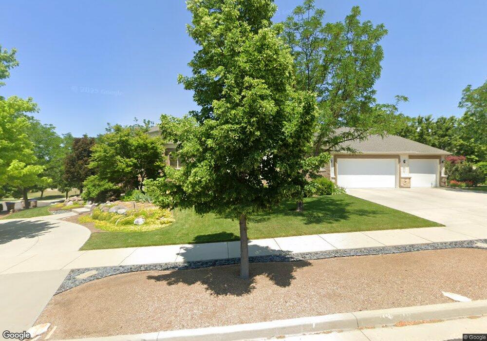
1667 E April Ann Ct Draper, UT 84020
Estimated Value: $1,462,000 - $1,618,000
3
Beds
3
Baths
5,564
Sq Ft
$278/Sq Ft
Est. Value
About This Home
This home is located at 1667 E April Ann Ct, Draper, UT 84020 and is currently estimated at $1,545,899, approximately $277 per square foot. 1667 E April Ann Ct is a home located in Salt Lake County with nearby schools including Draper Park Middle School, Corner Canyon High School, and Summit Academy - Draper Elementary Campus.
Ownership History
Date
Name
Owned For
Owner Type
Purchase Details
Closed on
Oct 16, 2024
Sold by
Paul B Kershisnik B and Paul Virgina L
Bought by
Kershisnik Family Trust and Kershisnik
Current Estimated Value
Purchase Details
Closed on
May 7, 2010
Sold by
Kershisnik Paul and Kershisnik Virgina
Bought by
Kershisnik Paul B and Kershisnik Virginia K
Purchase Details
Closed on
May 22, 2009
Sold by
Finsand Kenneth
Bought by
Kershisnik Paul and Kershisnik Virginia
Purchase Details
Closed on
Mar 13, 2006
Sold by
New Mark Development Inc
Bought by
Finsand Ii Kenneth J
Home Financials for this Owner
Home Financials are based on the most recent Mortgage that was taken out on this home.
Original Mortgage
$528,000
Interest Rate
6.87%
Mortgage Type
Purchase Money Mortgage
Purchase Details
Closed on
Mar 13, 2003
Sold by
Elk Ridge Development Inc
Bought by
New Mark Development Inc
Create a Home Valuation Report for This Property
The Home Valuation Report is an in-depth analysis detailing your home's value as well as a comparison with similar homes in the area
Home Values in the Area
Average Home Value in this Area
Purchase History
| Date | Buyer | Sale Price | Title Company |
|---|---|---|---|
| Kershisnik Family Trust | -- | None Listed On Document | |
| Kershisnik Paul B | -- | Accommodation | |
| Kershisnik Paul | $460,000 | Premier Title Ins Agency | |
| Finsand Ii Kenneth J | -- | Crown Title | |
| New Mark Development Inc | -- | Landmark Title |
Source: Public Records
Mortgage History
| Date | Status | Borrower | Loan Amount |
|---|---|---|---|
| Previous Owner | Finsand Ii Kenneth J | $528,000 |
Source: Public Records
Tax History
| Year | Tax Paid | Tax Assessment Tax Assessment Total Assessment is a certain percentage of the fair market value that is determined by local assessors to be the total taxable value of land and additions on the property. | Land | Improvement |
|---|---|---|---|---|
| 2025 | $7,250 | $1,436,500 | $421,100 | $1,015,400 |
| 2024 | $7,250 | $1,384,900 | $405,400 | $979,500 |
| 2023 | $6,926 | $1,313,300 | $389,700 | $923,600 |
| 2022 | $0 | $1,316,900 | $382,100 | $934,800 |
| 2021 | $8,417 | $927,900 | $334,300 | $593,600 |
| 2020 | $5,962 | $884,200 | $316,400 | $567,800 |
| 2019 | $5,996 | $869,000 | $303,200 | $565,800 |
| 2016 | $5,460 | $752,800 | $273,200 | $479,600 |
Source: Public Records
Map
Nearby Homes
- 12397 S Relation St Unit 1
- 12882 S Ellerbeck Ln Unit 12882
- 12838 Hickory Ridge Ln
- 1518 Stanford Ct
- 12567 Blacksmith Ln
- 12525 S 1300 E
- 12268 S Raleigh Ct
- 13050 S 1300 E
- 12182 S Pine Valley Way
- 12321 S Graystone Ct
- 1187 E Parkstone Dr
- 1137 Parkstone Dr
- 13543 S Aintree Ave
- 13216 S Telemark Ln
- 12095 Milona Dr E
- 12959 S Fort St
- 12161 S Spring Ridge Cir
- 13294 Trail Rider Cir
- 902 E 12650 S
- 12056 S Cortina Crest Dr
- 1667 April Ann Ct
- 12774 S Moose Hollow Dr
- 12774 Moose Hollow Dr
- 1653 E April Ann Ct
- 1653 April Ann Ct
- 12828 Moose Hollow Dr
- 12828 S Moose Hollow Dr
- 1656 E April Ann Ct
- 1656 April Ann Ct
- 1701 Somerset Ridge Dr
- 1648 April Ann Ct
- 1644 April Ann Ct
- 1702 E Somerset Ridge Dr
- 1702 Somerset Ridge Dr
- 12773 Moose Hollow Dr
- 12773 S Moose Hollow Dr
- 12923 Moose Hollow Dr Unit 106
- 12748 S Moose Hollow Dr
- 12748 Moose Hollow Dr
- 12848 Moose Hollow Dr
Your Personal Tour Guide
Ask me questions while you tour the home.