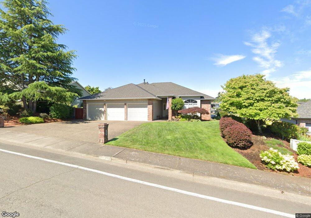
1667 Mousebird Ave NW Salem, OR 97304
West Salem NeighborhoodEstimated Value: $528,161 - $569,000
3
Beds
2
Baths
1,917
Sq Ft
$286/Sq Ft
Est. Value
About This Home
This home is located at 1667 Mousebird Ave NW, Salem, OR 97304 and is currently estimated at $548,040, approximately $285 per square foot. 1667 Mousebird Ave NW is a home located in Polk County with nearby schools including Chapman Hill Elementary School, Straub Middle School, and West Salem High School.
Ownership History
Date
Name
Owned For
Owner Type
Purchase Details
Closed on
Jun 19, 2006
Sold by
Thomas John P and Thomas Laura S
Bought by
Abel Steven E and Abel Denice D
Current Estimated Value
Home Financials for this Owner
Home Financials are based on the most recent Mortgage that was taken out on this home.
Original Mortgage
$225,000
Outstanding Balance
$132,134
Interest Rate
6.55%
Mortgage Type
Fannie Mae Freddie Mac
Estimated Equity
$415,907
Purchase Details
Closed on
Sep 2, 2004
Sold by
Atchison Michele L
Bought by
Thomas John P and Thomas Laura S
Home Financials for this Owner
Home Financials are based on the most recent Mortgage that was taken out on this home.
Original Mortgage
$224,000
Interest Rate
4.37%
Mortgage Type
Credit Line Revolving
Create a Home Valuation Report for This Property
The Home Valuation Report is an in-depth analysis detailing your home's value as well as a comparison with similar homes in the area
Home Values in the Area
Average Home Value in this Area
Purchase History
| Date | Buyer | Sale Price | Title Company |
|---|---|---|---|
| Abel Steven E | $324,900 | Fidelity Natl Title Co Of Or | |
| Thomas John P | $280,000 | Fidelity Natl Title Co Of Or |
Source: Public Records
Mortgage History
| Date | Status | Borrower | Loan Amount |
|---|---|---|---|
| Open | Abel Steven E | $225,000 | |
| Previous Owner | Thomas John P | $224,000 |
Source: Public Records
Tax History Compared to Growth
Tax History
| Year | Tax Paid | Tax Assessment Tax Assessment Total Assessment is a certain percentage of the fair market value that is determined by local assessors to be the total taxable value of land and additions on the property. | Land | Improvement |
|---|---|---|---|---|
| 2025 | $6,168 | $337,120 | $87,900 | $249,220 |
| 2024 | $6,168 | $327,310 | $85,340 | $241,970 |
| 2023 | $5,989 | $317,780 | $82,860 | $234,920 |
| 2022 | $5,798 | $308,530 | $80,450 | $228,080 |
| 2021 | $5,632 | $299,550 | $78,100 | $221,450 |
| 2020 | $5,465 | $290,830 | $75,830 | $215,000 |
| 2019 | $5,274 | $282,360 | $73,620 | $208,740 |
| 2018 | $5,187 | $274,140 | $71,470 | $202,670 |
| 2017 | $4,674 | $266,160 | $69,380 | $196,780 |
| 2016 | $4,563 | $258,410 | $67,360 | $191,050 |
| 2015 | $4,559 | $238,170 | $68,000 | $170,170 |
| 2014 | $4,086 | $228,560 | $59,650 | $168,910 |
Source: Public Records
Map
Nearby Homes
- 1842 Boulder Ridge Ct NW
- 1936 Orchard Heights Rd NW
- 2075 Opaque Ave NW
- 1656 Ashland Ct NW
- 1534 Gearhart Ave NW
- 1684 Doaks Ferry Rd NW
- Parcel 2 2832 Doaks Ferry Rd NW
- 1674 Olympia Ct NW
- 1929 Ptarmigan St NW
- 1615 Sisters Ct NW
- 1380 Ranier Loop NW
- 1321 Chapman Hill Dr NW
- 1782 Sunburst Terrace NW
- 2114 Mousebird Ave NW
- 0 NW 2nd St
- 1274 Westbrook Dr NW
- 1101 Satara Ct NW
- 2142 Westfarthing Way NW
- 2230 Doaks Ferry Rd W
- 1735 Misty Place NW
- 1687 Mousebird Ave NW
- 1647 Mousebird Ave NW
- 1660 Mousebird Ave NW
- 1627 Mousebird Ave NW
- 1697 Mousebird Ave NW
- 1853 Boulder Ridge Ct NW
- 1854 Wallowa Ave NW
- 1620 Mousebird Ave NW
- 1617 Mousebird Ave NW
- 1733 Mousebird Ave NW
- 1834 Wallowa Ave NW
- 1843 Boulder Ridge Ct NW
- 1610 Mousebird Ave NW
- 1812 Boulder Ridge Ct NW
- 1725 Snowbird Dr NW
- 1753 Mousebird Ave NW
- 1607 Mousebird Ave NW
- 1857 Wallowa Ave NW
- 1833 Boulder Ridge Ct NW
- 1827 Whitney Dr NW