C
Seller's Agent in 2015
Candis Yow
St James Sporting Properties
Estimated Value: $218,295 - $230,000
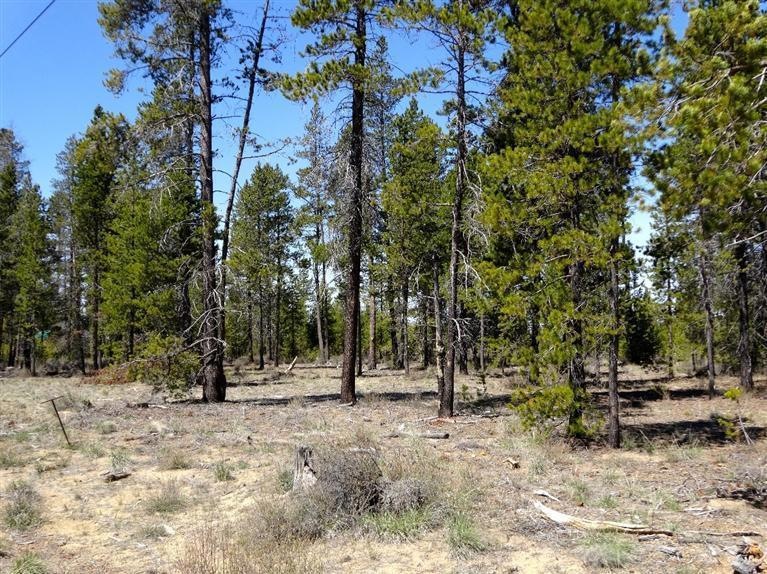
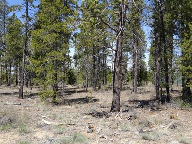
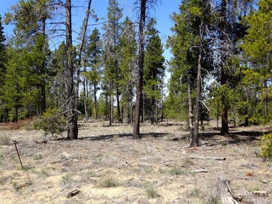
Very nice cleared lot with city water and sewer to the property as well as utilities. This one is ready to go, build your dream home on it, next to nice homes and close to downtown and ball part, rural setting.
Last Agent to Sell the Property
Candis Yow
St James Sporting Properties License #200102059 Listed on: 01/05/2015
Last Buyer's Agent
Candis Yow
St James Sporting Properties License #200102059 Listed on: 01/05/2015
| Date | Buyer | Sale Price | Title Company |
|---|---|---|---|
| Dale L Libolt Trust | -- | None Listed On Document | |
| Libolt Dale L | -- | None Listed On Document | |
| Libolt Dale L | -- | None Available | |
| Libolt Dale L | -- | Amerititle | |
| Libolt Dale L | -- | Amerititle | |
| Byrd Terry L | $24,500 | Western Title & Escrow | |
| Friend Benjamin F | -- | None Available |
| Date | Status | Borrower | Loan Amount |
|---|---|---|---|
| Previous Owner | Byrd Terry L | $19,600 |
| Date | Event | Price | List to Sale | Price per Sq Ft |
|---|---|---|---|---|
| 04/22/2015 04/22/15 | Sold | $24,500 | -36.4% | -- |
| 03/03/2015 03/03/15 | Pending | -- | -- | -- |
| 04/25/2014 04/25/14 | For Sale | $38,500 | -- | -- |
| Year | Tax Paid | Tax Assessment Tax Assessment Total Assessment is a certain percentage of the fair market value that is determined by local assessors to be the total taxable value of land and additions on the property. | Land | Improvement |
|---|---|---|---|---|
| 2025 | $985 | $64,160 | $64,160 | -- |
| 2024 | $944 | $62,300 | $62,300 | -- |
| 2023 | $923 | $60,490 | $60,490 | $0 |
| 2022 | $853 | $57,020 | $0 | $0 |
| 2021 | $858 | $40,820 | $0 | $0 |
| 2020 | $596 | $40,820 | $0 | $0 |
| 2019 | $568 | $38,880 | $0 | $0 |
| 2018 | $547 | $37,380 | $0 | $0 |
| 2017 | $493 | $33,680 | $0 | $0 |
| 2016 | $515 | $36,220 | $0 | $0 |
| 2015 | $512 | $36,220 | $0 | $0 |
| 2014 | $797 | $55,360 | $0 | $0 |
C
Seller's Agent in 2015
Candis Yow
St James Sporting Properties
Source: Oregon Datashare
MLS Number: 201403580
APN: 171659
Disclaimer: Certain information contained herein is derived from information provided by parties other than Homes.com. All information provided is deemed reliable, but is not guaranteed to be accurate and should be independently verified.
![]() © 2025 Oregon Datashare (KCAR | MLSCO | SOMLS). All rights reserved. The data relating to real estate for sale on this web site comes in part from the Internet Data Exchange Program of the Oregon Datashare. Real estate listings held by IDX Brokerage firms other than Ten-X are marked with the Internet Data Exchange logo or the Internet Data Exchange thumbnail logo and detailed information about them includes the name of the listing Brokers. Information provided is for consumers' personal, non-commercial use and may not be used for any purpose other than to identify prospective properties the viewer may be interested in purchasing. The consumer will not copy, retransmit nor redistribute any of the content from this website. Information provided is deemed reliable, but not guaranteed.
© 2025 Oregon Datashare (KCAR | MLSCO | SOMLS). All rights reserved. The data relating to real estate for sale on this web site comes in part from the Internet Data Exchange Program of the Oregon Datashare. Real estate listings held by IDX Brokerage firms other than Ten-X are marked with the Internet Data Exchange logo or the Internet Data Exchange thumbnail logo and detailed information about them includes the name of the listing Brokers. Information provided is for consumers' personal, non-commercial use and may not be used for any purpose other than to identify prospective properties the viewer may be interested in purchasing. The consumer will not copy, retransmit nor redistribute any of the content from this website. Information provided is deemed reliable, but not guaranteed.