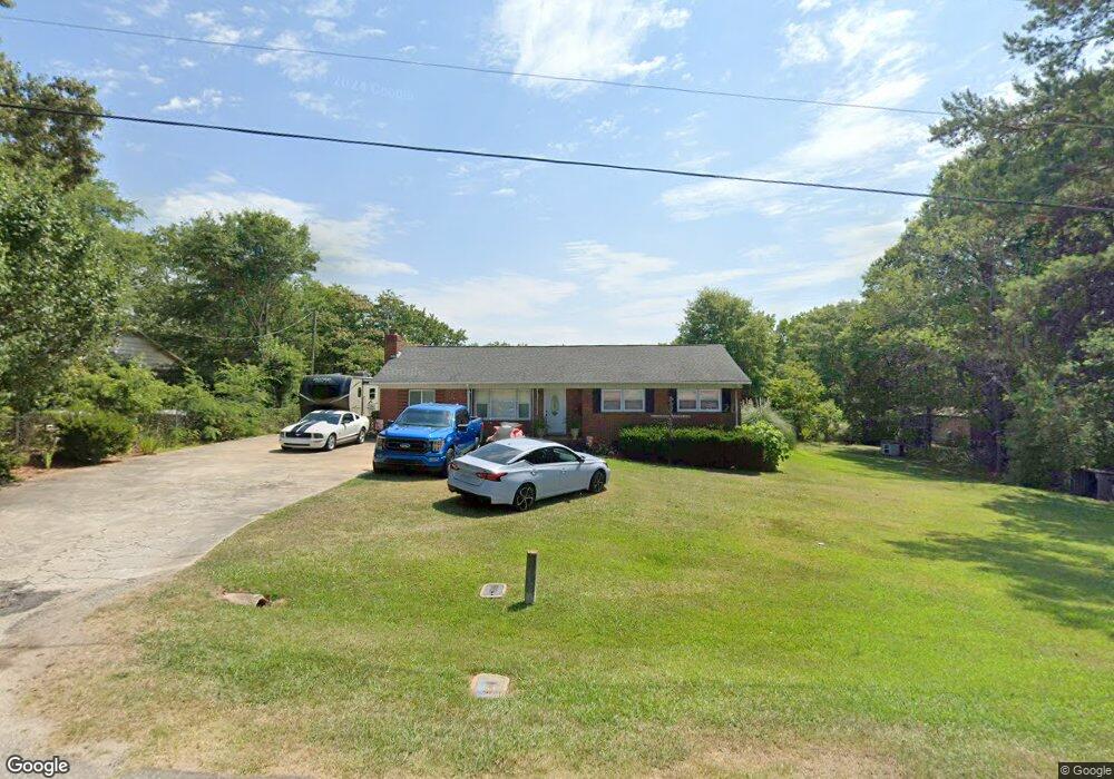
1669 Kaywood Dr Lancaster, SC 29720
Estimated Value: $207,000 - $229,000
--
Bed
2
Baths
1,503
Sq Ft
$143/Sq Ft
Est. Value
About This Home
This home is located at 1669 Kaywood Dr, Lancaster, SC 29720 and is currently estimated at $215,353, approximately $143 per square foot. 1669 Kaywood Dr is a home located in Lancaster County with nearby schools including Erwin Elementary School, South Middle School, and Lancaster High School.
Ownership History
Date
Name
Owned For
Owner Type
Purchase Details
Closed on
Mar 30, 2007
Sold by
Kersey Martin and Kersey Jacqueline
Bought by
Lucas Michael and Crump Amanda
Current Estimated Value
Home Financials for this Owner
Home Financials are based on the most recent Mortgage that was taken out on this home.
Original Mortgage
$94,900
Outstanding Balance
$56,904
Interest Rate
6%
Mortgage Type
Adjustable Rate Mortgage/ARM
Estimated Equity
$158,449
Create a Home Valuation Report for This Property
The Home Valuation Report is an in-depth analysis detailing your home's value as well as a comparison with similar homes in the area
Home Values in the Area
Average Home Value in this Area
Purchase History
| Date | Buyer | Sale Price | Title Company |
|---|---|---|---|
| Lucas Michael | $94,900 | None Available |
Source: Public Records
Mortgage History
| Date | Status | Borrower | Loan Amount |
|---|---|---|---|
| Open | Lucas Michael | $94,900 |
Source: Public Records
Tax History Compared to Growth
Tax History
| Year | Tax Paid | Tax Assessment Tax Assessment Total Assessment is a certain percentage of the fair market value that is determined by local assessors to be the total taxable value of land and additions on the property. | Land | Improvement |
|---|---|---|---|---|
| 2024 | $520 | $3,388 | $420 | $2,968 |
| 2023 | $534 | $3,388 | $420 | $2,968 |
| 2022 | $516 | $3,388 | $420 | $2,968 |
| 2021 | $505 | $3,388 | $420 | $2,968 |
| 2020 | $494 | $3,216 | $420 | $2,796 |
| 2019 | $1,089 | $3,216 | $420 | $2,796 |
| 2018 | $1,048 | $3,216 | $420 | $2,796 |
| 2017 | $482 | $0 | $0 | $0 |
| 2016 | $470 | $0 | $0 | $0 |
| 2015 | $396 | $0 | $0 | $0 |
| 2014 | $396 | $0 | $0 | $0 |
| 2013 | $396 | $0 | $0 | $0 |
Source: Public Records
Map
Nearby Homes
- 1797 Drywood Cir
- 1631 Oakdale Dr
- 1658 Oakdale Dr
- 1795 Grace Ave
- 1530 Danlee Dr
- 1428 Boxwood Ave
- 1746 Grace Ave Unit 1
- 1397 Grace Ave
- 1250 Hampton Grace Ave
- 1801 Grace Ave
- 1500 Victoria St Unit 4
- 1509 Victoria St Unit 13
- 1503 Victoria St
- 1817 Grace Ave
- 1501 Victoria St Unit 11
- 1324 Mason St
- 1841 Grace Ave
- 1447 Carmel Rd
- 1401 Carmel Rd
- 5.45 acres Memorial Park Rd
- 1661 Kaywood Dr
- 1977 Williams Cir
- 1653 Kaywood Dr
- 1988 Williams Cir
- 2020 Williams Cir
- 2012 Williams Cir
- 1980 Williams Cir
- 1798 Drywood Cir
- 1651 Drywood Cir
- 2028 Williams Cir
- 1645 Kaywood Dr
- 2038 Williams Cir
- 1972 Williams Cir
- 1790 Drywood Cir
- 1779 Drywood Cir
- 1674 Drywood Cir
- 1782 Drywood Cir
- 2052 Williams Cir
- 1641 Drywood Cir
- 1635 Kaywood Dr